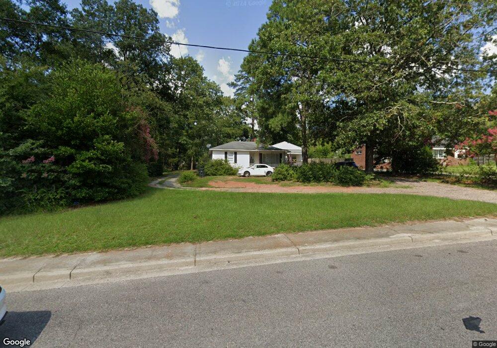
929 Martintown Rd North Augusta, SC 29841
Estimated Value: $148,618 - $263,000
--
Bed
1
Bath
1,722
Sq Ft
$122/Sq Ft
Est. Value
About This Home
This home is located at 929 Martintown Rd, North Augusta, SC 29841 and is currently estimated at $209,405, approximately $121 per square foot. 929 Martintown Rd is a home located in Aiken County with nearby schools including Hammond Hill Elementary School, Paul Knox Middle School, and North Augusta High School.
Ownership History
Date
Name
Owned For
Owner Type
Purchase Details
Closed on
Nov 28, 2011
Sold by
Bolton J Robert
Bought by
Cross Allen T
Current Estimated Value
Home Financials for this Owner
Home Financials are based on the most recent Mortgage that was taken out on this home.
Original Mortgage
$110,000
Interest Rate
4.15%
Mortgage Type
Seller Take Back
Purchase Details
Closed on
Oct 18, 2007
Sold by
Bowman Charles Stephen and Bowman Kristen L
Bought by
Bolton J Robert
Purchase Details
Closed on
Aug 14, 2007
Sold by
Bowman Charles Stephen
Bought by
Bowman Ii Charles Stephen
Create a Home Valuation Report for This Property
The Home Valuation Report is an in-depth analysis detailing your home's value as well as a comparison with similar homes in the area
Home Values in the Area
Average Home Value in this Area
Purchase History
| Date | Buyer | Sale Price | Title Company |
|---|---|---|---|
| Cross Allen T | $135,000 | -- | |
| Bolton J Robert | $64,000 | None Available | |
| Bowman Ii Charles Stephen | -- | None Available |
Source: Public Records
Mortgage History
| Date | Status | Borrower | Loan Amount |
|---|---|---|---|
| Closed | Cross Allen T | $110,000 |
Source: Public Records
Tax History Compared to Growth
Tax History
| Year | Tax Paid | Tax Assessment Tax Assessment Total Assessment is a certain percentage of the fair market value that is determined by local assessors to be the total taxable value of land and additions on the property. | Land | Improvement |
|---|---|---|---|---|
| 2023 | $2,193 | $9,350 | $2,520 | $113,850 |
| 2022 | $2,167 | $9,350 | $0 | $0 |
| 2021 | $2,169 | $9,350 | $0 | $0 |
| 2020 | $1,972 | $8,340 | $0 | $0 |
| 2019 | $1,972 | $8,340 | $0 | $0 |
| 2018 | $1,974 | $8,340 | $1,800 | $6,540 |
| 2017 | $1,932 | $0 | $0 | $0 |
| 2016 | $1,933 | $0 | $0 | $0 |
| 2015 | $1,935 | $0 | $0 | $0 |
| 2014 | $1,936 | $0 | $0 | $0 |
| 2013 | -- | $0 | $0 | $0 |
Source: Public Records
Map
Nearby Homes
- 924 W Martintown Rd
- 1904 Riley Ct
- 793 Big Pine Rd
- 5093 Anna Creek Way
- 1912 Coulter Dr
- 1425 Brookgreen Dr
- 1414 Brookgreen Dr
- 1415 Brookgreen Dr
- 1833 Pisgah Rd
- 1866 Whitebark Ave
- 1888 Knobcone Ave
- 4041 Jane Ln Unit 9b
- 710 W Martintown Rd
- Mill Creek Plan at Forrest Bluff
- Ridgeway II Plan at Forrest Bluff
- 1772 Plan at Forrest Bluff
- 1570 Plan at Forrest Bluff
- Bradford Plan at Forrest Bluff
- 1313 Plan at Forrest Bluff
- 1486 Plan at Forrest Bluff
- 925 Martintown Rd
- 933 Martintown Rd
- 933 W Martintown Rd
- 1801 Byrnes Rd
- 1803 Byrnes Rd
- 921 Martintown Rd
- 1938 Byrnes Rd
- 924 Martintown Rd
- 1936 Byrnes Rd
- 1805 Byrnes Rd
- 1934 Byrnes Rd
- 917 Martintown Rd
- 815 Greenwood Dr
- 1932 Byrnes Rd
- 1932 Byrnes Rd
- 1802 Byrnes Rd
- 813 Greenwood Dr
- 817 Greenwood Dr
- 811 Greenwood Dr
- 1923 Byrnes Rd