Estimated Value: $920,107 - $1,061,000
4
Beds
3
Baths
2,600
Sq Ft
$374/Sq Ft
Est. Value
About This Home
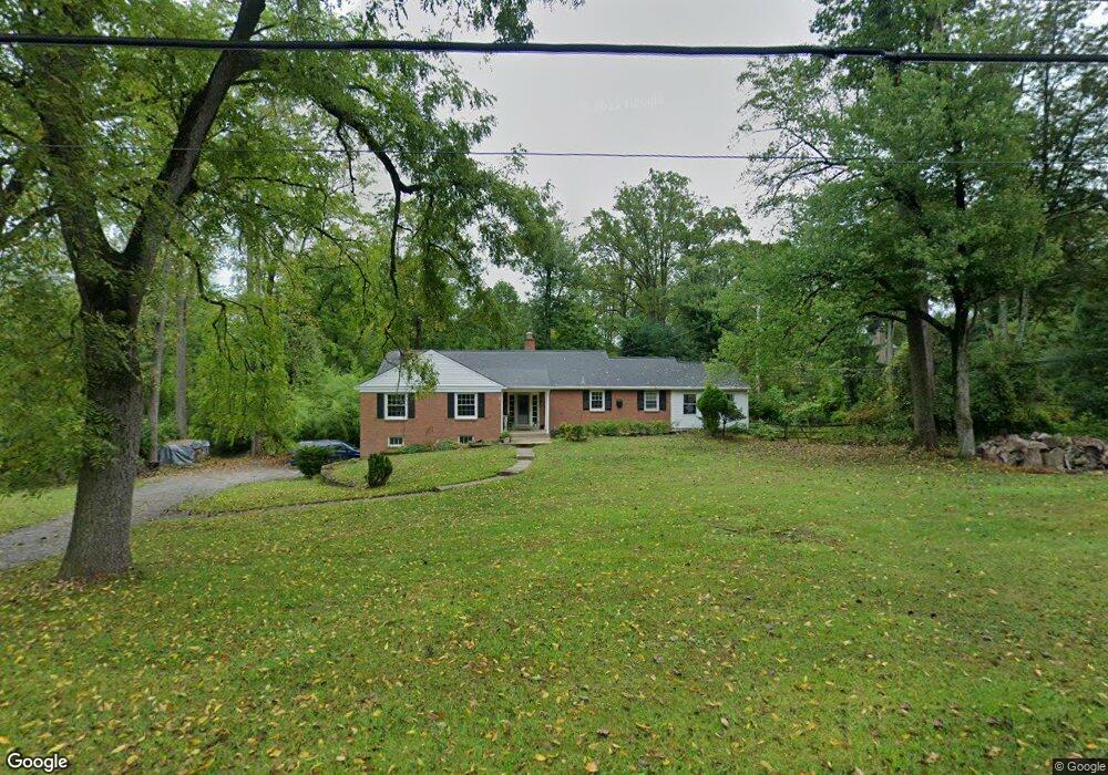
This home is located at 929 Newtown Rd, Devon, PA 19333 and is currently estimated at $973,277, approximately $374 per square foot. 929 Newtown Rd is a home located in Chester County with nearby schools including Beaumont Elementary School, Tredyffrin-Easttown Middle School, and Conestoga Senior High School.
Ownership History
Date
Name
Owned For
Owner Type
Purchase Details
Closed on
May 9, 2022
Sold by
Chingyuan Mao
Bought by
Xu Jane Yuan and Lin Xiaqin
Current Estimated Value
Home Financials for this Owner
Home Financials are based on the most recent Mortgage that was taken out on this home.
Original Mortgage
$270,000
Outstanding Balance
$184,510
Interest Rate
4.42%
Mortgage Type
New Conventional
Estimated Equity
$788,767
Purchase Details
Closed on
Mar 20, 2002
Sold by
Jenkins Rachel W F and Estate Of R Stuart Jenkins
Bought by
Chia Shirong and Mao Chingyuan
Home Financials for this Owner
Home Financials are based on the most recent Mortgage that was taken out on this home.
Original Mortgage
$220,000
Interest Rate
6.88%
Create a Home Valuation Report for This Property
The Home Valuation Report is an in-depth analysis detailing your home's value as well as a comparison with similar homes in the area
Home Values in the Area
Average Home Value in this Area
Purchase History
| Date | Buyer | Sale Price | Title Company |
|---|---|---|---|
| Xu Jane Yuan | $720,000 | None Listed On Document | |
| Chia Shirong | $325,000 | -- |
Source: Public Records
Mortgage History
| Date | Status | Borrower | Loan Amount |
|---|---|---|---|
| Open | Xu Jane Yuan | $270,000 | |
| Previous Owner | Chia Shirong | $220,000 |
Source: Public Records
Tax History
| Year | Tax Paid | Tax Assessment Tax Assessment Total Assessment is a certain percentage of the fair market value that is determined by local assessors to be the total taxable value of land and additions on the property. | Land | Improvement |
|---|---|---|---|---|
| 2025 | $9,556 | $256,200 | $83,180 | $173,020 |
| 2024 | $9,556 | $256,200 | $83,180 | $173,020 |
| 2023 | $8,935 | $256,200 | $83,180 | $173,020 |
| 2022 | $8,691 | $256,200 | $83,180 | $173,020 |
| 2021 | $8,502 | $256,200 | $83,180 | $173,020 |
| 2020 | $8,266 | $256,200 | $83,180 | $173,020 |
| 2019 | $8,035 | $256,200 | $83,180 | $173,020 |
| 2018 | $7,896 | $256,200 | $83,180 | $173,020 |
| 2017 | $7,718 | $256,200 | $83,180 | $173,020 |
| 2016 | -- | $256,200 | $83,180 | $173,020 |
| 2015 | -- | $256,200 | $83,180 | $173,020 |
| 2014 | -- | $256,200 | $83,180 | $173,020 |
Source: Public Records
Map
Nearby Homes
- 814 Newtown Rd
- 1105 Waterloo Rd
- 1012 Waltham Rd
- 3663 Wyola Dr
- 1108 Prescott Rd
- 641 Andover Rd
- 709 Newtown Rd
- 600 Waynesfield Dr
- 837-Lot1 Nathan Hale
- 718 S Waterloo Rd
- 850 Farragut Rd
- 518 Newtown Rd
- 514 Newtown Rd
- 1 Dunminning Rd
- 130 Beaumont Rd
- 6 Wingstone Ln
- 334 Echo Valley Ln
- 3716 Rose Trader Ln
- 311 Stoney Knoll Ln
- 422 S Waterloo Rd
- 923 Newtown Rd
- 533 Millbrook Rd
- 527 Millbrook Rd
- 948 Newtown Rd
- 928 Spring Ln
- 928 Newtown Rd
- 917 Newtown Rd
- 934 Newtown Rd
- 934 Spring Ln
- 922 Newtown Rd
- 922 Spring Ln
- 1005 Millbrook Rd
- 914 Newtown Rd
- 911 Newtown Rd
- 532 Millbrook Rd
- 538 Millbrook Rd
- 117 W Plum St
- 526 Millbrook Rd
- 1015 Millbrook Rd
- 935 Spring Ln
Your Personal Tour Guide
Ask me questions while you tour the home.