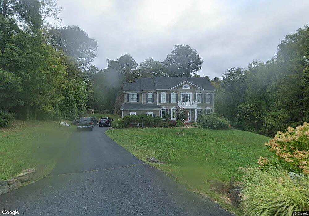
929 Queenscliff Ct Purcellville, VA 20132
Estimated Value: $1,066,704 - $1,221,000
5
Beds
5
Baths
3,785
Sq Ft
$299/Sq Ft
Est. Value
About This Home
This home is located at 929 Queenscliff Ct, Purcellville, VA 20132 and is currently estimated at $1,131,676, approximately $298 per square foot. 929 Queenscliff Ct is a home located in Loudoun County with nearby schools including Emerick Elementary School, Blue Ridge Middle School, and Loudoun Valley High School.
Ownership History
Date
Name
Owned For
Owner Type
Purchase Details
Closed on
Oct 15, 2012
Sold by
Carrington Bldrs Purcellville
Bought by
Ruscitella William T
Current Estimated Value
Home Financials for this Owner
Home Financials are based on the most recent Mortgage that was taken out on this home.
Original Mortgage
$417,000
Outstanding Balance
$289,845
Interest Rate
3.59%
Mortgage Type
New Conventional
Estimated Equity
$841,831
Create a Home Valuation Report for This Property
The Home Valuation Report is an in-depth analysis detailing your home's value as well as a comparison with similar homes in the area
Home Values in the Area
Average Home Value in this Area
Purchase History
| Date | Buyer | Sale Price | Title Company |
|---|---|---|---|
| Ruscitella William T | $665,107 | -- |
Source: Public Records
Mortgage History
| Date | Status | Borrower | Loan Amount |
|---|---|---|---|
| Open | Ruscitella William T | $417,000 |
Source: Public Records
Tax History Compared to Growth
Tax History
| Year | Tax Paid | Tax Assessment Tax Assessment Total Assessment is a certain percentage of the fair market value that is determined by local assessors to be the total taxable value of land and additions on the property. | Land | Improvement |
|---|---|---|---|---|
| 2025 | $8,987 | $1,076,330 | $263,500 | $812,830 |
| 2024 | $8,942 | $999,150 | $263,500 | $735,650 |
| 2023 | $8,277 | $945,990 | $263,500 | $682,490 |
| 2022 | $7,600 | $853,890 | $201,400 | $652,490 |
| 2021 | $7,027 | $717,050 | $173,900 | $543,150 |
| 2020 | $7,315 | $706,780 | $166,400 | $540,380 |
| 2019 | $7,199 | $688,880 | $161,400 | $527,480 |
| 2018 | $6,574 | $605,890 | $161,400 | $444,490 |
| 2017 | $6,768 | $601,590 | $161,400 | $440,190 |
| 2016 | $7,118 | $621,670 | $0 | $0 |
| 2015 | $7,055 | $460,150 | $0 | $460,150 |
| 2014 | $7,173 | $459,620 | $0 | $459,620 |
Source: Public Records
Map
Nearby Homes
- 104 Mcilhaney Way
- 102 Frazer Dr
- 619 Greysands Ln
- 17313 Pickwick Dr
- Millwright II Plan at Woodside Acres
- Aquinnah Plan at Woodside Acres
- Chapman Plan at Woodside Acres
- Robey Plan at Woodside Acres
- Hillsboro Plan at Woodside Acres
- 133 Misty Pond Terrace
- 608 E G St
- 221 S Maple Ave
- 15334 Berlin Turnpike
- 14691 Fordson Ct
- 14649 Fordson Ct
- 14629 Fordson Ct
- 17628 Bates Dr
- 3 Springbury Dr
- The Oakhall Plan at Valley Springs Estates
- The Elmsgate Plan at Valley Springs Estates
- 925 Queenscliff Ct
- 924 Queenscliff Ct
- 920 Queenscliff Ct
- 921 Queenscliff Ct
- 917 Queenscliff Ct
- 37891 Piggott House Place
- 908 Queenscliff Ct
- 913 Queenscliff Ct
- 909 Queenscliff Ct
- 904 Queenscliff Ct
- 905 Queenscliff Ct
- 601 Yaxley Dr
- 37877 Piggott House Place
- 0 Queenscliff Ct Unit 1007800492
- 0 Queenscliff Ct Unit 1007680868
- 0 Queenscliff Ct Unit 1006871664
- 0 Queenscliff Ct Unit LO7802319
- 0 Queenscliff Ct Unit LO7513437
- 0 Queenscliff Ct Unit LO7749397
- 0 Queenscliff Ct Unit LO7701277