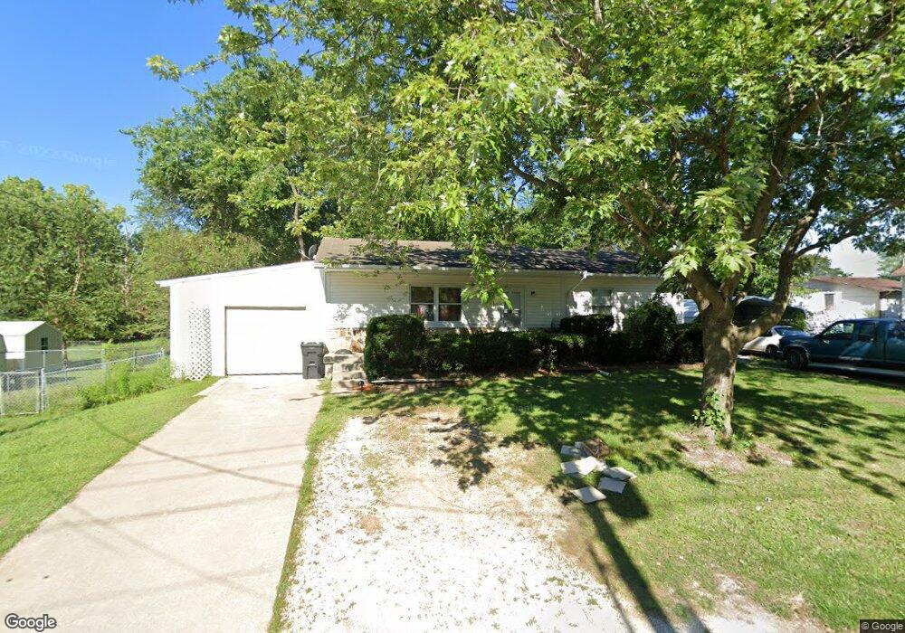
929 Saint Charles St Moberly, MO 65270
Estimated Value: $124,409 - $171,000
3
Beds
2
Baths
2,016
Sq Ft
$73/Sq Ft
Est. Value
About This Home
This home is located at 929 Saint Charles St, Moberly, MO 65270 and is currently estimated at $147,602, approximately $73 per square foot. 929 Saint Charles St is a home located in Randolph County with nearby schools including Moberly Senior High School, St. Pius X. Catholic School, and Maranatha Seventh-day Adventist School.
Ownership History
Date
Name
Owned For
Owner Type
Purchase Details
Closed on
Oct 17, 2008
Sold by
Herron Donald R and Herron Carolyn S
Bought by
Amirault David J and Amirault Dale R
Current Estimated Value
Home Financials for this Owner
Home Financials are based on the most recent Mortgage that was taken out on this home.
Original Mortgage
$106,910
Outstanding Balance
$76,124
Interest Rate
5.83%
Estimated Equity
$71,478
Create a Home Valuation Report for This Property
The Home Valuation Report is an in-depth analysis detailing your home's value as well as a comparison with similar homes in the area
Home Values in the Area
Average Home Value in this Area
Purchase History
| Date | Buyer | Sale Price | Title Company |
|---|---|---|---|
| Amirault David J | $105,000 | -- |
Source: Public Records
Mortgage History
| Date | Status | Borrower | Loan Amount |
|---|---|---|---|
| Open | Amirault David J | $106,910 |
Source: Public Records
Tax History Compared to Growth
Tax History
| Year | Tax Paid | Tax Assessment Tax Assessment Total Assessment is a certain percentage of the fair market value that is determined by local assessors to be the total taxable value of land and additions on the property. | Land | Improvement |
|---|---|---|---|---|
| 2025 | $1,309 | $19,230 | $1,520 | $17,710 |
| 2024 | $1,309 | $17,970 | $1,330 | $16,640 |
| 2023 | $1,329 | $17,970 | $1,330 | $16,640 |
| 2022 | $1,236 | $17,170 | $1,330 | $15,840 |
| 2021 | $1,236 | $17,170 | $1,330 | $15,840 |
| 2020 | $1,236 | $17,170 | $1,330 | $15,840 |
| 2019 | $1,233 | $17,170 | $1,330 | $15,840 |
| 2018 | $1,229 | $17,170 | $1,330 | $15,840 |
| 2017 | $1,227 | $17,170 | $0 | $0 |
| 2016 | $1,166 | $16,410 | $0 | $0 |
| 2014 | -- | $14,880 | $0 | $0 |
| 2013 | -- | $14,880 | $0 | $0 |
| 2012 | -- | $14,950 | $0 | $0 |
Source: Public Records
Map
Nearby Homes
- 625 Franklin Ave
- 523 Morehead St
- 720 Saint Charles St
- 609 Franklin Ave
- 1101 Stonebridge Ln
- Lot 11 Stonebridge Lane (Plat 2)
- Lot 10 Stonebridge Lane (Plat 2)
- 1102 N Morley St
- 511 Union Ave
- 664 & 668 N Ault St
- 602 Vincil St
- 531 Farror St
- 812 N Moulton St
- 524 Barrow St
- 101 N Ault St
- 428 Woodland Ave
- LOT 5 Robertson Road & Highway 24
- LOT 4 Robertson Road & Highway 24
- LOT 1 Robertson Road & Highway 24
- LOT 2 Robertson Road & Highway 24
- 925 Saint Charles St
- 822 Sinnock Ave
- 818 Sinnock Ave
- 900 Sinnock Ave
- 814 Sinnock Ave
- 928 Saint Charles St
- 921 Saint Charles St
- 810 Sinnock Ave
- 906 Sinnock Ave
- 922 Saint Charles St
- 919 Saint Charles St
- 901 Sinnock Ave
- 917 Saint Charles St
- 912 Sinnock Ave
- 914 Saint Charles St
- 905 Sinnock Ave
- 915 Saint Charles St
- 709 Franklin Ave
- 914 Sinnock Ave
- 800 Sinnock Ave