Estimated Value: $216,000 - $306,000
4
Beds
1
Bath
1,873
Sq Ft
$147/Sq Ft
Est. Value
About This Home
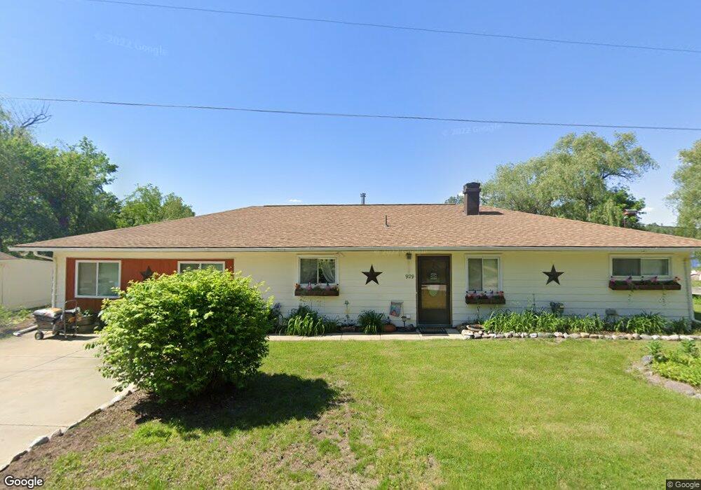
This home is located at 929 Sheldon Dr Unit Bldg-Unit, Holly, MI 48442 and is currently estimated at $275,312, approximately $146 per square foot. 929 Sheldon Dr Unit Bldg-Unit is a home located in Oakland County with nearby schools including Holly High School, Holly Academy, and Adelphian Junior Academy.
Ownership History
Date
Name
Owned For
Owner Type
Purchase Details
Closed on
Feb 22, 2024
Sold by
Rindahl Laura
Bought by
Rindahl Laura and Stuemke Larae
Current Estimated Value
Purchase Details
Closed on
Feb 28, 2019
Sold by
Apple Roy A and Apple Laura
Bought by
Rindahl Laura and Stuemke Larae
Purchase Details
Closed on
Oct 29, 2004
Sold by
Enghoffer Kathleen S
Bought by
Apple Roy A and Apple Laura
Home Financials for this Owner
Home Financials are based on the most recent Mortgage that was taken out on this home.
Original Mortgage
$134,400
Interest Rate
5.8%
Mortgage Type
Purchase Money Mortgage
Purchase Details
Closed on
Apr 24, 2002
Sold by
Enghoffer William J
Bought by
Enghoffer Kathleen S
Create a Home Valuation Report for This Property
The Home Valuation Report is an in-depth analysis detailing your home's value as well as a comparison with similar homes in the area
Home Values in the Area
Average Home Value in this Area
Purchase History
| Date | Buyer | Sale Price | Title Company |
|---|---|---|---|
| Rindahl Laura | -- | Michigan Land Title | |
| Rindahl Laura | -- | Michigan Land Title | |
| Rindahl Laura | -- | First American Title | |
| Rindahl Laura | $175,500 | Ata National Title Group Llc | |
| Apple Roy A | $168,000 | Metropolitan Title Company | |
| Enghoffer Kathleen S | -- | -- |
Source: Public Records
Mortgage History
| Date | Status | Borrower | Loan Amount |
|---|---|---|---|
| Previous Owner | Apple Roy A | $134,400 |
Source: Public Records
Tax History
| Year | Tax Paid | Tax Assessment Tax Assessment Total Assessment is a certain percentage of the fair market value that is determined by local assessors to be the total taxable value of land and additions on the property. | Land | Improvement |
|---|---|---|---|---|
| 2025 | $2,789 | $105,570 | $0 | $0 |
| 2024 | $2,013 | $98,520 | $0 | $0 |
| 2023 | $1,920 | $92,200 | $0 | $0 |
| 2022 | $2,498 | $83,620 | $0 | $0 |
| 2021 | $2,334 | $75,810 | $0 | $0 |
| 2020 | $1,951 | $83,010 | $0 | $0 |
| 2019 | $1,884 | $76,680 | $0 | $0 |
| 2018 | $1,844 | $71,450 | $0 | $0 |
| 2017 | $1,792 | $69,590 | $0 | $0 |
| 2016 | $1,551 | $60,960 | $0 | $0 |
| 2015 | -- | $57,970 | $0 | $0 |
| 2014 | -- | $54,010 | $0 | $0 |
| 2011 | -- | $52,500 | $0 | $0 |
Source: Public Records
Map
Nearby Homes
- VL Maple Holly Rd
- 412 Rosette St
- 16106 Lancaster Way
- Lot 43-46 Riviera Shores Dr
- 1059 Old Leake Ct Unit 11
- 605 Hartner St
- 5528 E Holly Rd
- 15087 N Holly Rd
- VL Delphine Dr
- 6024 E Holly Rd
- VL Parcel 6A Fagan Rd
- VL Parcel 2A Fagan Rd
- VL Parcel 4A Fagan Rd
- VL Parcel 5A Fagan Rd
- 840 Oak Canyon Ct
- 844 Oak Canyon Ct
- 845 Oak Canyon Ct
- 360 Hidden River W
- 374 Edge Brook Dr
- 378 Edge Brook Dr
Your Personal Tour Guide
Ask me questions while you tour the home.