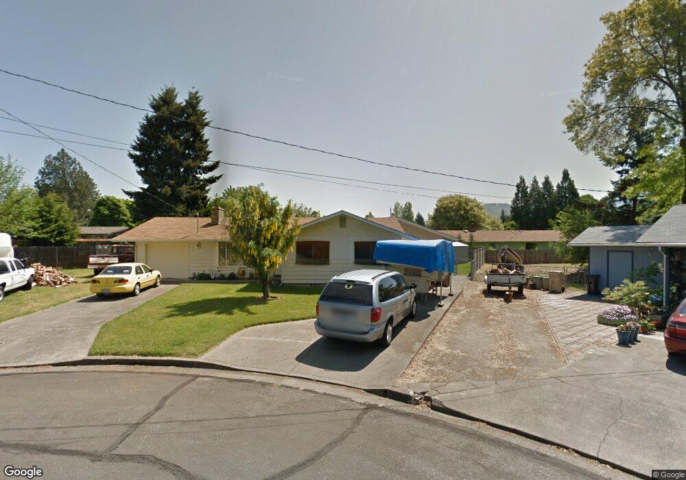
929 SW Dan Cir Grants Pass, OR 97526
Estimated Value: $355,000 - $355,216
3
Beds
2
Baths
1,694
Sq Ft
$210/Sq Ft
Est. Value
About This Home
This home is located at 929 SW Dan Cir, Grants Pass, OR 97526 and is currently estimated at $355,108, approximately $209 per square foot. 929 SW Dan Cir is a home located in Josephine County with nearby schools including Parkside Elementary School, North Middle School, and Grants Pass High School.
Ownership History
Date
Name
Owned For
Owner Type
Purchase Details
Closed on
Apr 6, 2020
Sold by
Foster Gayle Lorraine and Gayle Kunkler Family Trust
Bought by
Foster Gayle L
Current Estimated Value
Home Financials for this Owner
Home Financials are based on the most recent Mortgage that was taken out on this home.
Original Mortgage
$85,000
Interest Rate
3.4%
Mortgage Type
New Conventional
Purchase Details
Closed on
Nov 16, 2005
Sold by
Kunkler Gayle Lorraine
Bought by
Kunkler Gayle Lorraine and The Gayle Kunkler Family Trust
Create a Home Valuation Report for This Property
The Home Valuation Report is an in-depth analysis detailing your home's value as well as a comparison with similar homes in the area
Home Values in the Area
Average Home Value in this Area
Purchase History
| Date | Buyer | Sale Price | Title Company |
|---|---|---|---|
| Foster Gayle L | -- | Ticor Title Company Of Or | |
| Kunkler Gayle Lorraine | -- | -- |
Source: Public Records
Mortgage History
| Date | Status | Borrower | Loan Amount |
|---|---|---|---|
| Closed | Foster Gayle L | $85,000 |
Source: Public Records
Tax History Compared to Growth
Tax History
| Year | Tax Paid | Tax Assessment Tax Assessment Total Assessment is a certain percentage of the fair market value that is determined by local assessors to be the total taxable value of land and additions on the property. | Land | Improvement |
|---|---|---|---|---|
| 2025 | $2,411 | $185,670 | -- | -- |
| 2024 | $2,411 | $180,270 | -- | -- |
| 2023 | $2,271 | $175,020 | $0 | $0 |
| 2022 | $2,282 | $169,930 | -- | -- |
| 2021 | $2,143 | $164,990 | $0 | $0 |
| 2020 | $2,082 | $160,190 | $0 | $0 |
| 2019 | $2,021 | $155,530 | $0 | $0 |
| 2018 | $2,057 | $151,000 | $0 | $0 |
| 2017 | $2,042 | $146,610 | $0 | $0 |
| 2016 | $1,795 | $142,340 | $0 | $0 |
| 2015 | $1,732 | $138,200 | $0 | $0 |
| 2014 | $1,673 | $134,180 | $0 | $0 |
Source: Public Records
Map
Nearby Homes
- 1453 SW Silver Maple Way
- 1719 SW Bridge St
- 1126 SW Cottonwood St
- 1710 SW Brownell Ave
- 1950 SW Betty Ln
- 1990 SW Betty Ln
- 1986 SW Betty Ln
- 1613 SW I St
- 1202 SW Viola Dr
- 1129 SW Ballinger Dr
- 3487 SW Leonard St
- 738 Lincoln Rd
- 2082 Lower River Rd
- 1013 SW L St
- 955 SW Rogue River Ave Unit A
- 927 SW L St
- 1019 SW J St
- 789 Tami Rd
- 11311133 SW Central Ave
- 1011 SW I St
- 925 SW Dan Cir
- 933 SW Dan Cir
- 928 SW Spruce St
- 922 SW Spruce St
- 936 SW Spruce St
- 923 SW Cottonwood St
- 935 SW Cottonwood St
- 916 SW Spruce St
- 1702 SW Rogue River Ave
- 1704 SW Rogue River Ave
- 1700 SW Rogue River Ave
- 917 SW Cottonwood St
- 1701 SW Bridge St
- 943 SW Cottonwood St
- 910 SW Spruce St
- 929 SW Spruce St
- 923 SW Spruce St
- 935 SW Spruce St
- 909 SW Cottonwood St
- 917 SW Spruce St