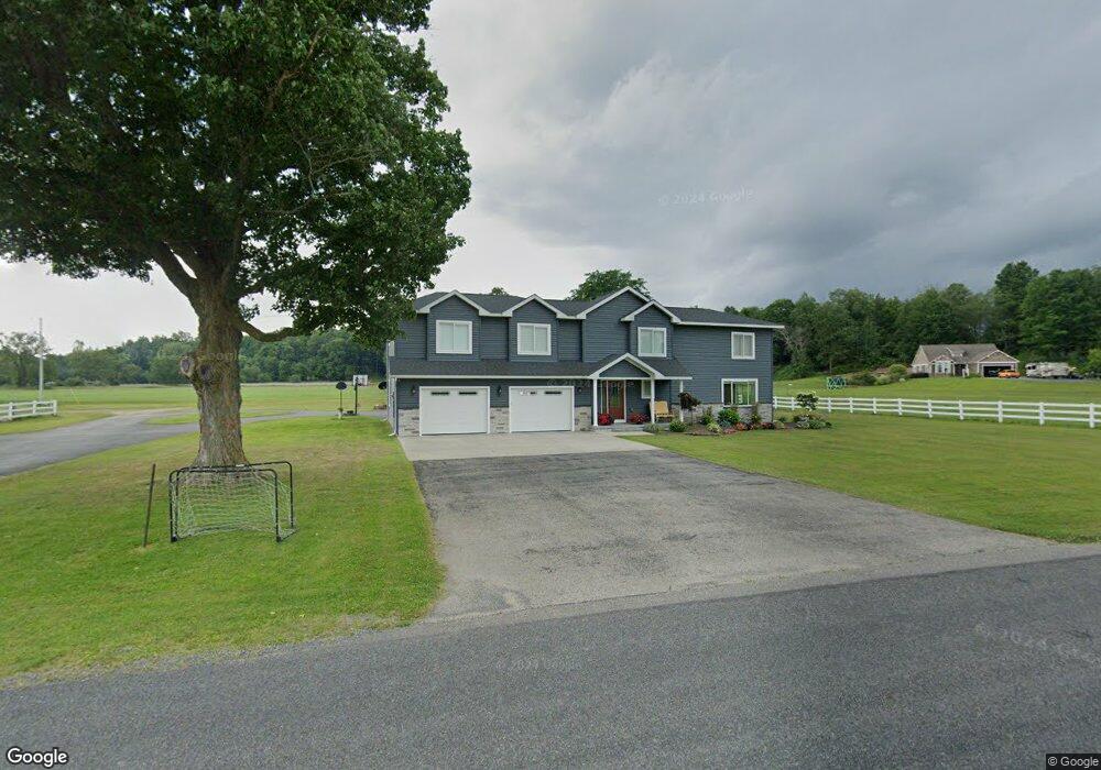
929 West Ave Big Rapids, MI 49307
Estimated Value: $363,000 - $530,029
3
Beds
2
Baths
2,394
Sq Ft
$186/Sq Ft
Est. Value
About This Home
This home is located at 929 West Ave, Big Rapids, MI 49307 and is currently estimated at $445,007, approximately $185 per square foot. 929 West Ave is a home located in Mecosta County with nearby schools including Big Rapids High School, Crossroads Charter Academy Elementary School, and Crossroads Charter Academy Middle/High School.
Ownership History
Date
Name
Owned For
Owner Type
Purchase Details
Closed on
Apr 30, 2012
Sold by
Patrick B Currie Revocable Trust
Bought by
Currie Matthew and Currie Amanda
Current Estimated Value
Home Financials for this Owner
Home Financials are based on the most recent Mortgage that was taken out on this home.
Original Mortgage
$80,000
Outstanding Balance
$11,485
Interest Rate
4.08%
Mortgage Type
New Conventional
Estimated Equity
$433,522
Create a Home Valuation Report for This Property
The Home Valuation Report is an in-depth analysis detailing your home's value as well as a comparison with similar homes in the area
Home Values in the Area
Average Home Value in this Area
Purchase History
| Date | Buyer | Sale Price | Title Company |
|---|---|---|---|
| Currie Matthew | $123,000 | Lakeland Title |
Source: Public Records
Mortgage History
| Date | Status | Borrower | Loan Amount |
|---|---|---|---|
| Open | Currie Matthew | $80,000 |
Source: Public Records
Tax History
| Year | Tax Paid | Tax Assessment Tax Assessment Total Assessment is a certain percentage of the fair market value that is determined by local assessors to be the total taxable value of land and additions on the property. | Land | Improvement |
|---|---|---|---|---|
| 2025 | $4,661 | $280,900 | $0 | $0 |
| 2024 | -- | $256,100 | $0 | $0 |
| 2023 | -- | $224,000 | $0 | $0 |
| 2022 | $0 | $204,100 | $0 | $0 |
Source: Public Records
Map
Nearby Homes
- 16659 Canyon Cove Unit 13
- 20600 Rolling Hills Ln
- Integrity 2080 Plan at Hills of Mitchell Creek
- 16281 Mitchell Creek Trail
- Integrity 1830 Plan at Hills of Mitchell Creek
- Integrity 1880 Plan at Hills of Mitchell Creek
- 16327 Birch Top Ridge
- 16314 Mitchell Creek Trail
- 16289 Birch Top Ridge Unit 40
- 16377 Mitchell Creek Trail
- 16282 Mitchell Creek Trail
- 16345 Mitchell Creek Trail
- 515 W Bridge St
- 20616 Madison Ave
- 513 Rose Ave
- 818 N State St
- 118 E Grand Traverse St
- 226 Baldwin St
- 16698 220th Ave
- 305 W Pine St
- 1009 West Ave
- 826 West Ave
- 829 West Ave
- 1020 West Ave
- 823 West Ave
- 815 West Ave
- 880 West Ave
- 914 West Ave
- 918 West Ave
- 804 West Ave
- 21045 17 Mile Rd
- 16744 Mitchell Creek Trail
- 724 West Ave
- 740 West Ave
- 729 West Ave
- 16687 Canyon Cove
- 16717 Mitchell Creek Trail
- 16 Canyon Cove
- 16656 Canyon Cove Unit 16
- 16656 Canyon Cove