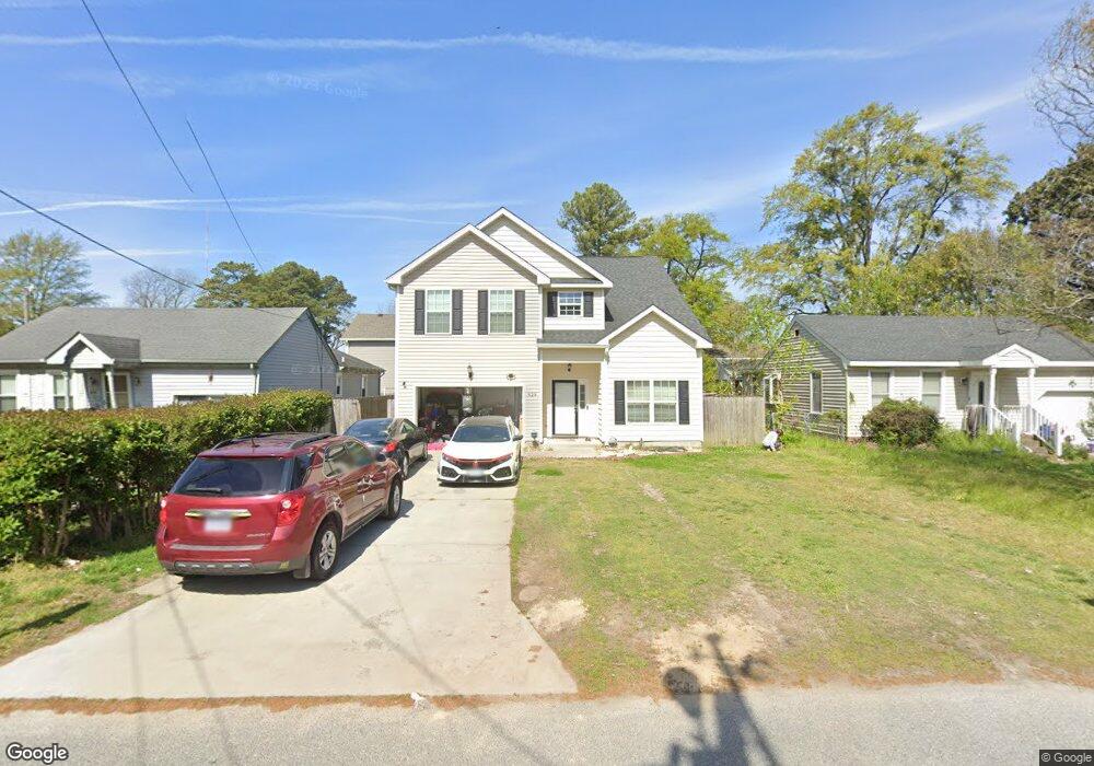
929 Wingfield Ave Chesapeake, VA 23325
Indian River NeighborhoodEstimated Value: $427,282 - $435,000
4
Beds
3
Baths
2,226
Sq Ft
$194/Sq Ft
Est. Value
About This Home
This home is located at 929 Wingfield Ave, Chesapeake, VA 23325 and is currently estimated at $431,071, approximately $193 per square foot. 929 Wingfield Ave is a home located in Chesapeake City with nearby schools including Norfolk Highlands Primary School, Sparrow Road Intermediate School, and Indian River Middle.
Ownership History
Date
Name
Owned For
Owner Type
Purchase Details
Closed on
Jan 27, 2021
Sold by
Forest Craig L
Bought by
Ladao Benedict C
Current Estimated Value
Home Financials for this Owner
Home Financials are based on the most recent Mortgage that was taken out on this home.
Original Mortgage
$305,250
Outstanding Balance
$272,776
Interest Rate
2.65%
Mortgage Type
New Conventional
Estimated Equity
$158,295
Purchase Details
Closed on
Jun 15, 2015
Sold by
D & B Properties Inc
Bought by
Forest Craig L
Home Financials for this Owner
Home Financials are based on the most recent Mortgage that was taken out on this home.
Original Mortgage
$268,143
Interest Rate
3.78%
Mortgage Type
VA
Purchase Details
Closed on
Aug 26, 2014
Sold by
Samuel I White Pc Sub Tr
Bought by
D And B Properties Inc
Create a Home Valuation Report for This Property
The Home Valuation Report is an in-depth analysis detailing your home's value as well as a comparison with similar homes in the area
Home Values in the Area
Average Home Value in this Area
Purchase History
| Date | Buyer | Sale Price | Title Company |
|---|---|---|---|
| Ladao Benedict C | $300,000 | Liberty Title & Escrow | |
| Forest Craig L | $262,500 | -- | |
| D And B Properties Inc | $57,100 | -- |
Source: Public Records
Mortgage History
| Date | Status | Borrower | Loan Amount |
|---|---|---|---|
| Open | Ladao Benedict C | $305,250 | |
| Previous Owner | Forest Craig L | $268,143 |
Source: Public Records
Tax History Compared to Growth
Tax History
| Year | Tax Paid | Tax Assessment Tax Assessment Total Assessment is a certain percentage of the fair market value that is determined by local assessors to be the total taxable value of land and additions on the property. | Land | Improvement |
|---|---|---|---|---|
| 2025 | $3,973 | $403,100 | $120,000 | $283,100 |
| 2024 | $3,973 | $393,400 | $110,000 | $283,400 |
| 2023 | $3,328 | $347,500 | $100,000 | $247,500 |
| 2022 | $3,407 | $337,300 | $90,000 | $247,300 |
| 2021 | $2,990 | $284,800 | $75,000 | $209,800 |
| 2020 | $2,604 | $248,000 | $75,000 | $173,000 |
| 2019 | $2,604 | $248,000 | $75,000 | $173,000 |
| 2018 | $2,604 | $258,100 | $75,000 | $183,100 |
| 2017 | $2,710 | $258,100 | $75,000 | $183,100 |
| 2016 | $2,710 | $258,100 | $75,000 | $183,100 |
| 2015 | $2,649 | $252,300 | $75,000 | $177,300 |
| 2014 | -- | $147,000 | $75,000 | $72,000 |
Source: Public Records
Map
Nearby Homes
- 1205 Wingfield Ave
- 402 Stalham Rd Unit A
- 1330 Wingfield Ave
- 3006 Menands Dr
- 3521 Riverstone Way
- 506 Stalham Rd
- 3005 Scotia Dr
- 2603 Berkley Ave
- 704 Sycamore St
- 105 Lenwil Dr
- 2904 Berkley Ave
- 1128 Lilac Ave
- 2702 Cayce Dr
- 305 Keith Ct
- 2216 Berkley Ave
- 123 Ridgewood Rd
- 708 Stalham Rd
- 1204 Myrtle Ave
- 1812 Montclair Ave
- 902 Laurel Ave
- 935 Wingfield Ave
- 925 Wingfield Ave
- 2810 Eustis Ave
- 917 Wingfield Ave
- 934 Wingfield Ave
- 934 Wingfield Ave Unit B
- 916 Wingfield Ave
- 2808 Eustis Ave
- 912 Wingfield Ave
- 920 Wingfield Ave
- 2806 Eustis Ave
- 2815 Canton Ave
- 1005 Wingfield Ave
- 2809 Canton Ave
- 2904 Eustis Ave
- 819 Wingfield Ave
- 2805 Canton Ave
- 1050 Wingfield Ave
- 2808 Canton Ave
- 2915 Canton Ave