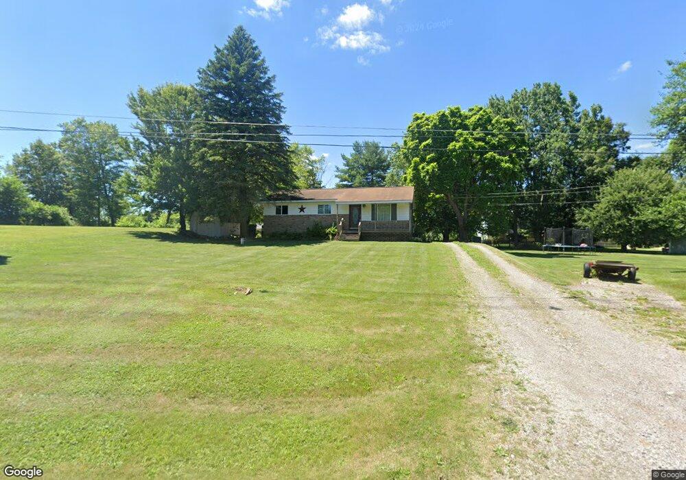
9294 Jason Rd Laingsburg, MI 48848
Estimated Value: $214,066 - $256,000
3
Beds
2
Baths
1,840
Sq Ft
$124/Sq Ft
Est. Value
About This Home
This home is located at 9294 Jason Rd, Laingsburg, MI 48848 and is currently estimated at $228,767, approximately $124 per square foot. 9294 Jason Rd is a home located in Clinton County with nearby schools including Laingsburg Elementary School, Laingsburg Middle School, and Laingsburg High School.
Ownership History
Date
Name
Owned For
Owner Type
Purchase Details
Closed on
May 5, 2021
Sold by
Merrill Donald B and Merrill Diana
Bought by
Powis Teresa and Powis Jeffery K
Current Estimated Value
Home Financials for this Owner
Home Financials are based on the most recent Mortgage that was taken out on this home.
Original Mortgage
$159,065
Outstanding Balance
$144,153
Interest Rate
3.1%
Mortgage Type
FHA
Estimated Equity
$84,614
Create a Home Valuation Report for This Property
The Home Valuation Report is an in-depth analysis detailing your home's value as well as a comparison with similar homes in the area
Home Values in the Area
Average Home Value in this Area
Purchase History
| Date | Buyer | Sale Price | Title Company |
|---|---|---|---|
| Powis Teresa | $160,000 | Amrock |
Source: Public Records
Mortgage History
| Date | Status | Borrower | Loan Amount |
|---|---|---|---|
| Open | Powis Teresa | $159,065 |
Source: Public Records
Tax History Compared to Growth
Tax History
| Year | Tax Paid | Tax Assessment Tax Assessment Total Assessment is a certain percentage of the fair market value that is determined by local assessors to be the total taxable value of land and additions on the property. | Land | Improvement |
|---|---|---|---|---|
| 2025 | $2,874 | $86,900 | $23,000 | $63,900 |
| 2024 | $955 | $82,900 | $21,000 | $61,900 |
| 2023 | $905 | $77,300 | $0 | $0 |
| 2022 | $2,620 | $72,800 | $19,300 | $53,500 |
| 2021 | $1,881 | $68,400 | $19,000 | $49,400 |
| 2020 | $1,748 | $64,000 | $18,000 | $46,000 |
| 2019 | $1,765 | $61,500 | $18,000 | $43,500 |
| 2018 | $1,580 | $57,700 | $18,000 | $39,700 |
| 2017 | $1,562 | $58,300 | $18,000 | $40,300 |
| 2016 | $1,513 | $56,700 | $18,000 | $38,700 |
| 2015 | $1,500 | $56,500 | $0 | $0 |
| 2011 | -- | $50,100 | $0 | $0 |
Source: Public Records
Map
Nearby Homes
- 9195 Westchester Dr
- V/L Victoria Shore Dr
- 0 Peninsula Way
- Parcel B S Hollister Rd
- 9457 S Hollister Rd
- 702 N Oakland Dr
- 780 N West St
- V/L W 2nd St N
- 7599 Alward Rd
- 7370 Cross Creek Dr
- 302 N Shiawassee St
- 8584 E Parker Rd
- 407 S Woodhull Rd
- 0 Doyle Rd Unit 291996
- 0 Laingsburg Rd
- 6706 E Price Rd
- V/L S Shepardsville Rd
- 3525 S Hollister Rd
- 5025 S Saint Clair Rd
- 0
- 7081 Cambridge Dr
- 9266 Jason Rd
- 7059 Cambridge Dr
- 9295 Jason Rd
- 9291 Jason Rd
- 9326 Jason Rd
- o Lancaster Jason (Lot 63)
- 12335 Edgewood Oaks Dr
- Lot 45 Cambridge Dr
- Lot 44 Cambridge Dr
- 0 Cambridge Dr
- 7072 Westgate Dr
- 7080 Cambridge Dr
- 9354 Lancaster Rd
- 7048 Cambridge Dr
- 9338 Jason Rd
- 9337 Jason Rd
- 7032 Cambridge Dr
- 0 Cambridge (Lot 32) Unit 217167
- 7060 Westgate Dr