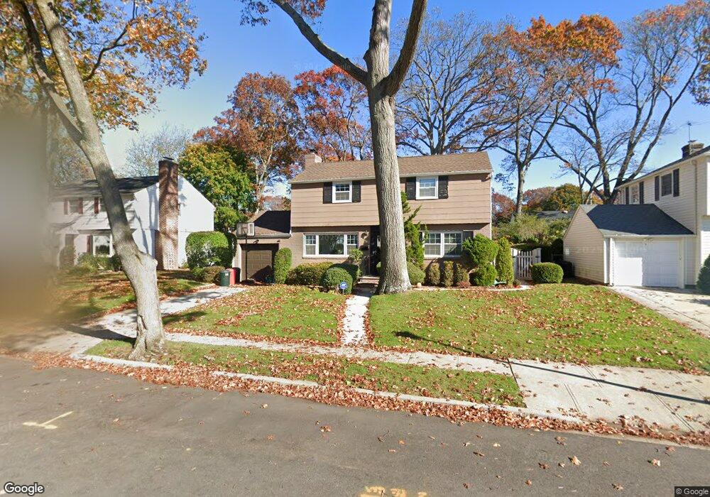
93 Alfred Rd E Merrick, NY 11566
Estimated Value: $704,417 - $869,000
Studio
2
Baths
1,558
Sq Ft
$505/Sq Ft
Est. Value
About This Home
This home is located at 93 Alfred Rd E, Merrick, NY 11566 and is currently estimated at $786,709, approximately $504 per square foot. 93 Alfred Rd E is a home located in Nassau County with nearby schools including Merrick Avenue Middle School, Sanford H Calhoun High School, and Grace Christian Academy.
Ownership History
Date
Name
Owned For
Owner Type
Purchase Details
Closed on
Feb 17, 2000
Sold by
Hertz Hamilton
Bought by
Kessel Richard M
Current Estimated Value
Home Financials for this Owner
Home Financials are based on the most recent Mortgage that was taken out on this home.
Original Mortgage
$265,000
Outstanding Balance
$83,377
Interest Rate
7.5%
Mortgage Type
Purchase Money Mortgage
Estimated Equity
$703,332
Purchase Details
Closed on
Jul 16, 1997
Create a Home Valuation Report for This Property
The Home Valuation Report is an in-depth analysis detailing your home's value as well as a comparison with similar homes in the area
Home Values in the Area
Average Home Value in this Area
Purchase History
| Date | Buyer | Sale Price | Title Company |
|---|---|---|---|
| Kessel Richard M | $290,000 | -- | |
| -- | -- | -- |
Source: Public Records
Mortgage History
| Date | Status | Borrower | Loan Amount |
|---|---|---|---|
| Open | Kessel Richard M | $265,000 |
Source: Public Records
Tax History
| Year | Tax Paid | Tax Assessment Tax Assessment Total Assessment is a certain percentage of the fair market value that is determined by local assessors to be the total taxable value of land and additions on the property. | Land | Improvement |
|---|---|---|---|---|
| 2025 | $14,206 | $468 | $181 | $287 |
| 2024 | $3,337 | $489 | $189 | $300 |
Source: Public Records
Map
Nearby Homes
- 24 Loines Ave
- 16 Margaret Blvd
- 19 Margaret Blvd
- 1931 Miller Place
- 138 Hewlett Ave
- 1911 Carroll Ave
- 18 Helene Ave
- 2 Garfield St
- 70 Nancy Blvd
- 2203 Washington St
- 2171 Seneca Dr S
- 132 Webster St
- 221 Thelma Ave
- 236 Thelma Ave
- 1715 Remson Ave
- 1811 Bedford Ave
- 1729 Gormley Ave
- 1680 Lake Ave
- TBD Camp Ave
- 1741 Bushwick Ave
- 95 Alfred Rd E
- 91 Alfred Rd E
- 173 Merrick Ave
- 97 Alfred Rd E
- 2000 Merrick Ave
- 89 Alfred Rd E
- 2014 Merrick Ave
- 161 Merrick Ave
- 1992 Merrick Ave
- 2000 Alfred Rd E
- 2012 Alfred Rd E
- 87 Alfred Rd E
- 4 W Loines Ave
- 191 Merrick Ave
- 86 Alfred Rd E
- 155 Merrick Ave
- 4 Juniper Ave
- 180 Merrick Ave
- 2028 Alfred Rd E
- 3 Juniper Ave
Your Personal Tour Guide
Ask me questions while you tour the home.