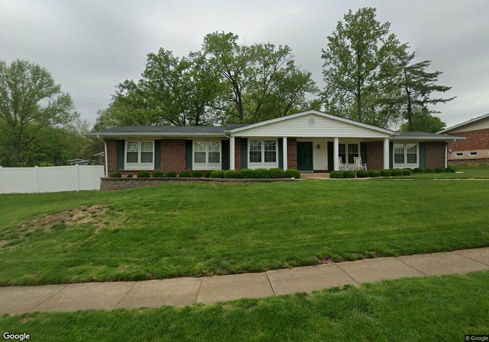
93 Burning Tree Dr Chesterfield, MO 63017
Estimated Value: $426,000 - $468,000
4
Beds
3
Baths
2,214
Sq Ft
$203/Sq Ft
Est. Value
About This Home
This home is located at 93 Burning Tree Dr, Chesterfield, MO 63017 and is currently estimated at $449,987, approximately $203 per square foot. 93 Burning Tree Dr is a home located in St. Louis County with nearby schools including River Bend Elementary School, Parkway Central Middle School, and Parkway Central High School.
Ownership History
Date
Name
Owned For
Owner Type
Purchase Details
Closed on
Oct 6, 2021
Sold by
Wienstroer John V and Wienstroer Sharon
Bought by
Wienstroer John Vincent and Wienstroer Sharon Marie
Current Estimated Value
Purchase Details
Closed on
Jul 9, 2007
Sold by
Meehan Michael J and Meehan Kathleen B
Bought by
Wienstroer John and Wienstroer Sharon M
Home Financials for this Owner
Home Financials are based on the most recent Mortgage that was taken out on this home.
Original Mortgage
$200,000
Outstanding Balance
$123,365
Interest Rate
6.25%
Mortgage Type
Purchase Money Mortgage
Estimated Equity
$326,622
Purchase Details
Closed on
May 8, 1999
Sold by
Meehan Michael J and Meehan Kathleen B
Bought by
Meehan Michael Joseph and Meehan Timothy Raymond
Create a Home Valuation Report for This Property
The Home Valuation Report is an in-depth analysis detailing your home's value as well as a comparison with similar homes in the area
Home Values in the Area
Average Home Value in this Area
Purchase History
We collect this data history from publicly available records. To have your information removed, we recommend requesting removal directly through your county’s website.
| Date | Buyer | Sale Price | Title Company |
|---|---|---|---|
| Wienstroer John Vincent | -- | None Available | |
| Wienstroer John | $250,000 | None Available | |
| Meehan Michael Joseph | -- | -- |
Source: Public Records
Mortgage History
We collect this data history from publicly available records. To have your information removed, we recommend requesting removal directly through your county’s website.
| Date | Status | Borrower | Loan Amount |
|---|---|---|---|
| Open | Wienstroer John | $200,000 |
Source: Public Records
Tax History
| Year | Tax Paid | Tax Assessment Tax Assessment Total Assessment is a certain percentage of the fair market value that is determined by local assessors to be the total taxable value of land and additions on the property. | Land | Improvement |
|---|---|---|---|---|
| 2025 | $4,520 | $70,360 | $39,620 | $30,740 |
| 2024 | $4,520 | $68,270 | $29,280 | $38,990 |
| 2023 | $4,335 | $68,270 | $29,280 | $38,990 |
| 2022 | $4,894 | $70,190 | $29,280 | $40,910 |
| 2021 | $4,874 | $70,190 | $29,280 | $40,910 |
| 2020 | $4,619 | $63,860 | $25,100 | $38,760 |
| 2019 | $4,518 | $63,860 | $25,100 | $38,760 |
| 2018 | $4,543 | $59,550 | $23,010 | $36,540 |
| 2017 | $4,419 | $59,550 | $23,010 | $36,540 |
| 2016 | $4,511 | $57,780 | $18,810 | $38,970 |
| 2015 | $4,729 | $57,780 | $18,810 | $38,970 |
| 2014 | $4,044 | $52,790 | $12,450 | $40,340 |
Source: Public Records
Map
Nearby Homes
- 287 Glen Valley Dr
- 38 Forestvale Dr
- 111 La Gorce Dr
- 357 N Woods Mill Rd
- 13451 Land O Woods Dr Unit C
- 14308 Strawbridge Ct
- 13573 Coliseum Dr
- 13438 Forestlac Dr
- 13815 Olive Blvd
- 13419 Forestlac Dr
- 13484 Coliseum Dr
- 13503 Coliseum Dr
- 13312 Wood Chapel Dr
- 13459 Coliseum Dr
- 13453 Coliseum Dr Unit F
- 13453 Coliseum Dr Unit E
- 13304 Streamwood Dr
- 14286 Harmony Meadow Ct
- 13305 Woodlake Village Ct E
- 13311 Chapel Mill Dr Unit 3
- 184 Glen Cove Dr
- 92 Burning Tree Dr
- 185 Glen Cove Dr
- 219 Glen Cove Dr
- 94 Burning Tree Dr
- 91 Burning Tree Dr
- 186 Glen Cove Dr
- 218 Glen Cove Dr
- 70 Burning Tree Dr
- 427 Madewood Ln
- 217 Glen Cove Dr
- 431 Madewood Ln
- 113 Del Monte Ct
- 90 Burning Tree Dr
- 187 Glen Cove Dr
- 423 Madewood Ln
- 114 Del Monte Ct
- 112 La Gorce Dr
- 69 Burning Tree Dr
- 435 Madewood Ln
Your Personal Tour Guide
Ask me questions while you tour the home.