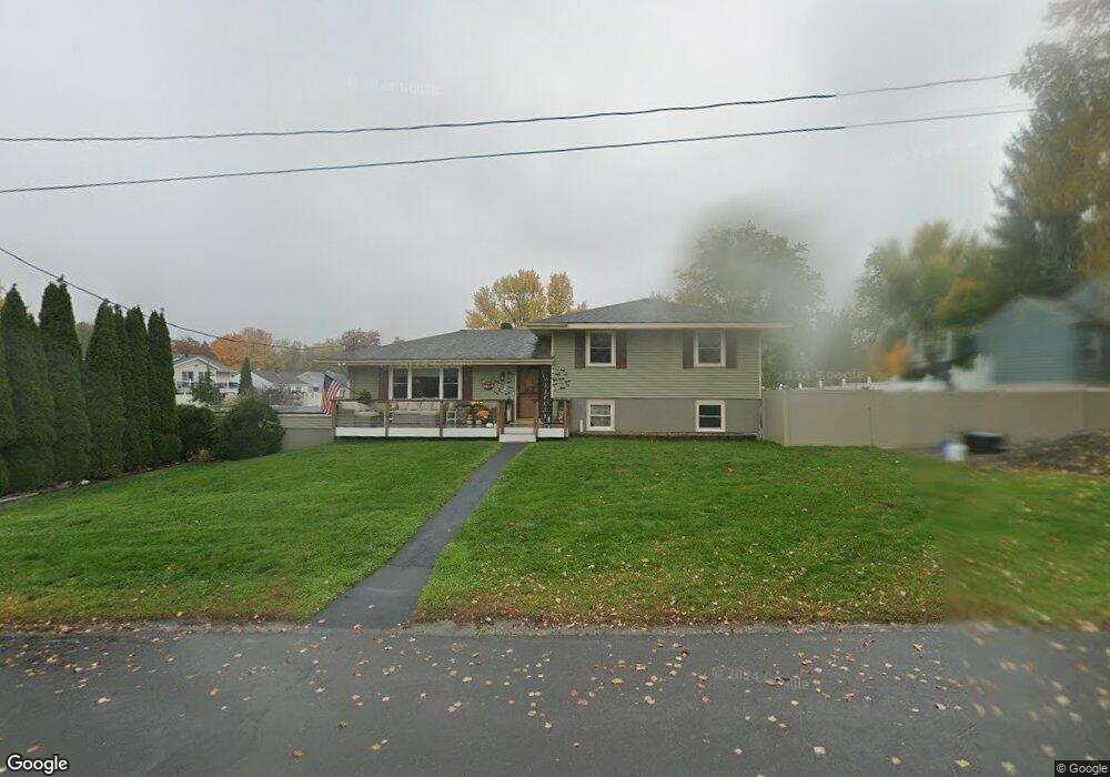
93 County Route 25b Hudson, NY 12534
Estimated Value: $482,000 - $709,000
3
Beds
1
Bath
1,528
Sq Ft
$385/Sq Ft
Est. Value
About This Home
This home is located at 93 County Route 25b, Hudson, NY 12534 and is currently estimated at $587,891, approximately $384 per square foot. 93 County Route 25b is a home located in Columbia County with nearby schools including Ichabod Crane Primary School, Ichabod Crane Middle School, and Ichabod Crane High School.
Ownership History
Date
Name
Owned For
Owner Type
Purchase Details
Closed on
Feb 23, 2018
Sold by
Laudati Michael and Leandrou Despina
Bought by
Baack Hillary and Baack Alexander
Current Estimated Value
Home Financials for this Owner
Home Financials are based on the most recent Mortgage that was taken out on this home.
Original Mortgage
$299,669
Outstanding Balance
$254,805
Interest Rate
4.15%
Mortgage Type
Stand Alone Refi Refinance Of Original Loan
Estimated Equity
$333,087
Purchase Details
Closed on
Feb 2, 2007
Sold by
Trust Woods Family
Bought by
Laudati Michael
Create a Home Valuation Report for This Property
The Home Valuation Report is an in-depth analysis detailing your home's value as well as a comparison with similar homes in the area
Purchase History
| Date | Buyer | Sale Price | Title Company |
|---|---|---|---|
| Baack Hillary | $429,932 | -- | |
| Laudati Michael | $395,000 | Virginia Smith |
Source: Public Records
Mortgage History
| Date | Status | Borrower | Loan Amount |
|---|---|---|---|
| Open | Baack Hillary | $299,669 |
Source: Public Records
Tax History
| Year | Tax Paid | Tax Assessment Tax Assessment Total Assessment is a certain percentage of the fair market value that is determined by local assessors to be the total taxable value of land and additions on the property. | Land | Improvement |
|---|---|---|---|---|
| 2024 | $8,361 | $474,000 | $37,800 | $436,200 |
| 2023 | $7,669 | $217,994 | $30,390 | $187,604 |
| 2022 | $7,576 | $217,994 | $30,390 | $187,604 |
| 2021 | $7,566 | $217,994 | $30,390 | $187,604 |
| 2020 | $7,452 | $217,994 | $30,390 | $187,604 |
| 2019 | $7,092 | $217,994 | $30,390 | $187,604 |
| 2018 | $7,092 | $217,994 | $30,390 | $187,604 |
| 2017 | $5,947 | $181,994 | $30,390 | $151,604 |
| 2016 | $5,688 | $181,994 | $30,390 | $151,604 |
| 2015 | -- | $181,994 | $30,390 | $151,604 |
| 2014 | -- | $181,994 | $30,390 | $151,604 |
Source: Public Records
Map
Nearby Homes
- 0 Route 9 Unit 20260419
- 0 Route 9 Unit KEY958784
- 0 Route 9 Unit 20260407
- 1154 U S 9 Unit 23
- 1154 U S 9 Unit 17
- 1154 U S 9 Unit 33
- 1154 U S 9 Unit 31
- 1154 U S 9 Unit 27
- 6727 U S 9
- 6881 Rod and Gun Rd
- 2884 Atlantic Ave
- 6616 US Route 9
- 9459 U S 9 Unit 79 Dennis Street
- 6650 Hill St
- 2970 Salisbury Place
- 2970 Salisbury Place
- 6568 Hill St
- 2971 Garden Place
- 469 Fairview Ave
- 6550 Hill St
- 93 Route 25
- 93 Cty Rt 25
- 81 County Route 25
- 81 Country Rte 25
- 94 County Route 25b
- 81 County Route 25b
- 81 County Route 25
- 81 Route 25
- 110 County Route 25
- 73 County Route 25
- 78 County Route 25b
- 22 County Route 25b
- 22 County Route 25b
- 894 Us Route 9
- 107 County Route 25
- 107 Co Rt 25
- 894 Rt 9
- 65 County Route 25b
- 22 Route 25 B
- 10 County Route 25b
Your Personal Tour Guide
Ask me questions while you tour the home.