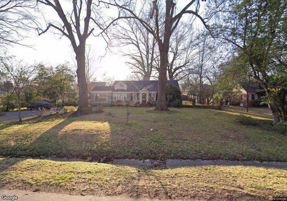
93 Devon Way Memphis, TN 38111
High Point Terrace NeighborhoodEstimated Value: $406,000 - $581,000
3
Beds
2
Baths
3,007
Sq Ft
$170/Sq Ft
Est. Value
About This Home
This home is located at 93 Devon Way, Memphis, TN 38111 and is currently estimated at $510,345, approximately $169 per square foot. 93 Devon Way is a home located in Shelby County with nearby schools including White Station Elementary School, White Station High, and White Station Middle.
Ownership History
Date
Name
Owned For
Owner Type
Purchase Details
Closed on
May 4, 2023
Sold by
Eikner Philip B and Kim Justis
Bought by
Joint Revocable Trust
Current Estimated Value
Purchase Details
Closed on
Mar 19, 1997
Sold by
Justis E Jeff and Justis Sally V
Bought by
Eikner Phillip B and Justis Kim
Home Financials for this Owner
Home Financials are based on the most recent Mortgage that was taken out on this home.
Original Mortgage
$60,000
Interest Rate
8.6%
Create a Home Valuation Report for This Property
The Home Valuation Report is an in-depth analysis detailing your home's value as well as a comparison with similar homes in the area
Home Values in the Area
Average Home Value in this Area
Purchase History
| Date | Buyer | Sale Price | Title Company |
|---|---|---|---|
| Joint Revocable Trust | -- | None Listed On Document | |
| Eikner Phillip B | $175,000 | -- | |
| Eikner Phillip B | $175,000 | -- |
Source: Public Records
Mortgage History
| Date | Status | Borrower | Loan Amount |
|---|---|---|---|
| Previous Owner | Eikner Phillip B | $60,000 |
Source: Public Records
Tax History
| Year | Tax Paid | Tax Assessment Tax Assessment Total Assessment is a certain percentage of the fair market value that is determined by local assessors to be the total taxable value of land and additions on the property. | Land | Improvement |
|---|---|---|---|---|
| 2025 | $4,062 | $126,800 | $63,200 | $63,600 |
| 2024 | $4,062 | $119,825 | $63,200 | $56,625 |
| 2023 | $7,299 | $119,825 | $63,200 | $56,625 |
| 2022 | $7,299 | $119,825 | $63,200 | $56,625 |
| 2021 | $7,385 | $119,825 | $63,200 | $56,625 |
| 2020 | $8,458 | $116,725 | $63,200 | $53,525 |
| 2019 | $8,458 | $116,725 | $63,200 | $53,525 |
| 2018 | $8,458 | $116,725 | $63,200 | $53,525 |
| 2017 | $4,797 | $116,725 | $63,200 | $53,525 |
| 2016 | $4,596 | $105,175 | $0 | $0 |
Source: Public Records
Map
Nearby Homes
- 59 Devon Way
- 55 Saint Andrews Fwy
- 3815 Highland Park Place
- 4009 Walnut Grove Rd
- 4072 N Walnut Grove Cir
- 73 N Goodlett St
- 103 N Goodlett St
- 3790 Walnut Grove Rd
- 3759 Highland Park Place
- 236 Eastland Dr
- 207 N Goodlett St
- 40 N Goodlett St
- 4015 N Galloway Dr
- 40 S Rose Rd
- 274 Eastland Dr
- 3763 Cardinal Ave
- 267 N Rose Rd
- 194 Wallace Rd
- 3815 Montclair Dr
- 3754 Montclair Dr
- 81 Devon Way
- 105 Devon Way
- 94 Saint Albans Fairway
- 94 Saint Albans Fwy
- 84 St Albans Fwy
- 84 Saint Albans Fwy
- 104 Saint Albans Fwy
- 71 Devon Way
- 86 Devon Way
- 100 Devon Way
- 76 Saint Albans Fairway
- 119 Devon Way
- 76 Saint Albans Fwy
- 74 Devon Way
- 120 Saint Albans Fwy
- 116 Devon Way
- 60 Saint Albans Fwy
- 91 Saint Albans Fwy
- 2 Devon Way
- 81 Saint Albans Fwy
Your Personal Tour Guide
Ask me questions while you tour the home.