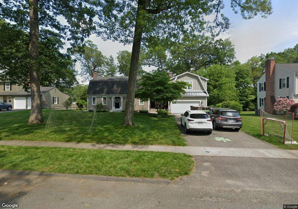
93 Duxbury Ln Unit 93 Longmeadow, MA 01106
Estimated Value: $541,578 - $612,000
3
Beds
2
Baths
1,788
Sq Ft
$321/Sq Ft
Est. Value
About This Home
This home is located at 93 Duxbury Ln Unit 93, Longmeadow, MA 01106 and is currently estimated at $573,645, approximately $320 per square foot. 93 Duxbury Ln Unit 93 is a home located in Hampden County with nearby schools including Blueberry Hill, Williams Middle School, and Longmeadow High School.
Ownership History
Date
Name
Owned For
Owner Type
Purchase Details
Closed on
Jan 25, 2013
Sold by
Wells Fargo Bank Na
Bought by
Manning Patrick and Manning Shannon
Current Estimated Value
Home Financials for this Owner
Home Financials are based on the most recent Mortgage that was taken out on this home.
Original Mortgage
$204,000
Outstanding Balance
$142,211
Interest Rate
3.35%
Mortgage Type
New Conventional
Estimated Equity
$431,434
Purchase Details
Closed on
Feb 29, 2012
Sold by
Rowe William H and Connery Catherine M
Bought by
Wells Fargo Bank Na
Purchase Details
Closed on
Jan 27, 2006
Sold by
Christina D Little Irt
Bought by
Rowe William H
Home Financials for this Owner
Home Financials are based on the most recent Mortgage that was taken out on this home.
Original Mortgage
$272,000
Interest Rate
6.34%
Mortgage Type
Purchase Money Mortgage
Create a Home Valuation Report for This Property
The Home Valuation Report is an in-depth analysis detailing your home's value as well as a comparison with similar homes in the area
Home Values in the Area
Average Home Value in this Area
Purchase History
| Date | Buyer | Sale Price | Title Company |
|---|---|---|---|
| Manning Patrick | $255,000 | -- | |
| Wells Fargo Bank Na | $292,249 | -- | |
| Rowe William H | $340,000 | -- |
Source: Public Records
Mortgage History
| Date | Status | Borrower | Loan Amount |
|---|---|---|---|
| Open | Manning Patrick | $204,000 | |
| Closed | Manning Patrick | $25,500 | |
| Previous Owner | Rowe William H | $272,000 | |
| Previous Owner | Manning Patrick | $50,000 |
Source: Public Records
Tax History Compared to Growth
Tax History
| Year | Tax Paid | Tax Assessment Tax Assessment Total Assessment is a certain percentage of the fair market value that is determined by local assessors to be the total taxable value of land and additions on the property. | Land | Improvement |
|---|---|---|---|---|
| 2025 | $10,317 | $488,500 | $168,200 | $320,300 |
| 2024 | $10,102 | $488,500 | $168,200 | $320,300 |
| 2023 | $9,940 | $433,700 | $153,400 | $280,300 |
| 2022 | $9,590 | $389,200 | $153,400 | $235,800 |
| 2021 | $9,206 | $372,100 | $146,100 | $226,000 |
| 2020 | $8,900 | $367,600 | $146,100 | $221,500 |
| 2019 | $8,480 | $352,000 | $146,100 | $205,900 |
| 2018 | $7,789 | $320,000 | $169,800 | $150,200 |
| 2017 | $7,652 | $324,500 | $169,800 | $154,700 |
| 2016 | $7,284 | $299,400 | $154,100 | $145,300 |
| 2015 | $7,034 | $297,800 | $152,500 | $145,300 |
Source: Public Records
Map
Nearby Homes
- 124 Tecumseh Dr
- 0 Dennis Rd
- 64 Magnolia Cir
- 132 Coventry Ln
- 911 Williams St
- 111 Ashford Rd
- 32 Edgewood Ave
- 361 Frank Smith Rd
- 260 Longmeadow St
- 44 Wendover Rd
- 217 Inverness Ln
- 0 Mill Rd
- 120 Inverness Ln
- 50 Elmwood Ave
- 47 Academy Dr
- 49 Wimbleton Dr
- 85 Inverness Ln
- 136 Fenwood Rd
- 114 Park Dr
- 52 Smithfield Ct