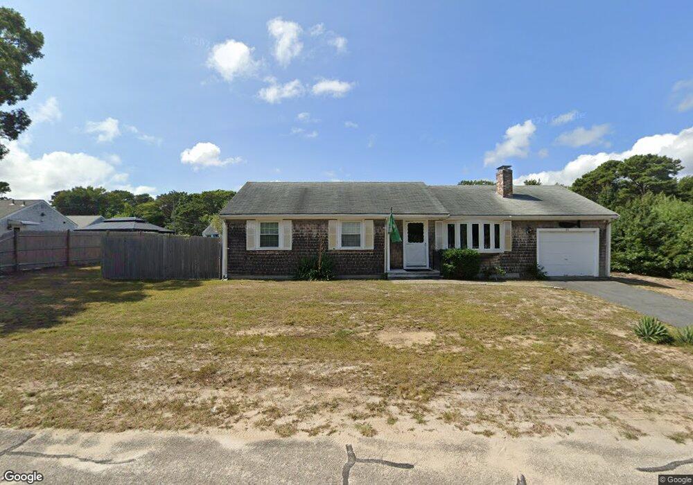
93 Lawrence Rd Dennis Port, MA 02639
Dennis Port NeighborhoodEstimated Value: $608,000 - $752,000
3
Beds
2
Baths
1,001
Sq Ft
$684/Sq Ft
Est. Value
About This Home
This home is located at 93 Lawrence Rd, Dennis Port, MA 02639 and is currently estimated at $684,279, approximately $683 per square foot. 93 Lawrence Rd is a home located in Barnstable County with nearby schools including Dennis-Yarmouth Regional High School and St. Pius X. School.
Ownership History
Date
Name
Owned For
Owner Type
Purchase Details
Closed on
May 1, 2018
Sold by
Wright Joanne M
Bought by
Joanne M Wright 2002 T
Current Estimated Value
Purchase Details
Closed on
Dec 15, 1999
Sold by
Smyth J Thomas and Smyth Dianne S
Bought by
Wright Joanne M
Home Financials for this Owner
Home Financials are based on the most recent Mortgage that was taken out on this home.
Original Mortgage
$124,000
Interest Rate
7.81%
Mortgage Type
Purchase Money Mortgage
Purchase Details
Closed on
Oct 3, 1988
Sold by
Franklin Rt
Bought by
Smyth J Thomas
Home Financials for this Owner
Home Financials are based on the most recent Mortgage that was taken out on this home.
Original Mortgage
$90,000
Interest Rate
10.66%
Mortgage Type
Purchase Money Mortgage
Create a Home Valuation Report for This Property
The Home Valuation Report is an in-depth analysis detailing your home's value as well as a comparison with similar homes in the area
Home Values in the Area
Average Home Value in this Area
Purchase History
| Date | Buyer | Sale Price | Title Company |
|---|---|---|---|
| Joanne M Wright 2002 T | -- | -- | |
| Wright Joanne M | $155,000 | -- | |
| Smyth J Thomas | $160,000 | -- |
Source: Public Records
Mortgage History
| Date | Status | Borrower | Loan Amount |
|---|---|---|---|
| Previous Owner | Smyth J Thomas | $155,800 | |
| Previous Owner | Wright Joanne M | $124,000 | |
| Previous Owner | Smyth J Thomas | $90,000 |
Source: Public Records
Tax History Compared to Growth
Tax History
| Year | Tax Paid | Tax Assessment Tax Assessment Total Assessment is a certain percentage of the fair market value that is determined by local assessors to be the total taxable value of land and additions on the property. | Land | Improvement |
|---|---|---|---|---|
| 2025 | $3,022 | $697,900 | $210,900 | $487,000 |
| 2024 | $2,871 | $653,900 | $202,800 | $451,100 |
| 2023 | $2,776 | $594,500 | $184,400 | $410,100 |
| 2022 | $2,574 | $459,700 | $166,100 | $293,600 |
| 2021 | $2,592 | $429,800 | $186,100 | $243,700 |
| 2020 | $2,342 | $383,900 | $162,800 | $221,100 |
| 2019 | $2,198 | $356,300 | $159,600 | $196,700 |
| 2018 | $2,111 | $333,000 | $152,000 | $181,000 |
| 2017 | $1,946 | $316,400 | $141,100 | $175,300 |
| 2016 | $1,970 | $301,700 | $152,000 | $149,700 |
| 2015 | $1,931 | $301,700 | $152,000 | $149,700 |
| 2014 | $1,778 | $280,000 | $130,300 | $149,700 |
Source: Public Records
Map
Nearby Homes
- 80 Michaels Ave
- 19 Standish Way
- 31 Easy St
- 22 Wixon Rd
- 37 Ocean Dr Unit 2
- 4 Coffey Ln
- 71 Main St
- 12 Spoonbill Rd
- 125 Main St Unit 3
- 64 Beaten Rd
- 15 Woodside Park Rd
- 72 Bassett Ln
- 61 Trotters Ln
- 112 Old Wharf Rd Unit E4
- 112 Old Wharf Rd Unit E1
- 154 Old Wharf Rd Unit 26
- 154 Old Wharf Rd Unit 14
- 120 Old Wharf Rd Unit 11
- 268 Main St
- 113 Old Wharf Rd Unit 7
- 74 Michaels Ave
- 87 Lawrence Rd
- 90 Lawrence Rd
- 101 Lawrence Rd
- 68 Michaels Ave
- 81 Lawrence Rd
- 86 Michaels Ave
- 79 Michael's Ave
- 94 Lawrence Rd
- 82 Lawrence Rd
- 79 Michaels Ave
- 68 Michael's Ave
- 83 Michaels Ave
- 79 Lawrence Rd
- 105 Lawrence Rd
- 79 Polly Fisk Ln
- 98 Lawrence Rd
- 64 Michaels Ave
- 85 Polly Fisk Ln
- 90 Michaels Ave