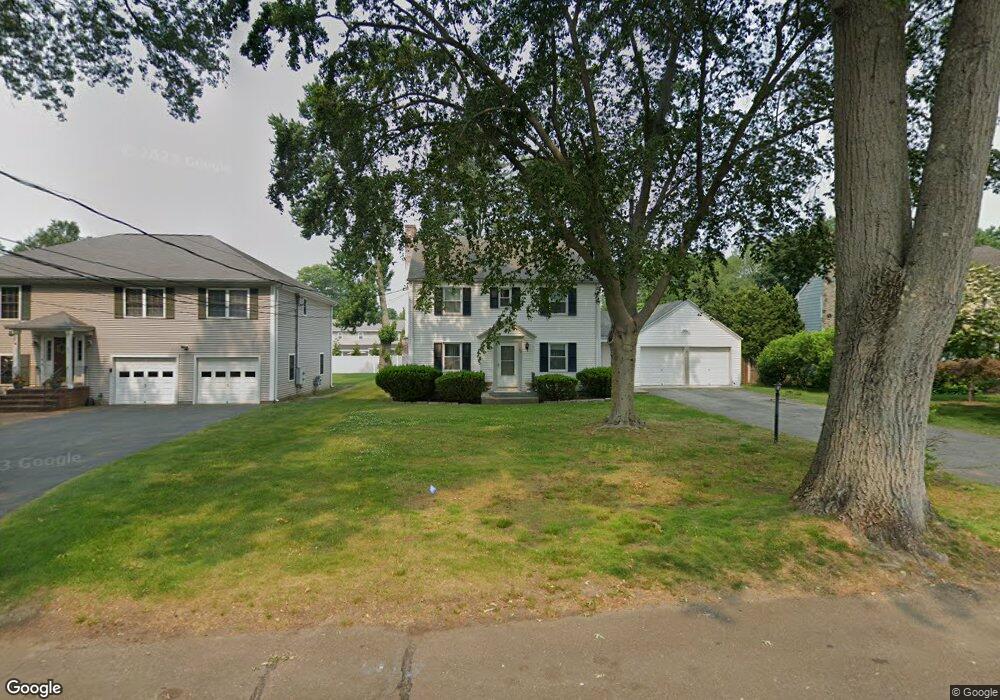
93 Lawrence Rd Fairfield, CT 06824
University NeighborhoodEstimated Value: $811,000 - $973,000
3
Beds
2
Baths
1,560
Sq Ft
$569/Sq Ft
Est. Value
About This Home
This home is located at 93 Lawrence Rd, Fairfield, CT 06824 and is currently estimated at $888,163, approximately $569 per square foot. 93 Lawrence Rd is a home located in Fairfield County with nearby schools including Riverfield Elementary School, Roger Ludlowe Middle School, and Fairfield Ludlowe High School.
Ownership History
Date
Name
Owned For
Owner Type
Purchase Details
Closed on
Oct 20, 2010
Sold by
93 Lawrence Road Llc
Bought by
Cellar 2Nd Richard S
Current Estimated Value
Home Financials for this Owner
Home Financials are based on the most recent Mortgage that was taken out on this home.
Original Mortgage
$552,150
Interest Rate
4.22%
Mortgage Type
FHA
Create a Home Valuation Report for This Property
The Home Valuation Report is an in-depth analysis detailing your home's value as well as a comparison with similar homes in the area
Home Values in the Area
Average Home Value in this Area
Purchase History
| Date | Buyer | Sale Price | Title Company |
|---|---|---|---|
| Cellar 2Nd Richard S | -- | -- | |
| Cellar 2Nd Richard S | -- | -- |
Source: Public Records
Mortgage History
| Date | Status | Borrower | Loan Amount |
|---|---|---|---|
| Open | Cellar 2Nd Richard S | $505,000 | |
| Closed | Cellar 2Nd Richard S | $545,000 | |
| Closed | Cellar 2Nd Richard S | $552,150 | |
| Previous Owner | Cellar 2Nd Richard S | $55,000 |
Source: Public Records
Tax History Compared to Growth
Tax History
| Year | Tax Paid | Tax Assessment Tax Assessment Total Assessment is a certain percentage of the fair market value that is determined by local assessors to be the total taxable value of land and additions on the property. | Land | Improvement |
|---|---|---|---|---|
| 2025 | $10,880 | $383,250 | $271,950 | $111,300 |
| 2024 | $10,693 | $383,250 | $271,950 | $111,300 |
| 2023 | $10,543 | $383,250 | $271,950 | $111,300 |
| 2022 | $10,440 | $383,250 | $271,950 | $111,300 |
| 2021 | $10,340 | $383,250 | $271,950 | $111,300 |
| 2020 | $10,475 | $391,020 | $269,150 | $121,870 |
| 2019 | $10,475 | $391,020 | $269,150 | $121,870 |
| 2018 | $10,307 | $391,020 | $269,150 | $121,870 |
| 2017 | $10,096 | $391,020 | $269,150 | $121,870 |
| 2016 | $9,951 | $391,020 | $269,150 | $121,870 |
| 2015 | $9,690 | $390,880 | $283,220 | $107,660 |
| 2014 | $9,537 | $390,880 | $283,220 | $107,660 |
Source: Public Records
Map
Nearby Homes
- 105 Charter Oak Rd
- 33 Middlebrook Place
- 360 Duck Farm Rd
- 338 Orchard Hill Ln
- 1207 Stillson Rd
- 2107 N Benson Rd
- 42 Robin Cir
- 359 Reid St
- 168 Wormwood Rd
- 293 Sigwin Dr
- 115 Mayfair Rd
- 15 Barton Rd
- 706 Judd St
- 109 Jeniford Rd
- 210 Pansy Rd
- 20 Ermine St
- 41 Pepperbush Ln
- 12 Sugar Plum Ln
- 327 Meadowbrook Rd
- 274 High St
- 101 Lawrence Rd
- 83 Lawrence Rd
- 117 Lawrence Rd
- 1848 Mill Plain Rd
- 1834 Mill Plain Rd
- 57 Lawrence Rd
- 1882 Mill Plain Rd
- 1818 Mill Plain Rd
- 133 Lawrence Rd
- 72 Lawrence Rd
- 86 Lawrence Rd
- 100 Lawrence Rd
- 116 Lawrence Rd
- 1894 Mill Plain Rd
- 1831 Mill Plain Rd
- 40 Lawrence Rd
- 1640 Round Hill Rd
- 1859 Mill Plain Rd
- 1660 Round Hill Rd
- 58 Lawrence Rd