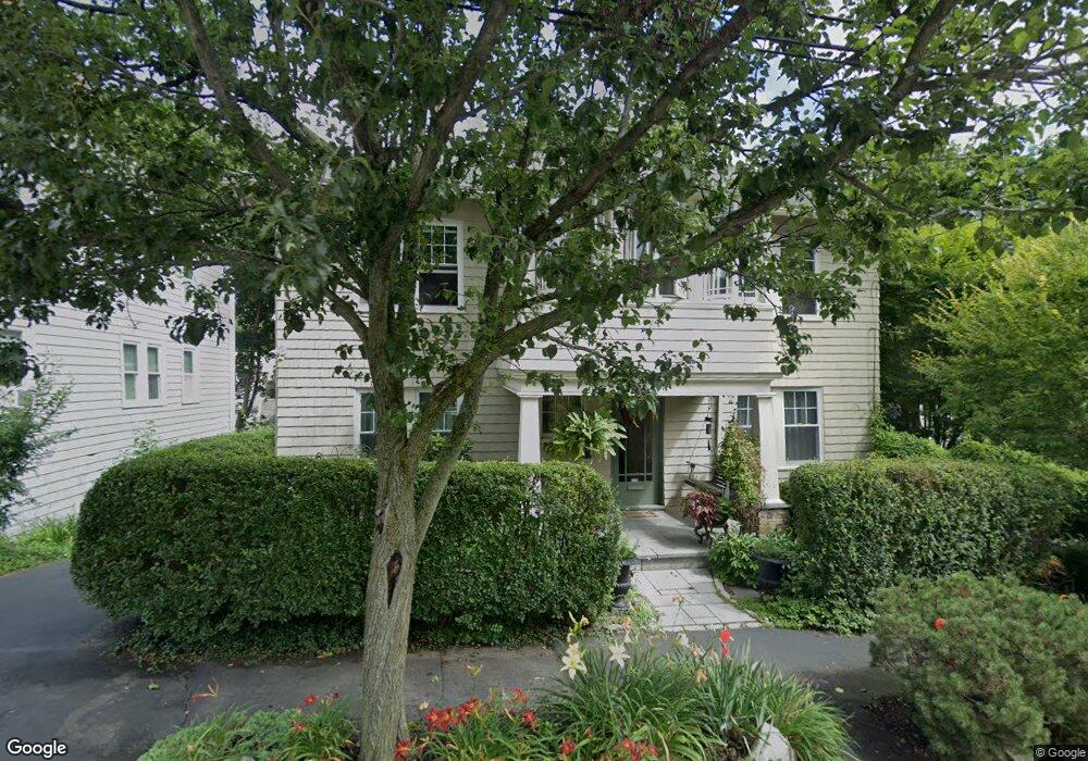
93 Maple St Milton, MA 02186
Columbine Cliffs NeighborhoodEstimated Value: $930,000 - $1,121,573
4
Beds
2
Baths
2,592
Sq Ft
$389/Sq Ft
Est. Value
About This Home
This home is located at 93 Maple St, Milton, MA 02186 and is currently estimated at $1,008,143, approximately $388 per square foot. 93 Maple St is a home located in Norfolk County with nearby schools including Milton High School, Codman Academy Charter Public School, and Conservatory Lab Upper School.
Ownership History
Date
Name
Owned For
Owner Type
Purchase Details
Closed on
Nov 25, 2025
Sold by
Clifford Karla L and Clifford Chris
Bought by
Clifford Ft and Clifford
Current Estimated Value
Purchase Details
Closed on
Dec 30, 1994
Sold by
Zeyfis Walter T
Bought by
Clifford Christopher S
Create a Home Valuation Report for This Property
The Home Valuation Report is an in-depth analysis detailing your home's value as well as a comparison with similar homes in the area
Home Values in the Area
Average Home Value in this Area
Purchase History
| Date | Buyer | Sale Price | Title Company |
|---|---|---|---|
| Clifford Ft | -- | -- | |
| Clifford Christopher S | $165,000 | -- |
Source: Public Records
Mortgage History
| Date | Status | Borrower | Loan Amount |
|---|---|---|---|
| Previous Owner | Clifford Christopher S | $194,000 | |
| Previous Owner | Clifford Christopher S | $165,000 | |
| Previous Owner | Clifford Christopher S | $25,000 | |
| Previous Owner | Clifford Christopher S | $132,000 |
Source: Public Records
Tax History
| Year | Tax Paid | Tax Assessment Tax Assessment Total Assessment is a certain percentage of the fair market value that is determined by local assessors to be the total taxable value of land and additions on the property. | Land | Improvement |
|---|---|---|---|---|
| 2025 | $10,196 | $919,400 | $456,800 | $462,600 |
| 2024 | $9,902 | $906,800 | $435,000 | $471,800 |
| 2023 | $9,644 | $846,000 | $414,300 | $431,700 |
| 2022 | $9,820 | $787,500 | $414,300 | $373,200 |
| 2021 | $9,417 | $717,200 | $361,800 | $355,400 |
| 2020 | $8,780 | $669,200 | $355,000 | $314,200 |
| 2019 | $8,148 | $618,200 | $344,600 | $273,600 |
| 2018 | $7,464 | $540,500 | $262,200 | $278,300 |
| 2017 | $6,814 | $502,500 | $249,700 | $252,800 |
| 2016 | $6,982 | $517,200 | $285,300 | $231,900 |
| 2015 | $5,835 | $418,600 | $208,100 | $210,500 |
Source: Public Records
Map
Nearby Homes
- 72 Columbine Rd
- 44 Allen Cir
- 259 Central Ave
- 67 Idaho St
- 32-32R Temple St
- 1241-1255 Adams St Unit F213
- 1241-1255 Adams St Unit B302
- 1245 Adams St Unit B503
- 23 Maryknoll St
- 260 Canton Ave
- 14 Avondale St
- 88 Wharf St Unit 105
- 30 Pleasant Hill Ave Unit 32
- 424 Brook Rd
- 8 Faunce Rd Unit A
- 214 Brook Rd
- 8 Violet St
- 988 Morton St
- 11 French St
- 4 Crossman St Unit 4
Your Personal Tour Guide
Ask me questions while you tour the home.