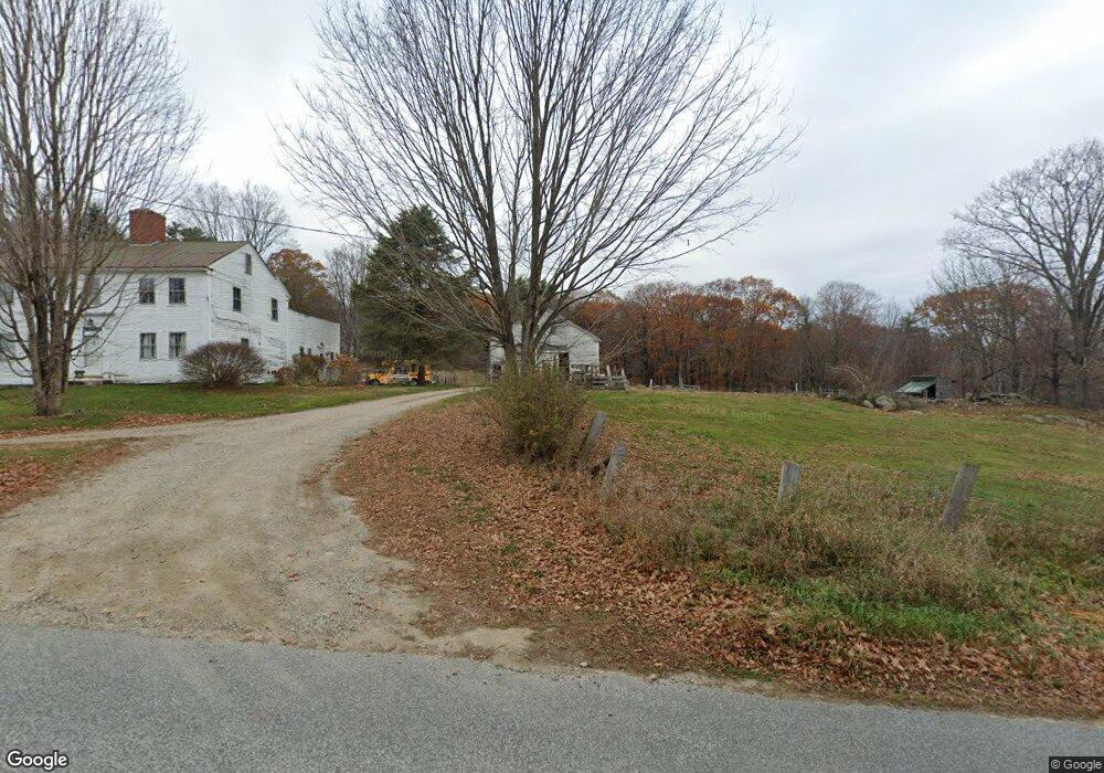
93 Moody Rd Limington, ME 04049
Limington NeighborhoodEstimated Value: $64,000 - $417,000
3
Beds
1
Bath
1,224
Sq Ft
$244/Sq Ft
Est. Value
About This Home
This home is located at 93 Moody Rd, Limington, ME 04049 and is currently estimated at $298,715, approximately $244 per square foot. 93 Moody Rd is a home with nearby schools including Bonny Eagle High School.
Create a Home Valuation Report for This Property
The Home Valuation Report is an in-depth analysis detailing your home's value as well as a comparison with similar homes in the area
Home Values in the Area
Average Home Value in this Area
Tax History Compared to Growth
Tax History
| Year | Tax Paid | Tax Assessment Tax Assessment Total Assessment is a certain percentage of the fair market value that is determined by local assessors to be the total taxable value of land and additions on the property. | Land | Improvement |
|---|---|---|---|---|
| 2025 | $4,097 | $365,839 | $127,039 | $238,800 |
| 2024 | $4,105 | $365,518 | $126,718 | $238,800 |
| 2023 | $3,729 | $364,492 | $125,692 | $238,800 |
| 2022 | $3,089 | $209,424 | $90,024 | $119,400 |
| 2021 | $2,785 | $211,007 | $91,607 | $119,400 |
| 2020 | $2,624 | $213,352 | $93,952 | $119,400 |
| 2019 | $2,647 | $215,217 | $95,817 | $119,400 |
| 2017 | $625 | $182,900 | $63,500 | $119,400 |
| 2016 | $1,806 | $211,308 | $0 | $0 |
| 2015 | $1,994 | $182,900 | $63,500 | $119,400 |
| 2014 | $1,994 | $182,900 | $63,500 | $119,400 |
| 2013 | $2,145 | $204,273 | $84,873 | $119,400 |
Source: Public Records
Map
Nearby Homes
- TBD Moody Rd
- 193 Moody Rd
- 72 Far Woods Cir
- R3 - 71 Cap Rd
- 11 Putnam Ridge
- Lot 7 Prokey Dr
- Lot 12 Prokey Dr
- 530 Cape Rd
- 55 Sportsmans Way
- 00 Doles Ridge Rd
- 474 Doles Ridge Rd
- 48 King Hill Rd
- 14 Mallard Dr
- 91 Pleasant Hill Rd
- 13 Quaker Ln
- LOT# 8 Business Park Rd
- Lot# 11 Business Park Rd
- 110 Pleasant Hill Rd
- 4 Deer Crossing Rd
- 16 Whiteley Rd