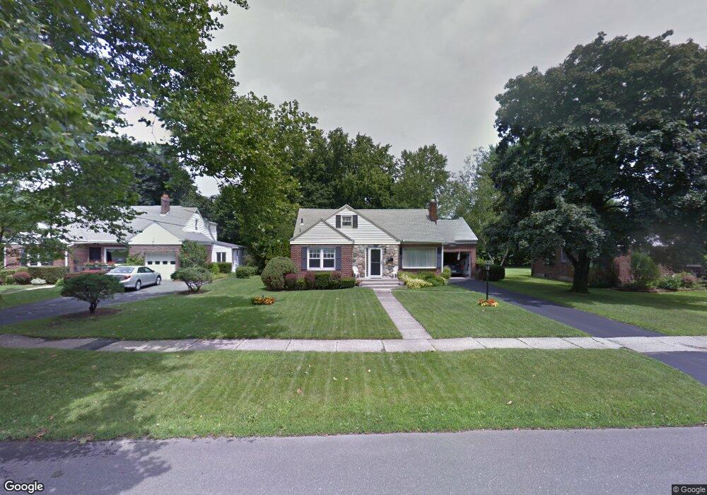
93 Sampson Pkwy Pittsfield, MA 01201
Estimated Value: $365,000 - $405,000
3
Beds
1
Bath
1,843
Sq Ft
$207/Sq Ft
Est. Value
About This Home
This home is located at 93 Sampson Pkwy, Pittsfield, MA 01201 and is currently estimated at $381,743, approximately $207 per square foot. 93 Sampson Pkwy is a home located in Berkshire County with nearby schools including Egremont Elementary School, Theodore Herberg Middle School, and Pittsfield High School.
Ownership History
Date
Name
Owned For
Owner Type
Purchase Details
Closed on
Apr 15, 1971
Bought by
Alibozek Ned and Alibozek Mary Jane
Current Estimated Value
Create a Home Valuation Report for This Property
The Home Valuation Report is an in-depth analysis detailing your home's value as well as a comparison with similar homes in the area
Home Values in the Area
Average Home Value in this Area
Purchase History
| Date | Buyer | Sale Price | Title Company |
|---|---|---|---|
| Alibozek Ned | -- | -- |
Source: Public Records
Mortgage History
| Date | Status | Borrower | Loan Amount |
|---|---|---|---|
| Closed | Alibozek Ned | $67,000 | |
| Closed | Alibozek Ned | $75,000 | |
| Closed | Alibozek Ned | $50,000 | |
| Closed | Alibozek Ned | $50,000 |
Source: Public Records
Tax History Compared to Growth
Tax History
| Year | Tax Paid | Tax Assessment Tax Assessment Total Assessment is a certain percentage of the fair market value that is determined by local assessors to be the total taxable value of land and additions on the property. | Land | Improvement |
|---|---|---|---|---|
| 2025 | $6,799 | $379,000 | $91,100 | $287,900 |
| 2024 | $6,701 | $363,200 | $91,100 | $272,100 |
| 2023 | $6,025 | $328,900 | $81,100 | $247,800 |
| 2022 | $6,067 | $291,500 | $76,100 | $215,400 |
| 2021 | $5,001 | $259,800 | $76,100 | $183,700 |
| 2020 | $4,996 | $253,500 | $76,100 | $177,400 |
| 2019 | $4,612 | $237,500 | $71,100 | $166,400 |
| 2018 | $4,630 | $231,400 | $71,100 | $160,300 |
| 2017 | $4,328 | $220,500 | $66,100 | $154,400 |
| 2016 | $4,088 | $217,900 | $66,100 | $151,800 |
| 2015 | $3,935 | $217,900 | $66,100 | $151,800 |
Source: Public Records
Map
Nearby Homes
- 106 Sampson Pkwy
- 40 Sampson Pkwy
- 99 Cambridge Ave
- 11 Sampson Pkwy
- 381 Williams St
- 51 Foote Ave
- 16 Revere Pkwy
- 66 Holmes Rd
- 25 Putnam Ave
- 39 Lexington Pkwy
- 31 Lexington Pkwy
- 75 Livingston Ave
- 25 E New Lenox Rd
- 206 Dawes Ave
- 44 Marcella Ave
- 30 Belvidere Ave
- 81 Northumberland Rd
- 20 Marshall Ave
- 63 Reuter Ave
- 168 Elm St
- 87 Sampson Pkwy
- 81 Sampson Pkwy
- 107 Sampson Pkwy
- 64 Marlboro Dr
- 70 Marlboro Dr
- 94 Sampson Pkwy
- 115 Sampson Pkwy
- 100 Sampson Pkwy
- 60 Marlboro Dr
- 75 Sampson Pkwy
- 74 Marlboro Dr
- 78 Sampson Pkwy
- 56 Marlboro Dr
- 119 Sampson Pkwy
- 112 Sampson Pkwy
- 78 Marlboro Dr
- 65 Sampson Pkwy
- 65 Marlboro Dr
- 329 Williams St
- 325 Williams St