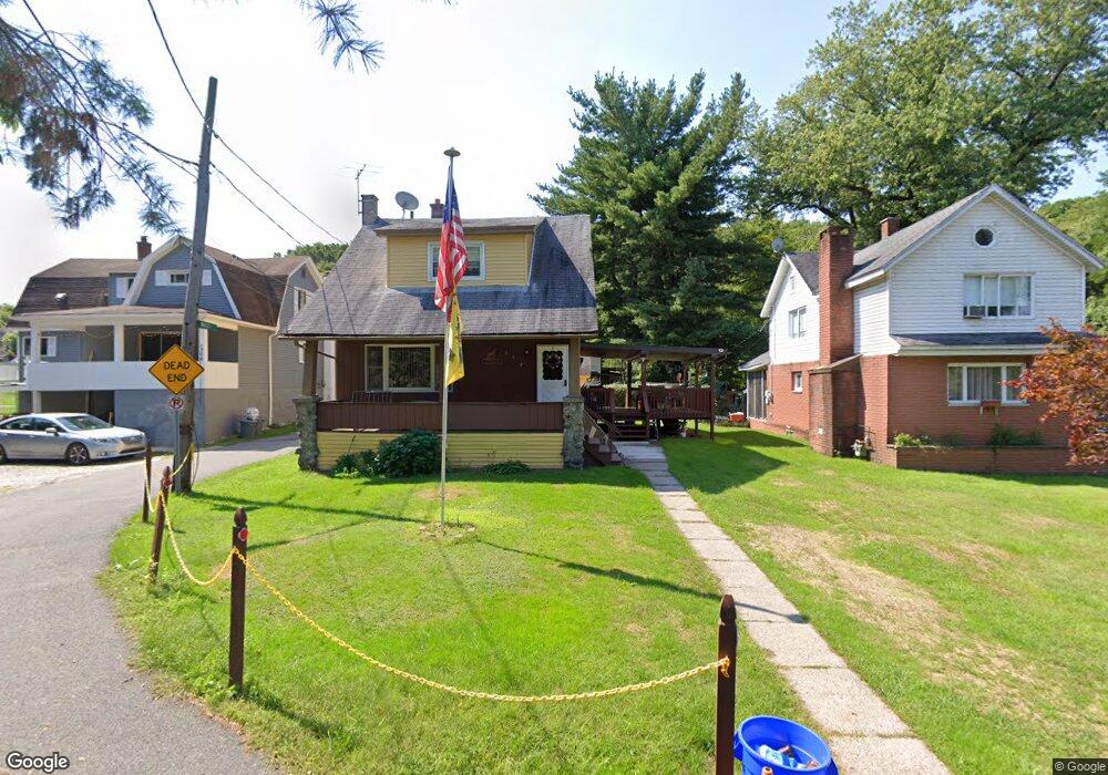
930 Brook St Scranton, PA 18505
South Side NeighborhoodEstimated Value: $136,511 - $221,000
3
Beds
2
Baths
--
Sq Ft
2,396
Sq Ft Lot
About This Home
This home is located at 930 Brook St, Scranton, PA 18505 and is currently estimated at $180,878. 930 Brook St is a home located in Lackawanna County with nearby schools including Ratcliffe Elementary School, Jackson Davis Elementary School, and Adams Elementary School.
Ownership History
Date
Name
Owned For
Owner Type
Purchase Details
Closed on
Apr 4, 2007
Sold by
Colville Ronald William and Rybcinski Jennifer M
Bought by
Colville Ronald William
Current Estimated Value
Home Financials for this Owner
Home Financials are based on the most recent Mortgage that was taken out on this home.
Original Mortgage
$74,400
Outstanding Balance
$45,083
Interest Rate
6.19%
Mortgage Type
New Conventional
Estimated Equity
$135,795
Purchase Details
Closed on
Sep 11, 2006
Sold by
Colville Ronald William
Bought by
Calville Ronald William and Rybcinski Jennifer M
Create a Home Valuation Report for This Property
The Home Valuation Report is an in-depth analysis detailing your home's value as well as a comparison with similar homes in the area
Home Values in the Area
Average Home Value in this Area
Purchase History
| Date | Buyer | Sale Price | Title Company |
|---|---|---|---|
| Colville Ronald William | -- | None Available | |
| Calville Ronald William | -- | None Available |
Source: Public Records
Mortgage History
| Date | Status | Borrower | Loan Amount |
|---|---|---|---|
| Open | Colville Ronald William | $74,400 |
Source: Public Records
Tax History Compared to Growth
Tax History
| Year | Tax Paid | Tax Assessment Tax Assessment Total Assessment is a certain percentage of the fair market value that is determined by local assessors to be the total taxable value of land and additions on the property. | Land | Improvement |
|---|---|---|---|---|
| 2025 | $1,511 | $5,000 | $300 | $4,700 |
| 2024 | $1,375 | $5,000 | $300 | $4,700 |
| 2023 | $1,375 | $5,000 | $300 | $4,700 |
| 2022 | $1,344 | $5,000 | $300 | $4,700 |
| 2021 | $1,344 | $5,000 | $300 | $4,700 |
| 2020 | $1,317 | $5,000 | $300 | $4,700 |
| 2019 | $1,237 | $5,000 | $300 | $4,700 |
| 2018 | $1,237 | $5,000 | $300 | $4,700 |
| 2017 | $1,213 | $5,000 | $300 | $4,700 |
| 2016 | $307 | $5,000 | $300 | $4,700 |
| 2015 | $893 | $5,000 | $300 | $4,700 |
| 2014 | -- | $5,000 | $300 | $4,700 |
Source: Public Records
Map
Nearby Homes
- 16 Cherry St
- 954 E Elm St
- 819 Brook St
- 922 Maple St
- 0 Brook St and Moltke Ave
- 719 Palm St
- 903 Stafford Ave
- 626 Cherry St
- 635 E Elm St Unit Rear
- 613 E Locust St
- 623 E Elm St
- 1429 Prospect Ave
- 1222 Prospect Ave
- 826 Moltke Ave
- 832 S Webster Ave
- 1332 E Elm St
- 624 626 Beech Unit L 14
- 1338 E Elm St
- 1829 S Webster Ave
- 1004 Prospect Ave
- 930 Brook St
- 928 Brook St
- 1308 Stafford Ave
- 1306 Stafford Ave
- 1310 Stafford Ave
- 931 Cherry St
- 926 Brook St
- 1318 Stafford Ave
- 1312 Stafford Ave
- 1320 Stafford Ave
- 1304 Stafford Ave
- 1302 Stafford Ave
- 924 Brook St
- 1216 Stafford Ave
- 1337 Stafford Ave
- 1309 Crown Ave
- 1307 Crown Ave
- 1305 Stafford Ave
- 1301 Crown Ave
- 1303 Stafford Ave