Estimated Value: $275,348 - $344,000
2
Beds
2
Baths
1,740
Sq Ft
$176/Sq Ft
Est. Value
About This Home
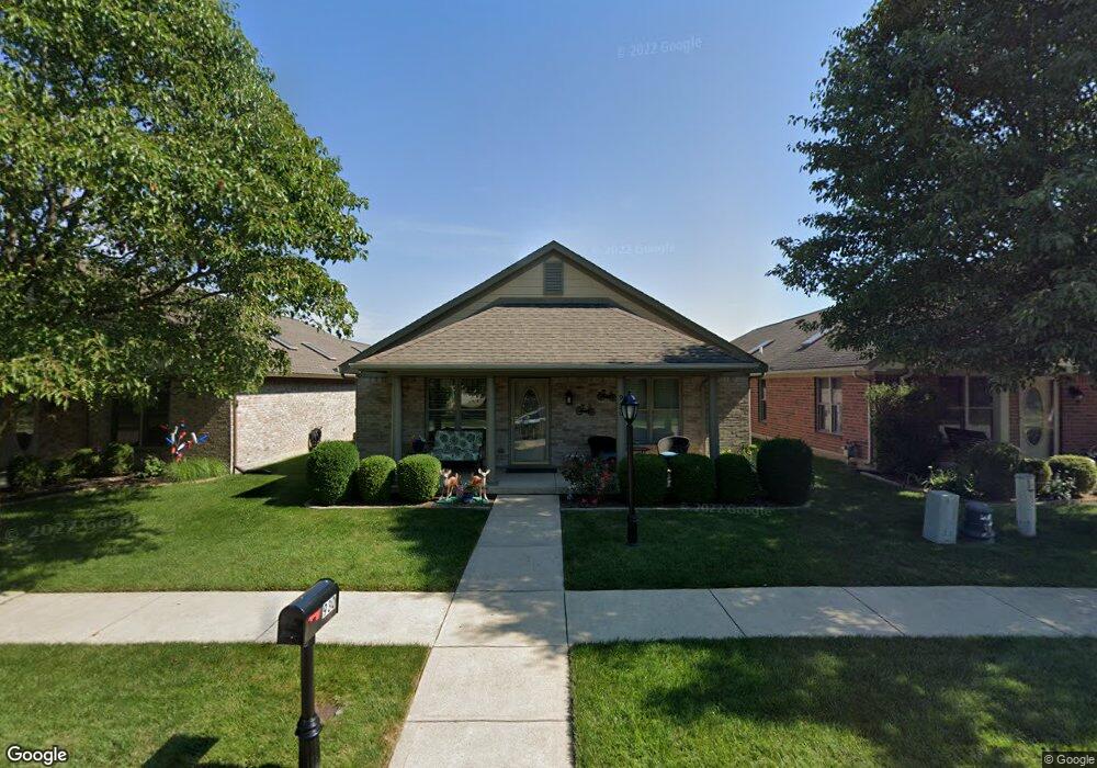
This home is located at 930 Cannondale Ave, Xenia, OH 45385 and is currently estimated at $305,587, approximately $175 per square foot. 930 Cannondale Ave is a home located in Greene County with nearby schools including Xenia High School, Summit Academy Community School for Alternative Learners - Xenia, and Legacy Christian Academy.
Ownership History
Date
Name
Owned For
Owner Type
Purchase Details
Closed on
Jan 28, 2019
Sold by
Wooten Dorsey A and Wooten Phyllis M
Bought by
Hesse Brenda K and Wooten Preservation Trust
Current Estimated Value
Purchase Details
Closed on
Aug 19, 2013
Sold by
Stultz Freddie Lee and Smith Cheryl L
Bought by
Wooten Dorsey A and Wooten Phyllis M
Purchase Details
Closed on
Jun 10, 2005
Sold by
Be Am Co Inc
Bought by
Stultz Rutherford Lowell and Stultz Peggy J
Create a Home Valuation Report for This Property
The Home Valuation Report is an in-depth analysis detailing your home's value as well as a comparison with similar homes in the area
Home Values in the Area
Average Home Value in this Area
Purchase History
| Date | Buyer | Sale Price | Title Company |
|---|---|---|---|
| Hesse Brenda K | -- | None Available | |
| Wooten Dorsey A | $147,900 | Seemark Title Agency Inc | |
| Stultz Rutherford Lowell | $189,400 | -- |
Source: Public Records
Tax History Compared to Growth
Tax History
| Year | Tax Paid | Tax Assessment Tax Assessment Total Assessment is a certain percentage of the fair market value that is determined by local assessors to be the total taxable value of land and additions on the property. | Land | Improvement |
|---|---|---|---|---|
| 2024 | $2,818 | $77,400 | $10,500 | $66,900 |
| 2023 | $2,818 | $77,400 | $10,500 | $66,900 |
| 2022 | $2,450 | $58,850 | $7,000 | $51,850 |
| 2021 | $2,483 | $58,850 | $7,000 | $51,850 |
| 2020 | $2,376 | $58,850 | $7,000 | $51,850 |
| 2019 | $2,075 | $49,930 | $6,430 | $43,500 |
| 2018 | $2,083 | $49,930 | $6,430 | $43,500 |
| 2017 | $1,919 | $49,930 | $6,430 | $43,500 |
| 2016 | $1,919 | $46,000 | $6,430 | $39,570 |
| 2015 | $1,925 | $46,000 | $6,430 | $39,570 |
| 2014 | $1,841 | $46,000 | $6,430 | $39,570 |
Source: Public Records
Map
Nearby Homes
- 2223 Tandem Dr
- 2144 Tandem Dr
- 2096 High Wheel Dr
- 2540 Cornwall Dr
- 1881 Commonwealth Dr
- 2499 Jenny Marie Dr
- 2540 Jenny Marie Dr
- 2421 Louisiana Dr
- 0 Berkshire Dr Unit 942854
- 1255 Colorado Dr
- 2187 Minnesota Dr
- 1430 E Kearney Ln
- 1908 Whitt St
- 2265 Minnesota Dr
- 2189 Mississippi Dr
- 2852 Raxit Ct
- 1766 Gayhart Dr
- 2685 Childers Dr
- 1272 Bellbrook Ave
- 1068 Hedges Rd
- 926 Cannondale Ave
- 934 Cannondale Ave
- 922 Cannondale Ave
- 938 Cannondale Ave
- 918 Cannondale Ave
- 942 Cannondale Ave
- 931 Wright Ave
- 927 Wright Ave
- 935 Wright Ave
- 914 Cannondale Ave
- 923 Wright Ave
- 939 Wright Ave
- 948 Cannondale Ave
- 931 Cannondale Ave
- 935 Cannondale Ave
- 927 Cannondale Ave
- 919 Wright Ave
- 943 Wright Ave
- 923 Cannondale Ave
- 939 Cannondale Ave