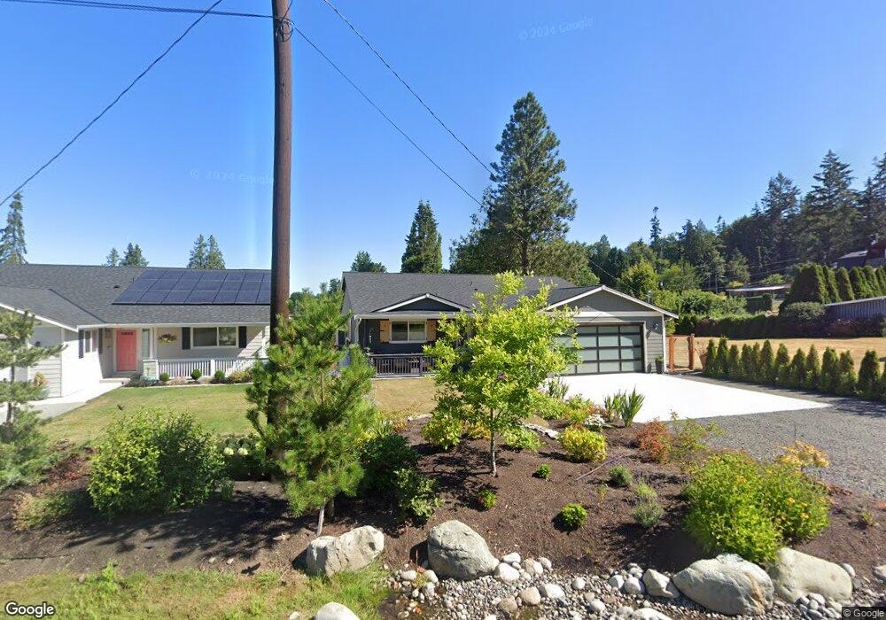
930 High Rd Camano Island, WA 98282
Estimated Value: $656,000 - $804,000
2
Beds
2
Baths
1,788
Sq Ft
$401/Sq Ft
Est. Value
About This Home
This home is located at 930 High Rd, Camano Island, WA 98282 and is currently estimated at $716,441, approximately $400 per square foot. 930 High Rd is a home with nearby schools including Utsalady Elementary School, Port Susan Middle School, and Stanwood High School.
Ownership History
Date
Name
Owned For
Owner Type
Purchase Details
Closed on
Nov 1, 2021
Sold by
Shepard Family Development Llc
Bought by
Lund Kjristine Robin
Current Estimated Value
Home Financials for this Owner
Home Financials are based on the most recent Mortgage that was taken out on this home.
Original Mortgage
$590,000
Outstanding Balance
$541,380
Interest Rate
3.09%
Mortgage Type
New Conventional
Estimated Equity
$175,061
Purchase Details
Closed on
Mar 26, 2021
Sold by
Low Ardlyn M
Bought by
Shepard Family Development Llc
Home Financials for this Owner
Home Financials are based on the most recent Mortgage that was taken out on this home.
Original Mortgage
$390,000
Interest Rate
3%
Mortgage Type
Construction
Purchase Details
Closed on
Jun 16, 2020
Sold by
Low Ardlyn M
Bought by
Shepard Family Development Llc
Home Financials for this Owner
Home Financials are based on the most recent Mortgage that was taken out on this home.
Original Mortgage
$67,000
Interest Rate
3.2%
Mortgage Type
Land Contract Argmt. Of Sale
Purchase Details
Closed on
Jun 1, 2020
Sold by
Low Ardiyn M and East Clarene C
Bought by
Low Ardlyn M
Home Financials for this Owner
Home Financials are based on the most recent Mortgage that was taken out on this home.
Original Mortgage
$67,000
Interest Rate
3.2%
Mortgage Type
Land Contract Argmt. Of Sale
Create a Home Valuation Report for This Property
The Home Valuation Report is an in-depth analysis detailing your home's value as well as a comparison with similar homes in the area
Home Values in the Area
Average Home Value in this Area
Purchase History
| Date | Buyer | Sale Price | Title Company |
|---|---|---|---|
| Lund Kjristine Robin | $575,299 | Land T&E Island Cnty | |
| Shepard Family Development Llc | -- | Land Title & Escrow | |
| Shepard Family Development Llc | $90,000 | Land Title & Escrow | |
| Low Ardlyn M | -- | Land T&E Island Cnty |
Source: Public Records
Mortgage History
| Date | Status | Borrower | Loan Amount |
|---|---|---|---|
| Open | Lund Kjristine Robin | $590,000 | |
| Previous Owner | Shepard Family Development Llc | $390,000 | |
| Previous Owner | Shepard Family Development Llc | $67,000 | |
| Previous Owner | Low Ardlyn M | $7,200 |
Source: Public Records
Tax History Compared to Growth
Tax History
| Year | Tax Paid | Tax Assessment Tax Assessment Total Assessment is a certain percentage of the fair market value that is determined by local assessors to be the total taxable value of land and additions on the property. | Land | Improvement |
|---|---|---|---|---|
| 2024 | $4,797 | $623,157 | $240,000 | $383,157 |
| 2023 | $4,797 | $627,179 | $240,000 | $387,179 |
| 2022 | $1,626 | $586,959 | $230,000 | $356,959 |
| 2021 | $713 | $172,735 | $80,000 | $92,735 |
| 2020 | $718 | $80,000 | $80,000 | $0 |
| 2019 | $627 | $80,000 | $80,000 | $0 |
| 2018 | $672 | $70,000 | $70,000 | $0 |
| 2017 | $853 | $70,000 | $70,000 | $0 |
| 2016 | $718 | $100,000 | $100,000 | $0 |
| 2015 | -- | $80,320 | $80,320 | $0 |
| 2013 | -- | $80,320 | $80,320 | $0 |
Source: Public Records
Map
Nearby Homes
- 923 Olympic St
- 139 N Maple St
- 176 N Maple St
- 10 Edgewater Dr
- 211 N Sunset Dr
- 90 Edgewater Dr
- 212 Grandview Ave
- 275 Maple St
- 276 Melissa St
- 130 Pleasant Ln
- 329 Burke Dr
- 325 Melissa St
- 350 N Sunset Dr
- 345 Seaview Ct
- 67 Gilbertson Rd
- 870 Cedar Ln
- 2 XX Woodland Beach Rd
- 2 Xx Woodland Beach Rd
- 900 N Sunset Dr
- 435 NW Camano Dr