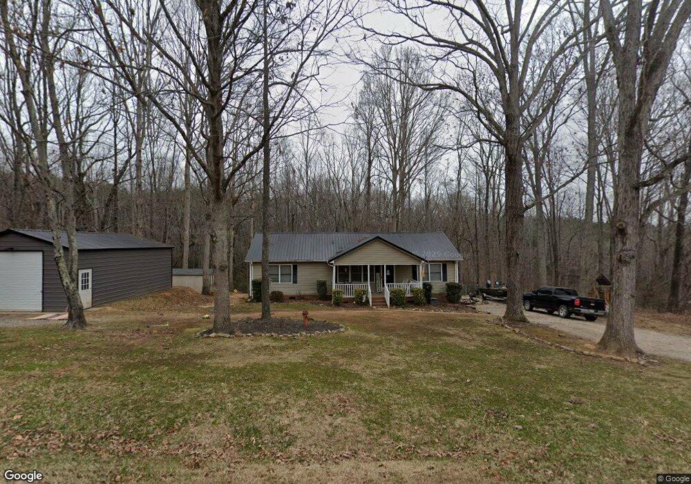
930 Laurelwood Dr Clover, SC 29710
Estimated Value: $260,000 - $321,000
3
Beds
2
Baths
1,352
Sq Ft
$209/Sq Ft
Est. Value
About This Home
This home is located at 930 Laurelwood Dr, Clover, SC 29710 and is currently estimated at $282,033, approximately $208 per square foot. 930 Laurelwood Dr is a home located in York County with nearby schools including Bethany Elementary School, Clover Middle School, and Clover High School.
Ownership History
Date
Name
Owned For
Owner Type
Purchase Details
Closed on
May 16, 2013
Sold by
The Secretary Of Veterans Affairs
Bought by
Strain Joseph Colby and Strain Lauren
Current Estimated Value
Home Financials for this Owner
Home Financials are based on the most recent Mortgage that was taken out on this home.
Original Mortgage
$95,000
Interest Rate
3.42%
Mortgage Type
New Conventional
Purchase Details
Closed on
Jan 31, 2013
Sold by
Hartsoe Daniel K and Hartsoe Leslie T
Bought by
Secretary Of Veterans Affairs
Create a Home Valuation Report for This Property
The Home Valuation Report is an in-depth analysis detailing your home's value as well as a comparison with similar homes in the area
Home Values in the Area
Average Home Value in this Area
Purchase History
| Date | Buyer | Sale Price | Title Company |
|---|---|---|---|
| Strain Joseph Colby | $100,000 | -- | |
| Secretary Of Veterans Affairs | $114,569 | -- |
Source: Public Records
Mortgage History
| Date | Status | Borrower | Loan Amount |
|---|---|---|---|
| Previous Owner | Strain Joseph Colby | $95,000 |
Source: Public Records
Tax History Compared to Growth
Tax History
| Year | Tax Paid | Tax Assessment Tax Assessment Total Assessment is a certain percentage of the fair market value that is determined by local assessors to be the total taxable value of land and additions on the property. | Land | Improvement |
|---|---|---|---|---|
| 2025 | $694 | $5,528 | $1,729 | $3,799 |
| 2024 | $623 | $4,807 | $1,267 | $3,540 |
| 2023 | $640 | $4,807 | $1,271 | $3,536 |
| 2022 | $517 | $4,807 | $1,271 | $3,536 |
| 2021 | -- | $4,807 | $1,307 | $3,500 |
| 2020 | $509 | $4,807 | $0 | $0 |
| 2019 | $485 | $4,180 | $0 | $0 |
| 2018 | $490 | $4,180 | $0 | $0 |
| 2017 | $454 | $4,180 | $0 | $0 |
| 2016 | $445 | $4,180 | $0 | $0 |
| 2014 | $521 | $4,180 | $1,440 | $2,740 |
| 2013 | $521 | $6,990 | $2,160 | $4,830 |
Source: Public Records
Map
Nearby Homes
- 946 Laurelwood Dr
- 966 Laurelwood Dr
- 00 State Road S-46-883
- Lot 1 Rhyne Rd
- 1312 Sage Pine Cir Unit 19
- Princeton Plan at Shepherd's Trace - Shepherds Trace
- Pinehurst Plan at Shepherd's Trace - Shepherds Trace
- Muirfield Plan at Shepherd's Trace - Shepherds Trace
- Pinehurst with 3rd Floor Retreat Plan at Shepherd's Trace - Shepherds Trace
- Madison Plan at Shepherd's Trace - Shepherds Trace
- Davidson Plan at Shepherd's Trace - Shepherds Trace
- Bethpage Plan at Shepherd's Trace - Shepherds Trace
- Columbia Plan at Shepherd's Trace - Shepherds Trace
- St. Andrews Plan at Shepherd's Trace - Shepherds Trace
- Augusta Plan at Shepherd's Trace - Shepherds Trace
- St. Andrews with 3rd Floor Retreat Plan at Shepherd's Trace - Shepherds Trace
- Harvard Plan at Shepherd's Trace - Shepherds Trace
- 1069 Sage Pine Cir Unit 57
- 1059 Sage Pine Cir Unit 56
- Lot 3 Rhyne Rd
- 921 Laurelwood Dr
- 921 Laurelwood Dr
- 0000 45+/- Acres Laurelwood Dr
- 955 Laurelwood Dr
- 960 Laurelwood Dr
- 918 Laurelwood Dr
- 970 Laurelwood Dr
- 990 Laurelwood Dr
- 858 Laurelwood Dr
- 998 Laurelwood Dr
- 2230 Highway 55 W
- 2240 Highway 55 W
- 2362 Agony Acres Rd
- 2362 Agony Acres Rd Unit Tract 4
- 2375 Agony Acres Rd
- 2375 Agony Acres Rd
- 139 Thomas Rd
- 139 Thomas Rd
- 1980 Highway 55 W
- 205 Thomas Rd