Estimated Value: $308,642 - $388,000
5
Beds
3
Baths
1,420
Sq Ft
$250/Sq Ft
Est. Value
About This Home
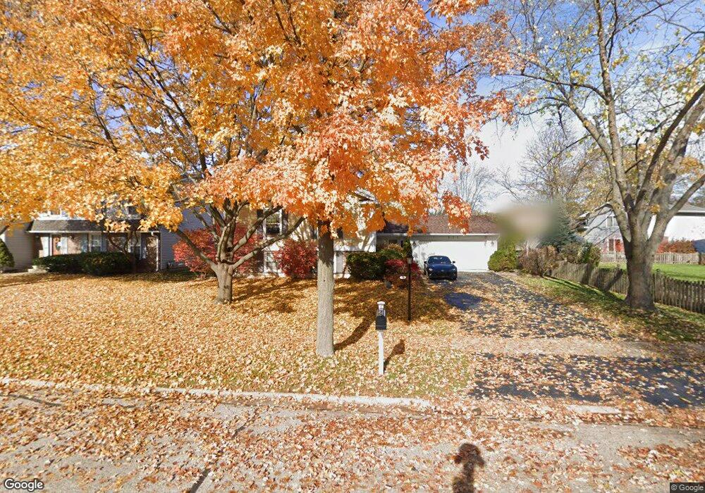
This home is located at 930 Mayfield St, Cary, IL 60013 and is currently estimated at $354,661, approximately $249 per square foot. 930 Mayfield St is a home located in McHenry County with nearby schools including Briargate Elementary School, Cary Jr High School, and Cary-Grove High School.
Ownership History
Date
Name
Owned For
Owner Type
Purchase Details
Closed on
Oct 27, 1997
Sold by
Stone Gary W and Stone Pamela A
Bought by
Ristow David J and Ristow Laura L
Current Estimated Value
Home Financials for this Owner
Home Financials are based on the most recent Mortgage that was taken out on this home.
Original Mortgage
$122,000
Outstanding Balance
$20,288
Interest Rate
7.43%
Estimated Equity
$334,373
Purchase Details
Closed on
May 1, 1997
Sold by
Witt Emmett and Witt Mary
Bought by
Stone Gary W and Stone Pamela A
Home Financials for this Owner
Home Financials are based on the most recent Mortgage that was taken out on this home.
Original Mortgage
$155,777
Interest Rate
8.05%
Mortgage Type
FHA
Create a Home Valuation Report for This Property
The Home Valuation Report is an in-depth analysis detailing your home's value as well as a comparison with similar homes in the area
Home Values in the Area
Average Home Value in this Area
Purchase History
| Date | Buyer | Sale Price | Title Company |
|---|---|---|---|
| Ristow David J | $172,000 | Chicago Title Insurance Co | |
| Stone Gary W | $175,000 | -- |
Source: Public Records
Mortgage History
| Date | Status | Borrower | Loan Amount |
|---|---|---|---|
| Open | Ristow David J | $122,000 | |
| Previous Owner | Stone Gary W | $155,777 |
Source: Public Records
Tax History
| Year | Tax Paid | Tax Assessment Tax Assessment Total Assessment is a certain percentage of the fair market value that is determined by local assessors to be the total taxable value of land and additions on the property. | Land | Improvement |
|---|---|---|---|---|
| 2024 | $8,256 | $106,042 | $21,975 | $84,067 |
| 2023 | $8,039 | $94,841 | $19,654 | $75,187 |
| 2022 | $7,786 | $89,149 | $20,749 | $68,400 |
| 2021 | $7,414 | $83,053 | $19,330 | $63,723 |
| 2020 | $7,191 | $80,113 | $18,646 | $61,467 |
| 2019 | $7,045 | $76,677 | $17,846 | $58,831 |
| 2018 | $7,441 | $78,729 | $16,486 | $62,243 |
| 2017 | $7,295 | $74,168 | $15,531 | $58,637 |
| 2016 | $7,237 | $69,563 | $14,567 | $54,996 |
| 2013 | -- | $65,667 | $13,589 | $52,078 |
Source: Public Records
Map
Nearby Homes
- 417 Haber Rd Unit 6
- 421 Haber Rd Unit 7
- 425 Haber Rd Unit 6
- 259 Firenze Dr Unit 110
- 363 Milano Dr Unit 41
- 316 Haber Rd Unit 34125
- 258 Stonegate Rd
- 603 W Main St
- 204 Country Commons Rd
- 1163 E Danbury Dr
- 582 Arthur Dr
- 0 Kaper Dr
- 735 Royal Glen Dr
- 515 Surrey Ridge Dr
- 12 Oak Valley Dr
- 324 New Haven Dr
- 1436 New Haven Dr
- 3712 3 Oaks Rd
- 1161 Amber Dr
- 550 Enclave Dr
- 936 Mayfield St
- 8 Chelsea Ln
- 13 Duxbury Ln
- 18 Chelsea Ln
- 26 Chelsea Ln
- 19 Duxbury Ln
- 931 Mayfield St
- 32 Chelsea Ln
- 927 Mayfield St
- 935 Mayfield St
- 915 Mayfield St
- 944 Mayfield St
- 939 Mayfield St
- 25 Duxbury Ln
- 38 Chelsea Ln
- 18 Duxbury Ln
- 909 Mayfield St Unit 2
- 910 Mayfield St
- 15 Chelsea Ln
- 943 Mayfield St
Your Personal Tour Guide
Ask me questions while you tour the home.