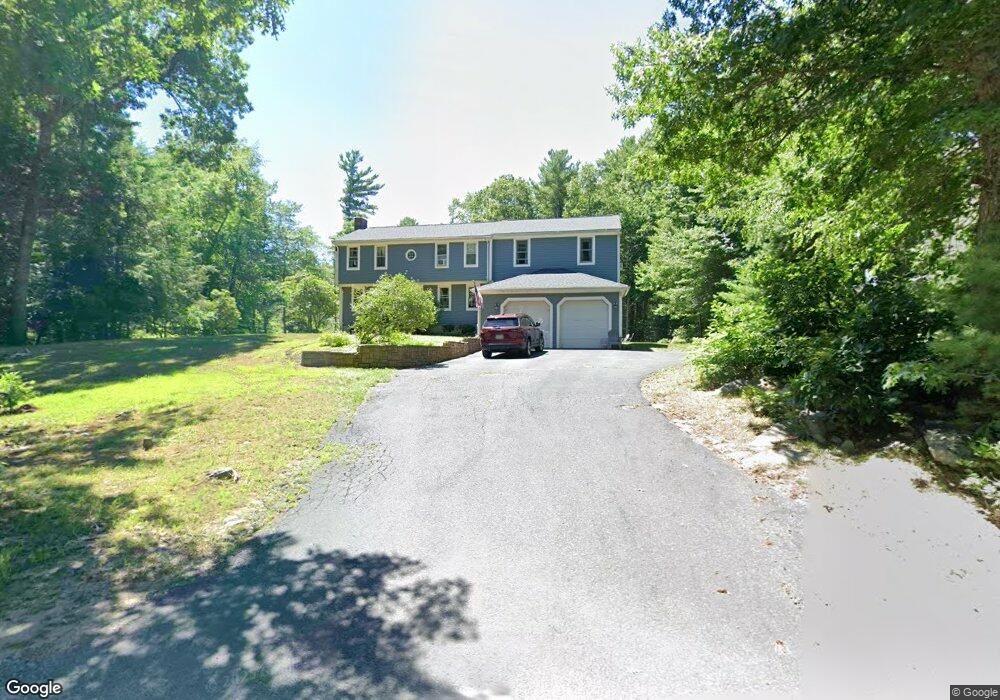
930 Union St Duxbury, MA 02332
Estimated Value: $1,024,970 - $1,111,000
5
Beds
3
Baths
2,512
Sq Ft
$422/Sq Ft
Est. Value
About This Home
This home is located at 930 Union St, Duxbury, MA 02332 and is currently estimated at $1,059,243, approximately $421 per square foot. 930 Union St is a home located in Plymouth County with nearby schools including Chandler Elementary School, Alden School, and Duxbury Middle School.
Ownership History
Date
Name
Owned For
Owner Type
Purchase Details
Closed on
Oct 29, 1992
Sold by
Bulman Richard J and Bird Kevin
Bought by
Schwanke Bryan K and Schwanke Sharon E
Current Estimated Value
Purchase Details
Closed on
Jan 31, 1991
Sold by
Hingham Instn Sv Rt
Bought by
Bulman Richard J and Bird Kevin
Purchase Details
Closed on
Dec 20, 1990
Sold by
Trident Investment T
Bought by
Hingham Inst Sav Rt
Create a Home Valuation Report for This Property
The Home Valuation Report is an in-depth analysis detailing your home's value as well as a comparison with similar homes in the area
Home Values in the Area
Average Home Value in this Area
Purchase History
| Date | Buyer | Sale Price | Title Company |
|---|---|---|---|
| Schwanke Bryan K | $170,500 | -- | |
| Bulman Richard J | $135,000 | -- | |
| Hingham Inst Sav Rt | $129,500 | -- |
Source: Public Records
Mortgage History
| Date | Status | Borrower | Loan Amount |
|---|---|---|---|
| Open | Hingham Inst Sav Rt | $227,000 | |
| Closed | Hingham Inst Sav Rt | $240,000 |
Source: Public Records
Tax History Compared to Growth
Tax History
| Year | Tax Paid | Tax Assessment Tax Assessment Total Assessment is a certain percentage of the fair market value that is determined by local assessors to be the total taxable value of land and additions on the property. | Land | Improvement |
|---|---|---|---|---|
| 2025 | $8,725 | $860,500 | $350,700 | $509,800 |
| 2024 | $8,788 | $873,600 | $350,700 | $522,900 |
| 2023 | $8,011 | $749,400 | $364,700 | $384,700 |
| 2022 | $8,437 | $657,100 | $300,600 | $356,500 |
| 2021 | $8,310 | $573,900 | $250,500 | $323,400 |
| 2020 | $8,040 | $548,400 | $252,500 | $295,900 |
| 2019 | $7,488 | $510,100 | $210,400 | $299,700 |
| 2018 | $7,439 | $490,700 | $195,600 | $295,100 |
| 2017 | $7,194 | $463,800 | $182,700 | $281,100 |
| 2016 | $7,212 | $463,800 | $182,700 | $281,100 |
| 2015 | $6,873 | $440,600 | $159,500 | $281,100 |
Source: Public Records
Map
Nearby Homes
- 286 North St
- 192 Taylor St
- 387 North St
- 89 Sunset Way
- 15 Bagnell Dr Unit 15
- 61 North St
- 593 Washington St Unit A
- 110 Keene St
- 599 Washington St Unit 7
- 31 Hillcrest Dr
- 547 Washington St Unit A10
- 30 Old Washington St Unit 9
- 523 Washington St Unit C6
- 523 Washington St Unit C8
- 66 Hemlock Dr
- 20 Amado Way
- 249 High St
- 28 Fieldstone Dr
- 18 King Phillips Path
- 11 Hayloft Ln Unit 11