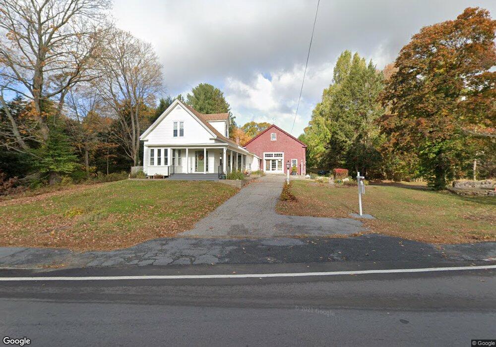
930 West St Wrentham, MA 02093
Sheldonville NeighborhoodEstimated Value: $784,390
2
Beds
2
Baths
1,924
Sq Ft
$408/Sq Ft
Est. Value
About This Home
This home is located at 930 West St, Wrentham, MA 02093 and is currently estimated at $784,390, approximately $407 per square foot. 930 West St is a home located in Norfolk County with nearby schools including Delaney Elementary School, Charles E Roderick, and Mercymount Country Day School.
Ownership History
Date
Name
Owned For
Owner Type
Purchase Details
Closed on
Aug 1, 2002
Sold by
Peasley Robert C and Peasley Madeleine T
Bought by
Tullock Peter J and Tullock Elen A
Current Estimated Value
Home Financials for this Owner
Home Financials are based on the most recent Mortgage that was taken out on this home.
Original Mortgage
$225,000
Outstanding Balance
$95,821
Interest Rate
6.64%
Mortgage Type
Commercial
Estimated Equity
$688,569
Purchase Details
Closed on
Jul 24, 1989
Sold by
Maguire Louis A
Bought by
Peasley Robt C
Home Financials for this Owner
Home Financials are based on the most recent Mortgage that was taken out on this home.
Original Mortgage
$135,000
Interest Rate
10.07%
Mortgage Type
Commercial
Create a Home Valuation Report for This Property
The Home Valuation Report is an in-depth analysis detailing your home's value as well as a comparison with similar homes in the area
Home Values in the Area
Average Home Value in this Area
Purchase History
| Date | Buyer | Sale Price | Title Company |
|---|---|---|---|
| Tullock Peter J | $335,000 | -- | |
| Tullock Peter J | $335,000 | -- | |
| Peasley Robt C | $195,000 | -- | |
| Peasley Robt C | $195,000 | -- |
Source: Public Records
Mortgage History
| Date | Status | Borrower | Loan Amount |
|---|---|---|---|
| Open | Tullock Peter J | $225,000 | |
| Closed | Peasley Robt C | $225,000 | |
| Previous Owner | Peasley Robt C | $165,000 | |
| Previous Owner | Peasley Robt C | $135,000 |
Source: Public Records
Tax History
| Year | Tax Paid | Tax Assessment Tax Assessment Total Assessment is a certain percentage of the fair market value that is determined by local assessors to be the total taxable value of land and additions on the property. | Land | Improvement |
|---|---|---|---|---|
| 2025 | -- | $610,300 | $288,100 | $322,200 |
| 2024 | -- | $579,300 | $288,100 | $291,200 |
| 2023 | $0 | $539,900 | $262,000 | $277,900 |
| 2022 | $0 | $494,300 | $255,200 | $239,100 |
| 2021 | $0 | $474,900 | $238,500 | $236,400 |
| 2020 | $6,423 | $428,600 | $182,100 | $246,500 |
| 2019 | $0 | $411,000 | $163,900 | $247,100 |
| 2018 | $0 | $379,800 | $163,800 | $216,000 |
| 2017 | $0 | $359,700 | $160,600 | $199,100 |
| 2016 | -- | $347,000 | $156,000 | $191,000 |
| 2015 | -- | $335,400 | $166,600 | $168,800 |
| 2014 | -- | $324,800 | $160,200 | $164,600 |
Source: Public Records
Map
Nearby Homes
- 613 West St
- 955 Summer St
- 440 Chestnut St
- 20 Field Cir
- 11 Amber Dr
- 19 Chestnut Lot 0
- 1565 West St
- 1620 West St
- 0 Fall Ln
- 9 Reagan Ave
- 1222 South St
- 10 Follett Dr
- 18 Huntington Ave
- 60 Grant Ave
- 0 Berry St
- 10 Earle Stewart Ln Unit Lot 5
- 12 Earle Stewart Ln
- 2 Earle Stewart Ln
- 139 King St Unit 306
- 3 Earle Stewart Ln
- 0 Route 121 & Sunny Meadow Unit 4653455
- 0 Route 121 & Sunny Meadow Dr Unit 4744023
- Lot A West St
- 945 West St
- 938 West St
- 962 West St
- 895 West St
- 965 West St
- 2 Burnt Swamp Rd
- 960 West St
- 975 West St
- 40 Sheldon Rd
- 900 West St
- 995 West St
- 996 West St
- 869 West St
- Bay 12 Townline Park Unit 11
- Bay 11 Townline Park Unit 11
- 999 West St
- 856 West St
Your Personal Tour Guide
Ask me questions while you tour the home.