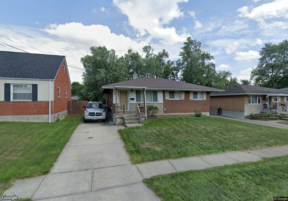
9300 Neil Dr Cincinnati, OH 45231
New Burlington NeighborhoodEstimated Value: $167,477 - $207,000
4
Beds
1
Bath
918
Sq Ft
$206/Sq Ft
Est. Value
About This Home
This home is located at 9300 Neil Dr, Cincinnati, OH 45231 and is currently estimated at $189,119, approximately $206 per square foot. 9300 Neil Dr is a home located in Hamilton County with nearby schools including Mt Healthy High School, Central Montessori Academy, and Our Lady of Grace Catholic School.
Ownership History
Date
Name
Owned For
Owner Type
Purchase Details
Closed on
Jul 31, 2009
Sold by
Smith J Mark and Smith Bonnie L
Bought by
Howard Emanuel Joseph and Howard Vandia Daci
Current Estimated Value
Home Financials for this Owner
Home Financials are based on the most recent Mortgage that was taken out on this home.
Original Mortgage
$87,387
Interest Rate
5.49%
Mortgage Type
FHA
Create a Home Valuation Report for This Property
The Home Valuation Report is an in-depth analysis detailing your home's value as well as a comparison with similar homes in the area
Home Values in the Area
Average Home Value in this Area
Purchase History
| Date | Buyer | Sale Price | Title Company |
|---|---|---|---|
| Howard Emanuel Joseph | $89,000 | Attorney |
Source: Public Records
Mortgage History
| Date | Status | Borrower | Loan Amount |
|---|---|---|---|
| Closed | Howard Emanuel Joseph | $87,387 |
Source: Public Records
Tax History
| Year | Tax Paid | Tax Assessment Tax Assessment Total Assessment is a certain percentage of the fair market value that is determined by local assessors to be the total taxable value of land and additions on the property. | Land | Improvement |
|---|---|---|---|---|
| 2025 | $2,502 | $46,477 | $5,908 | $40,569 |
| 2024 | $2,350 | $46,477 | $5,908 | $40,569 |
| 2023 | $2,373 | $46,477 | $5,908 | $40,569 |
| 2022 | $1,789 | $25,351 | $5,390 | $19,961 |
| 2021 | $1,742 | $25,351 | $5,390 | $19,961 |
| 2020 | $1,765 | $25,351 | $5,390 | $19,961 |
| 2019 | $1,633 | $21,484 | $4,568 | $16,916 |
| 2018 | $1,644 | $21,484 | $4,568 | $16,916 |
| 2017 | $1,558 | $21,484 | $4,568 | $16,916 |
| 2016 | $2,088 | $28,658 | $5,796 | $22,862 |
| 2015 | $2,101 | $28,658 | $5,796 | $22,862 |
| 2014 | $2,090 | $28,658 | $5,796 | $22,862 |
| 2013 | $2,182 | $31,150 | $6,300 | $24,850 |
Source: Public Records
Map
Nearby Homes
- 9287 Coogan Dr
- 9224 Comstock Dr
- 2329 Garrison Dr
- 2547 Adams Rd
- 9500 Ridgemoor Ave
- 2714 Compton Rd
- 2497 Ontario St
- 2908 Libra Ln
- 9369 Ranchill Dr
- 9636 Pippin Rd
- 2930 Aries Ct
- 2528 Mariposa St
- 2175 Carlsbory Dr
- 9561 Trafalgar Ct
- 8949 Pippin Rd
- 2934 Windsong Dr
- 2626 Ontario St
- 2937 Hyannis Dr
- 8936 Zoellner Dr
- 9577 Creekhill Dr
Your Personal Tour Guide
Ask me questions while you tour the home.