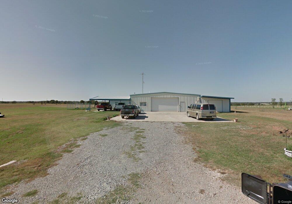
930335 S Pilot Dr Wellston, OK 74881
Estimated Value: $163,000 - $248,000
1
Bed
1
Bath
1,750
Sq Ft
$108/Sq Ft
Est. Value
About This Home
This home is located at 930335 S Pilot Dr, Wellston, OK 74881 and is currently estimated at $189,452, approximately $108 per square foot. 930335 S Pilot Dr is a home located in Lincoln County with nearby schools including Wellston Elementary School, Wellston Middle School, and Wellston High School.
Ownership History
Date
Name
Owned For
Owner Type
Purchase Details
Closed on
Feb 14, 2023
Sold by
Mulkey Randall L and Mulkey Cynthia J
Bought by
Mulkey Randall L and Mulkey Cynthia J
Current Estimated Value
Purchase Details
Closed on
Aug 22, 2008
Sold by
Morris Elvin Dane and Morris Peggy June
Bought by
Mulkey Randall L and Mulkey Cynthia J
Purchase Details
Closed on
Apr 28, 2008
Sold by
Graham Services Inc
Bought by
Morris Elvin Dane and Morris Peggy June
Purchase Details
Closed on
Oct 4, 2004
Sold by
Morris Elvin Dane and Morris Peggy
Bought by
Graham Services Inc
Purchase Details
Closed on
Jun 30, 2000
Sold by
Rogers Raylon R and Rogers Martha M
Bought by
Morris Elvin Dane
Purchase Details
Closed on
Jun 2, 2000
Sold by
Rogers Raylon R
Bought by
Morris Elvin Dane
Purchase Details
Closed on
Jan 30, 1995
Sold by
Rogers Raylon R and Rogers Martha M
Bought by
Morris Elvin D and Morris Lahoma
Purchase Details
Closed on
Apr 8, 1994
Sold by
Rogers Raylon R
Bought by
Morris Elvin D
Purchase Details
Closed on
Apr 18, 1988
Sold by
Fox Leslie G and Fox Anna B
Bought by
Rogers Raylon R
Create a Home Valuation Report for This Property
The Home Valuation Report is an in-depth analysis detailing your home's value as well as a comparison with similar homes in the area
Home Values in the Area
Average Home Value in this Area
Purchase History
| Date | Buyer | Sale Price | Title Company |
|---|---|---|---|
| Mulkey Randall L | -- | None Listed On Document | |
| Mulkey Randall L | -- | None Listed On Document | |
| Mulkey Randall L | $45,000 | None Available | |
| Morris Elvin Dane | $58,500 | None Available | |
| Graham Services Inc | $65,000 | -- | |
| Morris Elvin Dane | $14,500 | -- | |
| Morris Elvin Dane | $65,500 | -- | |
| Rogers Raylon R | $65,500 | -- | |
| Morris Elvin D | $35,000 | -- | |
| Morris Elvin D | $20,000 | -- | |
| Rogers Raylon R | $30,000 | -- |
Source: Public Records
Tax History Compared to Growth
Tax History
| Year | Tax Paid | Tax Assessment Tax Assessment Total Assessment is a certain percentage of the fair market value that is determined by local assessors to be the total taxable value of land and additions on the property. | Land | Improvement |
|---|---|---|---|---|
| 2024 | $819 | $9,765 | $1,216 | $8,549 |
| 2023 | $819 | $14,809 | $1,216 | $13,593 |
| 2022 | $781 | $10,451 | $835 | $9,616 |
| 2021 | $759 | $10,147 | $840 | $9,307 |
| 2020 | $749 | $9,851 | $837 | $9,014 |
| 2019 | $725 | $9,565 | $796 | $8,769 |
| 2018 | $692 | $9,286 | $1,046 | $8,240 |
| 2017 | $698 | $9,016 | $1,017 | $7,999 |
| 2016 | $675 | $8,753 | $313 | $8,440 |
| 2015 | $677 | $8,498 | $288 | $8,210 |
| 2014 | $655 | $8,250 | $300 | $7,950 |
Source: Public Records
Map
Nearby Homes
- 0 S Highway 177
- 940671 S 3360 Rd
- 940605 S 3350 Rd
- 910796 S 3350 Rd
- 330633 E 875 Rd
- 337248 E Pecan Meadows Ln
- 0 Oklahoma 66
- 960926 S Hoot Owl Ln
- 900690 S Oak Ridge Dr
- 332913 E 930 Rd
- 510 Cedar St
- 209 Ash St
- 960402 S 3340 Rd
- 609 Dogwood Ave
- 606 Elm Ave
- 411 E 2nd St
- 413 E 2nd St Unit 151
- 409 Fir St
- 0 E 980 Rd
- 332861 E Quail Run Dr S
- 930297 S Pilot Dr
- 930344 S Pilot Dr
- 0 S Pilot Dr Unit 1014888
- 930242 S Pilot Dr
- 930533 S 3370 Rd
- 336817 E 930 Rd
- 336689 E 930 Rd
- 930658 S 3370 Rd
- 930849 S 3370 Rd
- 337076 E 930 Rd
- 930804 S Highway 177
- 920720 S 3370 Rd
- 940250 S 3370 Rd
- 940005 S 3370 Rd
- 940034 S Highway 177
- 930400 S Highway 177
- 336057 E 930 Rd
- 930514 S 3360 Rd
- 940300 S 3370 Rd
- 930235 S Highway 177