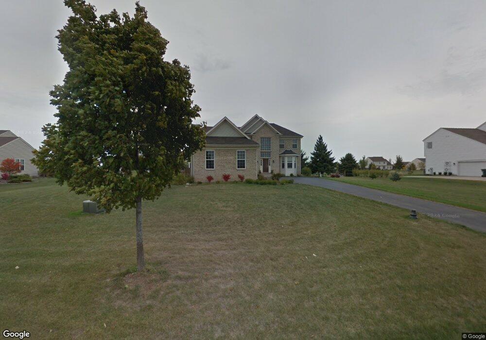
9304 Daniel Ln Spring Grove, IL 60081
Estimated Value: $525,516 - $630,000
4
Beds
3
Baths
3,032
Sq Ft
$193/Sq Ft
Est. Value
About This Home
This home is located at 9304 Daniel Ln, Spring Grove, IL 60081 and is currently estimated at $584,129, approximately $192 per square foot. 9304 Daniel Ln is a home located in McHenry County with nearby schools including Richmond Grade School, Nippersink Middle School, and Richmond-Burton High School.
Ownership History
Date
Name
Owned For
Owner Type
Purchase Details
Closed on
Jul 24, 2008
Sold by
Kocken Richard L
Bought by
Olmstead Michael W and Olmstead Constance A
Current Estimated Value
Home Financials for this Owner
Home Financials are based on the most recent Mortgage that was taken out on this home.
Original Mortgage
$345,800
Interest Rate
6.51%
Mortgage Type
Purchase Money Mortgage
Purchase Details
Closed on
Sep 1, 2007
Sold by
Kocken Gayle
Bought by
Kocken Richard L
Purchase Details
Closed on
Jun 18, 2004
Sold by
Buschman Homes Llc
Bought by
Kocken Richard L and Kocken Gayle A
Home Financials for this Owner
Home Financials are based on the most recent Mortgage that was taken out on this home.
Original Mortgage
$311,320
Interest Rate
6.17%
Mortgage Type
Purchase Money Mortgage
Create a Home Valuation Report for This Property
The Home Valuation Report is an in-depth analysis detailing your home's value as well as a comparison with similar homes in the area
Home Values in the Area
Average Home Value in this Area
Purchase History
| Date | Buyer | Sale Price | Title Company |
|---|---|---|---|
| Olmstead Michael W | $364,000 | First American Title Ins Co | |
| Kocken Richard L | -- | None Available | |
| Kocken Richard L | $390,372 | First American Title |
Source: Public Records
Mortgage History
| Date | Status | Borrower | Loan Amount |
|---|---|---|---|
| Closed | Olmstead Michael W | $345,800 | |
| Previous Owner | Kocken Richard L | $311,320 | |
| Closed | Kocken Richard L | $55,200 |
Source: Public Records
Tax History
| Year | Tax Paid | Tax Assessment Tax Assessment Total Assessment is a certain percentage of the fair market value that is determined by local assessors to be the total taxable value of land and additions on the property. | Land | Improvement |
|---|---|---|---|---|
| 2024 | $9,989 | $140,994 | $21,072 | $119,922 |
| 2023 | $9,926 | $131,500 | $19,653 | $111,847 |
| 2022 | $9,339 | $115,676 | $17,288 | $98,388 |
| 2021 | $8,876 | $109,046 | $16,297 | $92,749 |
| 2020 | $8,678 | $104,241 | $15,579 | $88,662 |
| 2019 | $8,734 | $102,620 | $15,337 | $87,283 |
| 2018 | $8,912 | $99,448 | $14,863 | $84,585 |
| 2017 | $8,790 | $93,387 | $13,957 | $79,430 |
| 2016 | $8,826 | $89,186 | $13,329 | $75,857 |
| 2013 | -- | $88,943 | $14,208 | $74,735 |
Source: Public Records
Map
Nearby Homes
- 1914 Spring Dale Dr
- 8610 Steeple Ln
- 8501 Country Shire Ln
- 2102 W Hunters Ln
- 9436 Bellaire Ln
- 8300 Appaloosa Ln
- Lot 65,66,&64 Main Street Rd
- 2214 Main Street Rd
- Lot 56 & 57 Beverly Way
- Lot 58 & 59 Beverly Way
- Lot 60 & 61 Beverly Way
- 7822 N Pillow Hill Rd
- 7830 N Pillow Hill Rd
- 10905 Breezy Lawn Rd
- LOT 9 Mayo Ct
- 8002 Morgan Cir
- 1410 Linden Rd
- 11106 Siedschlag Rd
- 11111 Huron Dr
- 11013 Serenity Path
- 9308 Daniel Ln
- 9210 Daniel Ln
- 9307 Deborah Ln
- 9206 Daniel Ln
- 9303 Deborah Ln
- 9209 Daniel Ln
- 9209 Deborah Ln
- 9207 Deborah Ln
- 9202 Daniel Ln
- 9207 Daniel Ln
- 1408 Wilmot Farms Dr
- 9304 Deborah Ln
- 9210 Deborah Ln
- 9201 Deborah Ln
- 9201 Daniel Ln
- 9206 Deborah Ln
- 9112 Daniel Ln
- 9308 Deborah Ln
- 9109 Deborah Ln
- 9202 Deborah Ln
Your Personal Tour Guide
Ask me questions while you tour the home.