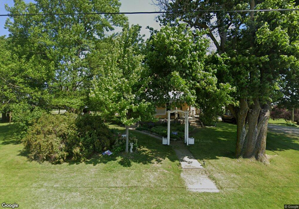
9304 Hollansburg Sampson Rd Arcanum, OH 45304
Estimated Value: $221,000 - $313,000
4
Beds
2
Baths
2,336
Sq Ft
$118/Sq Ft
Est. Value
About This Home
This home is located at 9304 Hollansburg Sampson Rd, Arcanum, OH 45304 and is currently estimated at $276,350, approximately $118 per square foot. 9304 Hollansburg Sampson Rd is a home with nearby schools including Franklin Monroe Elementary School and Franklin Monroe High School.
Ownership History
Date
Name
Owned For
Owner Type
Purchase Details
Closed on
Apr 16, 2013
Sold by
Thompson Family Farms Llc
Bought by
Myers Noel R and Myers Nonnie L
Current Estimated Value
Home Financials for this Owner
Home Financials are based on the most recent Mortgage that was taken out on this home.
Original Mortgage
$87,998
Outstanding Balance
$40,738
Interest Rate
3.5%
Mortgage Type
Purchase Money Mortgage
Estimated Equity
$235,612
Purchase Details
Closed on
Mar 14, 2005
Sold by
Thompson Family Farms Llc
Bought by
Myers Noel R and Myers Nonnie L
Home Financials for this Owner
Home Financials are based on the most recent Mortgage that was taken out on this home.
Original Mortgage
$150,000
Interest Rate
5.7%
Mortgage Type
Seller Take Back
Purchase Details
Closed on
Jan 27, 2005
Sold by
Thompson Carrol D and Thompson Helen L
Bought by
Thompson Family Farms Llc
Home Financials for this Owner
Home Financials are based on the most recent Mortgage that was taken out on this home.
Original Mortgage
$150,000
Interest Rate
5.7%
Mortgage Type
Seller Take Back
Purchase Details
Closed on
Jan 26, 2005
Sold by
Thompson Kent E and The Kent E Thompson Revocable
Bought by
Thompson Family Farms Llc
Home Financials for this Owner
Home Financials are based on the most recent Mortgage that was taken out on this home.
Original Mortgage
$150,000
Interest Rate
5.7%
Mortgage Type
Seller Take Back
Purchase Details
Closed on
Dec 15, 2004
Sold by
Thompson Kent E and Kent E Thompson Revocable Trus
Bought by
Thompson Kent E
Purchase Details
Closed on
Dec 14, 2004
Sold by
Thompson Dean T and Thompson Donna Lee
Bought by
Thompson Family Farms Llc
Purchase Details
Closed on
Jul 14, 2004
Sold by
Thompson Carrol D and Thompson Helen L
Bought by
Henry Carolyn L and Thompson Dean T
Purchase Details
Closed on
Dec 23, 2003
Sold by
Thompson Carrol D and Thompson Helen L
Bought by
Bratka Kaye M
Purchase Details
Closed on
Aug 1, 1988
Bought by
Myers Noel R and Myers Nonnie L
Create a Home Valuation Report for This Property
The Home Valuation Report is an in-depth analysis detailing your home's value as well as a comparison with similar homes in the area
Home Values in the Area
Average Home Value in this Area
Purchase History
| Date | Buyer | Sale Price | Title Company |
|---|---|---|---|
| Myers Noel R | $148,200 | Attorney | |
| Myers Noel R | $150,000 | -- | |
| Thompson Family Farms Llc | -- | -- | |
| Thompson Family Farms Llc | -- | -- | |
| Thompson Kent E | -- | -- | |
| Thompson Family Farms Llc | -- | -- | |
| Henry Carolyn L | -- | -- | |
| Henry Carolyn L | -- | -- | |
| Bratka Kaye M | -- | -- | |
| Henry Carolyn L | -- | -- | |
| Myers Noel R | $165,000 | -- |
Source: Public Records
Mortgage History
| Date | Status | Borrower | Loan Amount |
|---|---|---|---|
| Open | Myers Noel R | $87,998 | |
| Previous Owner | Myers Noel R | $150,000 |
Source: Public Records
Tax History Compared to Growth
Tax History
| Year | Tax Paid | Tax Assessment Tax Assessment Total Assessment is a certain percentage of the fair market value that is determined by local assessors to be the total taxable value of land and additions on the property. | Land | Improvement |
|---|---|---|---|---|
| 2024 | $1,720 | $59,530 | $18,750 | $40,780 |
| 2023 | $1,722 | $59,530 | $18,750 | $40,780 |
| 2022 | $1,480 | $47,410 | $16,470 | $30,940 |
| 2021 | $1,493 | $47,410 | $16,470 | $30,940 |
| 2020 | $1,430 | $47,410 | $16,470 | $30,940 |
| 2019 | $1,286 | $42,740 | $15,840 | $26,900 |
| 2018 | $1,300 | $42,740 | $15,840 | $26,900 |
| 2017 | $1,097 | $42,740 | $15,840 | $26,900 |
| 2016 | $1,106 | $37,140 | $14,130 | $23,010 |
| 2015 | $1,106 | $37,140 | $14,130 | $23,010 |
| 2014 | $1,113 | $37,140 | $14,130 | $23,010 |
| 2013 | $1,045 | $34,570 | $13,660 | $20,910 |
Source: Public Records
Map
Nearby Homes
- 2255 Red River-West Grove Rd
- 2255 Red River West Grove Rd
- 200 N Jefferson St
- 220 Baker St
- 508 S Jefferson St
- 11863 Hall Rd
- 11299 Coppock Rd
- 111 E Pike St
- 13 Laura Cir
- 0 Delisle Fourman Rd
- 0 N Furlong Rd
- 8784 Grubbs Rex Rd
- 8746 Grubbs Rex Rd
- 2546 Gordon Landis Rd
- 9980 Ohio 718
- 7231 Dull Rd
- 6987 Alternate State Route 49
- 2288 N State Route 721
- 20 Seminole Ln
- Alt St Rt 49 Alt State Route 49
- 9277 Hollansburg Sampson Rd
- 9330 Hollansburg Sampson Rd
- 9147 Hollansburg Sampson Rd
- 9529 Hollansburg Sampson Rd
- 2957 Schnorf Jones Rd
- 2957 Schnorf-Jones Rd
- 2954 Schnorf Jones Rd
- 9403 Browntown Rd
- 3170 Schnorf Jones Rd
- 3229 Schnorf Jones Rd
- 2886 Schnorf Jones Rd
- 3288 Red River West Grove Rd
- 2771 Red River West Grove Rd
- 3291 Schnorf Jones Rd
- 9691 Hollansburg Sampson Rd
- 8884 Hollansburg Sampson Rd
- 3369 Schnorf Jones Rd
- 9241 Delisle Fourman Rd
- 2594 Red River West Grove Rd
- 2631 Schnorf Jones Rd