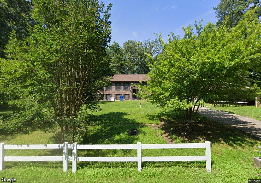
9306 Clifford Dr White Plains, MD 20695
Estimated Value: $411,460 - $453,000
--
Bed
4
Baths
1,248
Sq Ft
$344/Sq Ft
Est. Value
About This Home
This home is located at 9306 Clifford Dr, White Plains, MD 20695 and is currently estimated at $428,865, approximately $343 per square foot. 9306 Clifford Dr is a home located in Charles County with nearby schools including Dr. James Craik Elementary School, Matthew Henson Middle School, and Maurice J. McDonough High School.
Ownership History
Date
Name
Owned For
Owner Type
Purchase Details
Closed on
Dec 27, 1995
Sold by
Rucker Clifford E and Rucker Toma S
Bought by
Rucker Clifford E
Current Estimated Value
Purchase Details
Closed on
Nov 5, 1993
Sold by
Ro Arnold
Bought by
Rucker C E
Home Financials for this Owner
Home Financials are based on the most recent Mortgage that was taken out on this home.
Original Mortgage
$152,950
Interest Rate
6.83%
Create a Home Valuation Report for This Property
The Home Valuation Report is an in-depth analysis detailing your home's value as well as a comparison with similar homes in the area
Home Values in the Area
Average Home Value in this Area
Purchase History
| Date | Buyer | Sale Price | Title Company |
|---|---|---|---|
| Rucker Clifford E | -- | -- | |
| Rucker C E | $154,000 | -- |
Source: Public Records
Mortgage History
| Date | Status | Borrower | Loan Amount |
|---|---|---|---|
| Previous Owner | Rucker C E | $152,950 |
Source: Public Records
Tax History Compared to Growth
Tax History
| Year | Tax Paid | Tax Assessment Tax Assessment Total Assessment is a certain percentage of the fair market value that is determined by local assessors to be the total taxable value of land and additions on the property. | Land | Improvement |
|---|---|---|---|---|
| 2025 | $10,217 | $351,300 | $150,300 | $201,000 |
| 2024 | $4,428 | $324,633 | $0 | $0 |
| 2023 | $4,258 | $297,967 | $0 | $0 |
| 2022 | $3,841 | $271,300 | $130,300 | $141,000 |
| 2021 | $3,614 | $264,367 | $0 | $0 |
| 2020 | $3,614 | $257,433 | $0 | $0 |
| 2019 | $3,507 | $250,500 | $130,300 | $120,200 |
| 2018 | $3,431 | $247,833 | $0 | $0 |
| 2017 | $3,389 | $245,167 | $0 | $0 |
| 2016 | -- | $242,500 | $0 | $0 |
| 2015 | $2,776 | $238,100 | $0 | $0 |
| 2014 | $2,776 | $233,700 | $0 | $0 |
Source: Public Records
Map
Nearby Homes
- 9340 Rock Lynn Cir
- Columbia Plan at Brentwood
- Leland Plan at Brentwood
- Hudson Plan at Brentwood
- Seneca Plan at Brentwood
- Lot 2 Randall Kris
- 9343 Clifford Dr
- 9260 Biscayne St
- 9251 Kris Dr
- 9292 Seminole St
- 9197 Murdstone Ln
- 3433 Linden Grove Dr
- 9106 Hanley Ct
- 9273 Rock Lynn Cir
- 8633 Resilience St
- 8881 Bancroft Dr
- 0 Billingsley Rd Unit MDCH2041862
- 4000 Hanson Rd
- 4038 Spring Valley Dr
- 3849 Stoneybrook Rd
- 9310 Clifford Dr
- 9278 Rock Lynn Cir
- 9274 Rock Lynn Cir
- 9270 Rock Lynn Cir
- 9266 Rock Lynn Cir
- 9282 Rock Lynn Cir
- 9262 Rock Lynn Cir
- 9286 Rock Lynn Cir
- 9319 Clifford Dr
- 9258 Rock Lynn Cir
- 9314 Clifford Dr
- 9158 Maytide St
- 9162 Maytide St
- 9150 Maytide St
- 9287 Rock Lynn Cir
- 9290 Rock Lynn Cir
- 9254 Rock Lynn Cir
- 9295 Rock Lynn Cir
- 9263 Rock Lynn Cir
- 9146 Maytide St