Estimated Value: $231,462 - $272,000
3
Beds
2
Baths
2,016
Sq Ft
$125/Sq Ft
Est. Value
About This Home
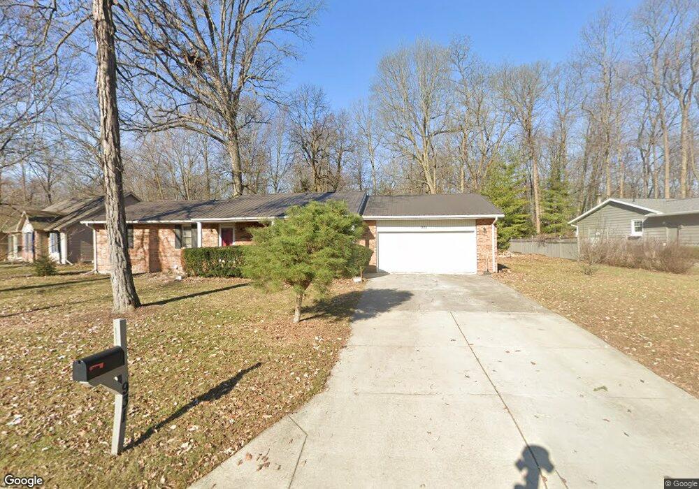
This home is located at 931 Christopher Cir, Ada, OH 45810 and is currently estimated at $252,366, approximately $125 per square foot. 931 Christopher Cir is a home located in Hardin County with nearby schools including Ada Elementary School and Ada High School.
Ownership History
Date
Name
Owned For
Owner Type
Purchase Details
Closed on
May 31, 2007
Sold by
Spike Peter W and Spike Jean E
Bought by
Spike Kathryn R and Sheets Henry L
Current Estimated Value
Home Financials for this Owner
Home Financials are based on the most recent Mortgage that was taken out on this home.
Original Mortgage
$148,100
Outstanding Balance
$89,001
Interest Rate
6.22%
Mortgage Type
New Conventional
Estimated Equity
$163,365
Purchase Details
Closed on
Jul 15, 2005
Sold by
Kaczkowski Thomas H and Kaczkowski Alyson W
Bought by
Spike Peter W and Spike Jean E
Home Financials for this Owner
Home Financials are based on the most recent Mortgage that was taken out on this home.
Original Mortgage
$146,395
Interest Rate
5.69%
Mortgage Type
New Conventional
Purchase Details
Closed on
Nov 28, 1994
Bought by
Kaczkowski Thomas H and Kaczkowski Al
Create a Home Valuation Report for This Property
The Home Valuation Report is an in-depth analysis detailing your home's value as well as a comparison with similar homes in the area
Home Values in the Area
Average Home Value in this Area
Purchase History
| Date | Buyer | Sale Price | Title Company |
|---|---|---|---|
| Spike Kathryn R | $147,500 | None Available | |
| Spike Peter W | $154,100 | -- | |
| Kaczkowski Thomas H | $94,500 | -- |
Source: Public Records
Mortgage History
| Date | Status | Borrower | Loan Amount |
|---|---|---|---|
| Open | Spike Kathryn R | $148,100 | |
| Closed | Spike Peter W | $146,395 |
Source: Public Records
Tax History
| Year | Tax Paid | Tax Assessment Tax Assessment Total Assessment is a certain percentage of the fair market value that is determined by local assessors to be the total taxable value of land and additions on the property. | Land | Improvement |
|---|---|---|---|---|
| 2024 | $2,958 | $66,200 | $8,010 | $58,190 |
| 2023 | $2,953 | $66,200 | $8,010 | $58,190 |
| 2022 | $2,641 | $50,240 | $7,640 | $42,600 |
| 2021 | $2,868 | $50,240 | $7,640 | $42,600 |
| 2020 | $2,913 | $50,240 | $7,640 | $42,600 |
| 2019 | $2,753 | $47,310 | $7,280 | $40,030 |
| 2018 | $2,715 | $47,310 | $7,280 | $40,030 |
| 2017 | $2,675 | $47,310 | $7,280 | $40,030 |
| 2016 | $2,471 | $44,940 | $4,110 | $40,830 |
| 2015 | $1,913 | $44,940 | $4,110 | $40,830 |
| 2014 | $2,442 | $44,940 | $4,110 | $40,830 |
| 2013 | $2,438 | $42,310 | $4,110 | $38,200 |
Source: Public Records
Map
Nearby Homes
- 820 S Main St
- 710 S Main St
- 722 S Johnson St
- 1689 County Road 50
- 318 Willeke Ave
- 314 E University Ave
- 308-310 S Simon St
- 2959 County Road 60
- 210 N Gilbert St
- 211 S Main St
- 510 E Lehr Ave Unit 510R
- 327 W North Ave
- 420 N Simon St
- 530 N Main St
- 442 Edwards St
- 629 N Main St
- 724 N Main St
- 503 E North Ave
- 5594 County Road 35
- 746 N Main St Unit 61
- 935 Christopher Cir
- 927 Christopher Cir
- 928 Christopher Cir
- 936 Christopher Cir
- 1011 Christopher Cir
- 925 Christopher Cir
- 924 Christopher Cir
- 923 Christopher Cir
- 103 Brandi Place
- 920 Christopher Cir
- 2003 Southernview St
- 1011 Southernview St
- 1014 Christopher Cir
- 1009 Southern View Dr
- 1009 Southernview St
- 105 Brandi Place
Your Personal Tour Guide
Ask me questions while you tour the home.