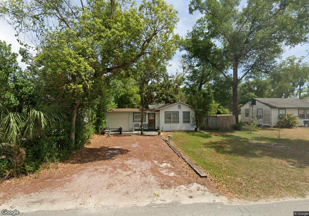
931 N Clara Ave Deland, FL 32720
North DeLand NeighborhoodEstimated Value: $115,000 - $208,000
2
Beds
1
Bath
671
Sq Ft
$244/Sq Ft
Est. Value
About This Home
This home is located at 931 N Clara Ave, Deland, FL 32720 and is currently estimated at $163,861, approximately $244 per square foot. 931 N Clara Ave is a home located in Volusia County with nearby schools including Deland High School, Citrus Grove Elementary, and Deland Middle School.
Ownership History
Date
Name
Owned For
Owner Type
Purchase Details
Closed on
Mar 13, 2006
Sold by
Morris Jack J and Morris Kristine
Bought by
Merritt Bruce E
Current Estimated Value
Home Financials for this Owner
Home Financials are based on the most recent Mortgage that was taken out on this home.
Original Mortgage
$91,100
Outstanding Balance
$51,547
Interest Rate
6.19%
Mortgage Type
Purchase Money Mortgage
Estimated Equity
$112,314
Purchase Details
Closed on
Oct 15, 1980
Bought by
Merritt Bruce E
Purchase Details
Closed on
Aug 15, 1973
Bought by
Merritt Bruce E
Create a Home Valuation Report for This Property
The Home Valuation Report is an in-depth analysis detailing your home's value as well as a comparison with similar homes in the area
Home Values in the Area
Average Home Value in this Area
Purchase History
| Date | Buyer | Sale Price | Title Company |
|---|---|---|---|
| Merritt Bruce E | $92,500 | Volusia Title Services | |
| Merritt Bruce E | $100 | -- | |
| Merritt Bruce E | $10,000 | -- |
Source: Public Records
Mortgage History
| Date | Status | Borrower | Loan Amount |
|---|---|---|---|
| Open | Merritt Bruce E | $91,100 |
Source: Public Records
Tax History Compared to Growth
Tax History
| Year | Tax Paid | Tax Assessment Tax Assessment Total Assessment is a certain percentage of the fair market value that is determined by local assessors to be the total taxable value of land and additions on the property. | Land | Improvement |
|---|---|---|---|---|
| 2025 | $574 | $39,424 | -- | -- |
| 2024 | $574 | $38,313 | -- | -- |
| 2023 | $574 | $37,198 | $0 | $0 |
| 2022 | $537 | $36,115 | $0 | $0 |
| 2021 | $532 | $35,063 | $0 | $0 |
| 2020 | $516 | $34,579 | $0 | $0 |
| 2019 | $513 | $33,802 | $0 | $0 |
| 2018 | $487 | $33,172 | $0 | $0 |
| 2017 | $451 | $32,490 | $0 | $0 |
| 2016 | $413 | $31,822 | $0 | $0 |
| 2015 | $412 | $31,601 | $0 | $0 |
| 2014 | $406 | $31,350 | $0 | $0 |
Source: Public Records
Map
Nearby Homes
- 2055 Buckhanon Trail
- 138 W Stetson Ave
- 740 N Sans Souci Ave
- 738 N Sans Souci Ave
- 735 N Clara Ave
- 3015 Buckhanon Trail
- 830 N Clake Ave
- 615 N Palmetto Ct
- 2312 Litchfield Loop
- 2249 Litchfield Loop
- 600 W Hogle Ave
- 0 N Stone St
- 1675 N Stone St
- 1669 N Stone St
- 1307 Cook St
- 727 N Stone St
- 325 E Plymouth Ave
- 127 W Palmetto Ave
- 205 E Kentucky Ave
- 0 W Plymouth Ave
- 929 N Clara Ave
- 933 N Clara Ave
- 927 N Clara Ave
- 0 Knoll St Unit 1090723
- 0 Knoll St Unit V4917828
- 0 Knoll St
- 920 N Sans Souci Ave
- 939 N Clara Ave
- 934 N Clara Ave
- 930 N Clara Ave
- 936 N Clara Ave
- 999 N Sans Souci Ave
- 923 N Clara Ave
- 300 Knoll St
- 1013 N Clara Ave
- 910 N Clara Ave
- 990 N Clara Ave
- 339 Knoll St
- 1014 N Clara Ave
- 925 N Sans Souci Ave