Estimated Value: $260,666 - $288,000
3
Beds
2
Baths
1,218
Sq Ft
$224/Sq Ft
Est. Value
About This Home
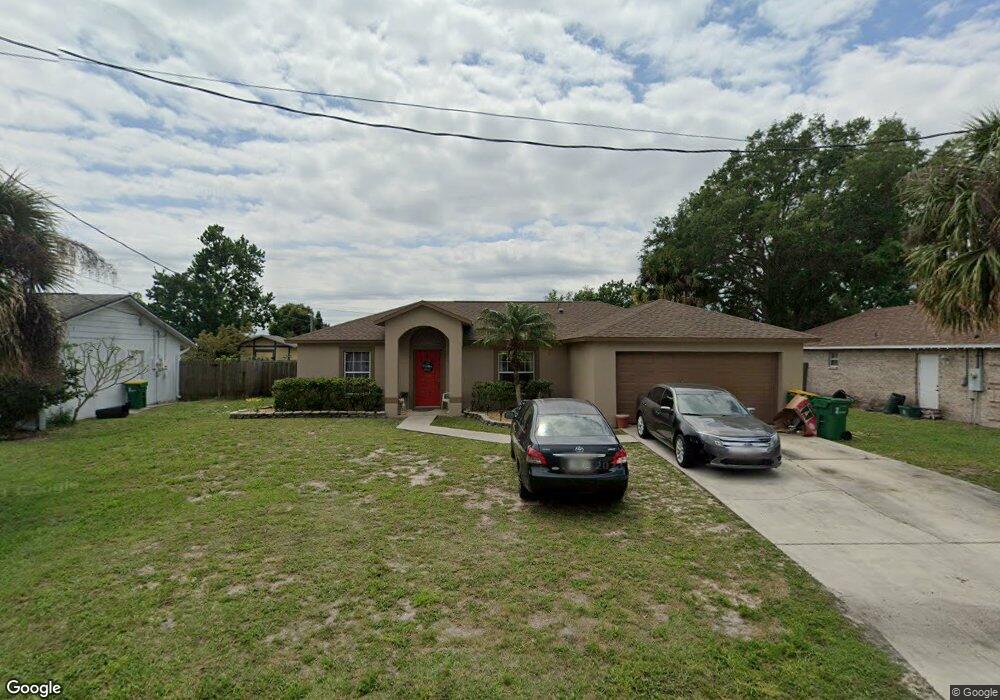
This home is located at 931 Tope St, Cocoa, FL 32927 and is currently estimated at $273,417, approximately $224 per square foot. 931 Tope St is a home located in Brevard County with nearby schools including Atlantis Elementary School, Space Coast Junior/Senior High School, and East Atlantic Prep of Brevard County.
Ownership History
Date
Name
Owned For
Owner Type
Purchase Details
Closed on
Sep 8, 2011
Sold by
Raleigh Jeanette B
Bought by
Raleigh Jeanette B and Jeanette B Raleigh Trust
Current Estimated Value
Purchase Details
Closed on
May 17, 2001
Sold by
Holiday Bldr Inc
Bought by
Raleigh Jeanette B
Home Financials for this Owner
Home Financials are based on the most recent Mortgage that was taken out on this home.
Original Mortgage
$68,106
Interest Rate
6.98%
Purchase Details
Closed on
Dec 18, 2000
Sold by
Belmont Homes Inc
Bought by
Holiday Bldr Inc
Create a Home Valuation Report for This Property
The Home Valuation Report is an in-depth analysis detailing your home's value as well as a comparison with similar homes in the area
Home Values in the Area
Average Home Value in this Area
Purchase History
| Date | Buyer | Sale Price | Title Company |
|---|---|---|---|
| Raleigh Jeanette B | -- | Attorney | |
| Raleigh Jeanette B | $79,800 | -- | |
| Holiday Bldr Inc | $8,500 | -- |
Source: Public Records
Mortgage History
| Date | Status | Borrower | Loan Amount |
|---|---|---|---|
| Previous Owner | Raleigh Jeanette B | $68,106 |
Source: Public Records
Tax History
| Year | Tax Paid | Tax Assessment Tax Assessment Total Assessment is a certain percentage of the fair market value that is determined by local assessors to be the total taxable value of land and additions on the property. | Land | Improvement |
|---|---|---|---|---|
| 2025 | $1,115 | $83,410 | -- | -- |
| 2024 | $1,081 | $81,060 | -- | -- |
| 2023 | $1,081 | $78,700 | $0 | $0 |
| 2022 | $1,002 | $76,410 | $0 | $0 |
| 2021 | $996 | $74,190 | $0 | $0 |
| 2020 | $951 | $73,170 | $0 | $0 |
| 2019 | $898 | $71,530 | $0 | $0 |
| 2018 | $900 | $70,200 | $0 | $0 |
| 2017 | $902 | $68,760 | $0 | $0 |
| 2016 | $910 | $67,350 | $18,000 | $49,350 |
| 2015 | $919 | $66,890 | $15,000 | $51,890 |
| 2014 | $923 | $66,360 | $11,000 | $55,360 |
Source: Public Records
Map
Nearby Homes
- 985 Tope St
- 973 Poinsetta St
- 977 Poinsetta St
- 361 Payne Ave
- 414 Oakridge Ave
- 1014 Illinois Rd
- 0 Kanawha St
- 925 MacCo Rd
- 873 Dunbar St
- 1029 Illinois Rd
- 865 Dunbar St
- 961 Kaufman St
- 1040 Jersey St
- 7350 N Highway 1 Unit 201
- 7330 N Highway 1 Unit 206
- 7310 N Highway 1 Unit 201
- 7300 N Highway 1 Unit 104
- 7240 N Highway 1 Unit 106
- 7170 N Highway 1 Unit 103
- 7400 N Highway 1 Unit 105
Your Personal Tour Guide
Ask me questions while you tour the home.