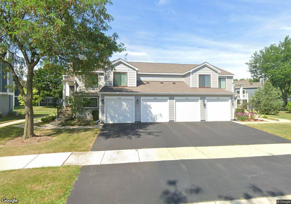
932 Brunswick Cir Unit 262B Schaumburg, IL 60193
South Schaumburg NeighborhoodEstimated Value: $273,000 - $298,000
2
Beds
--
Bath
1,200
Sq Ft
$241/Sq Ft
Est. Value
About This Home
This home is located at 932 Brunswick Cir Unit 262B, Schaumburg, IL 60193 and is currently estimated at $288,743, approximately $240 per square foot. 932 Brunswick Cir Unit 262B is a home located in Cook County with nearby schools including Michael Collins Elementary School, Robert Frost Junior High School, and J B Conant High School.
Ownership History
Date
Name
Owned For
Owner Type
Purchase Details
Closed on
Dec 3, 2007
Sold by
Kett Barbara A
Bought by
Berg Andrew J
Current Estimated Value
Home Financials for this Owner
Home Financials are based on the most recent Mortgage that was taken out on this home.
Original Mortgage
$164,000
Outstanding Balance
$103,966
Interest Rate
6.33%
Mortgage Type
Unknown
Estimated Equity
$184,777
Purchase Details
Closed on
Jun 20, 1997
Sold by
Blankenship Cheryl J
Bought by
Kett Barbara A
Home Financials for this Owner
Home Financials are based on the most recent Mortgage that was taken out on this home.
Original Mortgage
$88,800
Interest Rate
8%
Mortgage Type
Balloon
Create a Home Valuation Report for This Property
The Home Valuation Report is an in-depth analysis detailing your home's value as well as a comparison with similar homes in the area
Home Values in the Area
Average Home Value in this Area
Purchase History
| Date | Buyer | Sale Price | Title Company |
|---|---|---|---|
| Berg Andrew J | $205,000 | Attorneys Title Guaranty Fun | |
| Kett Barbara A | $111,000 | Chicago Title Insurance Co |
Source: Public Records
Mortgage History
| Date | Status | Borrower | Loan Amount |
|---|---|---|---|
| Open | Berg Andrew J | $164,000 | |
| Previous Owner | Kett Barbara A | $88,800 |
Source: Public Records
Tax History Compared to Growth
Tax History
| Year | Tax Paid | Tax Assessment Tax Assessment Total Assessment is a certain percentage of the fair market value that is determined by local assessors to be the total taxable value of land and additions on the property. | Land | Improvement |
|---|---|---|---|---|
| 2024 | $4,645 | $19,900 | $4,663 | $15,237 |
| 2023 | $4,476 | $19,900 | $4,663 | $15,237 |
| 2022 | $4,476 | $19,900 | $4,663 | $15,237 |
| 2021 | $3,849 | $16,029 | $2,543 | $13,486 |
| 2020 | $3,851 | $16,029 | $2,543 | $13,486 |
| 2019 | $3,855 | $17,810 | $2,543 | $15,267 |
| 2018 | $2,682 | $12,371 | $2,119 | $10,252 |
| 2017 | $2,657 | $12,371 | $2,119 | $10,252 |
| 2016 | $2,727 | $12,371 | $2,119 | $10,252 |
| 2015 | $2,505 | $10,998 | $1,907 | $9,091 |
| 2014 | $2,494 | $10,998 | $1,907 | $9,091 |
| 2013 | $2,413 | $10,998 | $1,907 | $9,091 |
Source: Public Records
Map
Nearby Homes
- 916 Manchester Cir Unit 91A
- 126 Manchester Ct Unit 61B
- 1100 Boston Harbor Unit 7004
- 205 Nantucket Harbor Unit 104
- 421 E Wise Rd
- 36 Shore Dr
- 426 E Niagara Ave
- 124 E Monterey Ave
- 733 Limerick Ln Unit 7333D
- 711 Tipperary Ct Unit 2D
- 712 Tipperary Ct Unit 1C
- 718 N Point Dr
- 620 S Point Dr
- 727 Killarney Ct Unit 1C
- 631 Derry Ct Unit 3C
- 635 Limerick Ln Unit 2B
- 614 Tralee Ct Unit 2-C
- 421 Summit Dr
- 722 Merlin Dr Unit 16
- 553 Stone Gate Cir
- 932 Brunswick Cir Unit 2B
- 930 Brunswick Cir Unit 261B
- 934 Brunswick Cir Unit 262A
- 936 Brunswick Cir Unit 261A
- 925 Manchester Cir Unit 122B
- 940 Brunswick Cir Unit 1B
- 940 Brunswick Cir Unit 251B
- 926 Brunswick Cir Unit 271A
- 921 Manchester Cir Unit 121A
- 942 Brunswick Cir Unit 252B
- 924 Brunswick Cir Unit 272A
- 927 Manchester Cir Unit 121B
- 920 Brunswick Cir Unit 271B
- 922 Brunswick Cir Unit 272B
- 944 Brunswick Cir Unit 252A
- 945 Glouchester Cir Unit 202B
- 933 Manchester Cir Unit 132A
- 946 Brunswick Cir Unit 251A
- 943 Glouchester Cir Unit 202A
- 941 Glouchester Cir Unit 201A