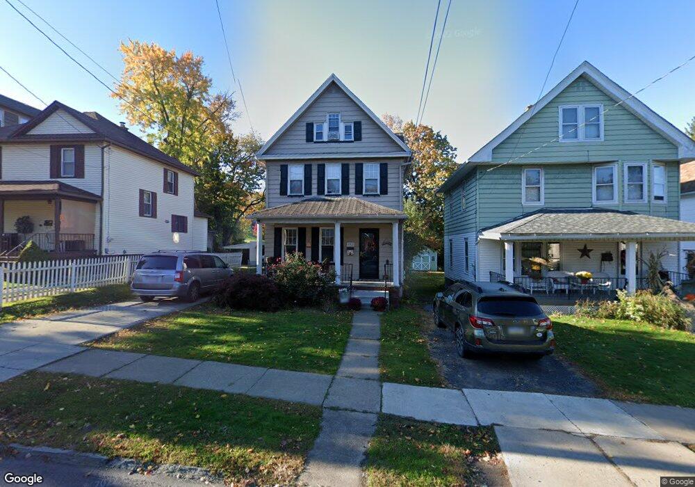
932 Fisk St Scranton, PA 18509
Greenridge NeighborhoodEstimated Value: $78,669 - $241,000
--
Bed
--
Bath
--
Sq Ft
5,968
Sq Ft Lot
About This Home
This home is located at 932 Fisk St, Scranton, PA 18509 and is currently estimated at $190,667. 932 Fisk St is a home located in Lackawanna County with nearby schools including Robert Morris #27, Northeast Scranton Intermediate School, and Scranton High School.
Ownership History
Date
Name
Owned For
Owner Type
Purchase Details
Closed on
May 29, 2007
Sold by
Yankowski Walter and Yankowski Reha
Bought by
Konarski Boguslaw and Konarski Bozenad
Current Estimated Value
Purchase Details
Closed on
Dec 30, 2004
Bought by
Cabets Mark
Home Financials for this Owner
Home Financials are based on the most recent Mortgage that was taken out on this home.
Original Mortgage
$73,300
Interest Rate
5.75%
Mortgage Type
New Conventional
Create a Home Valuation Report for This Property
The Home Valuation Report is an in-depth analysis detailing your home's value as well as a comparison with similar homes in the area
Home Values in the Area
Average Home Value in this Area
Purchase History
| Date | Buyer | Sale Price | Title Company |
|---|---|---|---|
| Konarski Boguslaw | $138,000 | None Available | |
| Cabets Mark | $80,000 | -- | |
| Cabets Mark | $80,000 | None Available |
Source: Public Records
Mortgage History
| Date | Status | Borrower | Loan Amount |
|---|---|---|---|
| Previous Owner | Cabets Mark | $73,300 |
Source: Public Records
Tax History Compared to Growth
Tax History
| Year | Tax Paid | Tax Assessment Tax Assessment Total Assessment is a certain percentage of the fair market value that is determined by local assessors to be the total taxable value of land and additions on the property. | Land | Improvement |
|---|---|---|---|---|
| 2025 | $4,326 | $13,000 | $2,800 | $10,200 |
| 2024 | $3,963 | $13,000 | $2,800 | $10,200 |
| 2023 | $3,963 | $13,000 | $2,800 | $10,200 |
| 2022 | $3,876 | $13,000 | $2,800 | $10,200 |
| 2021 | $3,876 | $13,000 | $2,800 | $10,200 |
| 2020 | $3,806 | $13,000 | $2,800 | $10,200 |
| 2019 | $3,583 | $13,000 | $2,800 | $10,200 |
| 2018 | $3,583 | $13,000 | $2,800 | $10,200 |
| 2017 | $3,522 | $13,000 | $2,800 | $10,200 |
| 2016 | $1,167 | $13,000 | $2,800 | $10,200 |
| 2015 | $2,341 | $13,000 | $2,800 | $10,200 |
| 2014 | -- | $13,000 | $2,800 | $10,200 |
Source: Public Records
Map
Nearby Homes
- 1008 Fisk St
- 2510 Boulevard Ave
- 831 Raines St
- 829 Raines St Unit 829-831
- 829 Raines St Unit 831
- 2237 Boulevard Ave
- 816 Woodlawn St
- 2106 Boulevard Ave
- 2129 Comegys Ave Unit L11
- 908 Richmont St
- 2446 Heermans Ave
- 35 Dean St
- 121 Throop St
- 1820 Sanderson Ave
- 722 Electric St
- 2724 N Main Ave
- 1008 Sunset St
- 1012 Sunset St
- 802 Sunset St
- 1747 Monsey Ave
- 936 Fisk St
- 928 Fisk St
- 926 Fisk St
- 1002 Fisk St Unit 1002 Fisk st unit 3
- 1002 Fisk St Unit 1002 Fisk st 2nd flo
- 1002 Fisk St
- 924 Fisk St
- 1004 Fisk St Unit Jim Kennedy 570-815-
- 1004 Fisk St Unit 1006
- 1004 Fisk St
- 918 Fisk St
- 927 Fisk St
- 916 Fisk St Unit 918
- 2502 Olyphant Ave
- 2406 Olyphant Ave
- 933 Fisk St
- 2404 Olyphant Ave
- 935 Fisk St
- 912 Fisk St
- 2402 Olyphant Ave