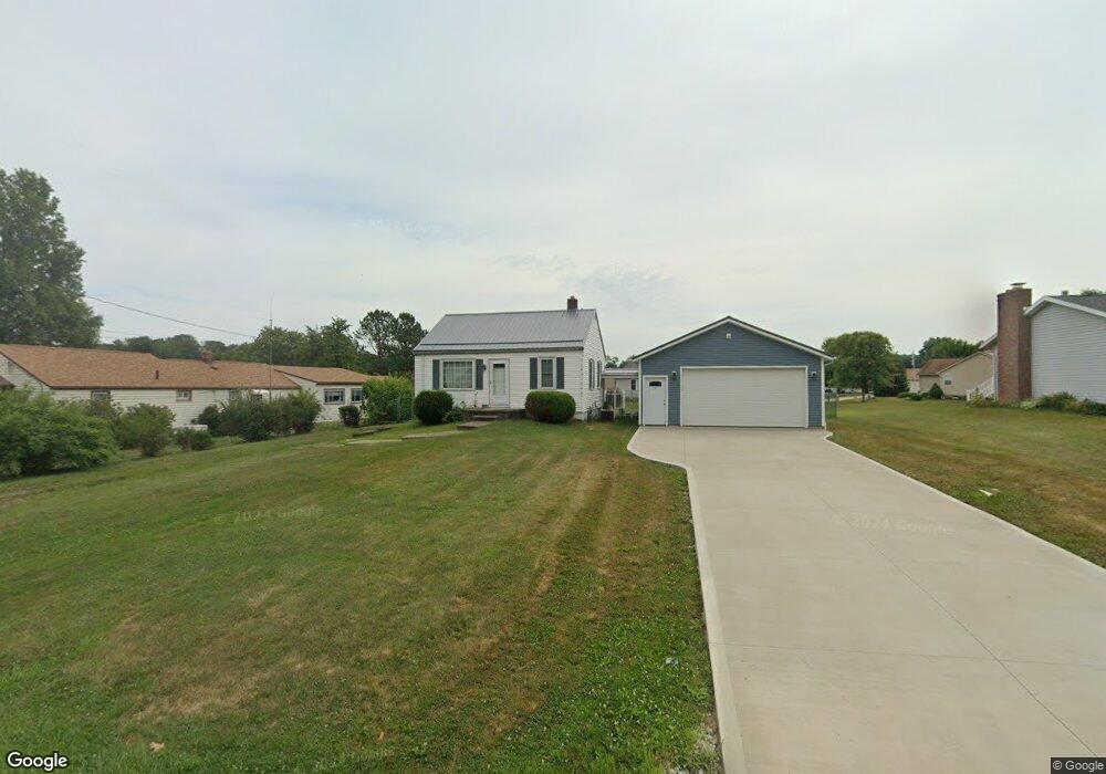
932 Hazel Ave Louisville, OH 44641
Estimated Value: $128,526 - $152,000
2
Beds
1
Bath
624
Sq Ft
$222/Sq Ft
Est. Value
About This Home
This home is located at 932 Hazel Ave, Louisville, OH 44641 and is currently estimated at $138,382, approximately $221 per square foot. 932 Hazel Ave is a home located in Stark County with nearby schools including Louisville High School and St. Thomas Aquinas High School & Middle School.
Ownership History
Date
Name
Owned For
Owner Type
Purchase Details
Closed on
Apr 12, 2004
Sold by
Kirby Timothy S and Kirby Erica Lee
Bought by
Frank Arthur A
Current Estimated Value
Home Financials for this Owner
Home Financials are based on the most recent Mortgage that was taken out on this home.
Original Mortgage
$75,900
Outstanding Balance
$35,693
Interest Rate
5.65%
Mortgage Type
Purchase Money Mortgage
Estimated Equity
$102,689
Purchase Details
Closed on
Dec 31, 1996
Sold by
Lingenhoel Arden R
Bought by
Kirby Timothy S
Home Financials for this Owner
Home Financials are based on the most recent Mortgage that was taken out on this home.
Original Mortgage
$52,250
Interest Rate
7.64%
Mortgage Type
New Conventional
Purchase Details
Closed on
Apr 23, 1993
Create a Home Valuation Report for This Property
The Home Valuation Report is an in-depth analysis detailing your home's value as well as a comparison with similar homes in the area
Home Values in the Area
Average Home Value in this Area
Purchase History
| Date | Buyer | Sale Price | Title Company |
|---|---|---|---|
| Frank Arthur A | $79,900 | -- | |
| Kirby Timothy S | $55,500 | -- | |
| -- | -- | -- |
Source: Public Records
Mortgage History
| Date | Status | Borrower | Loan Amount |
|---|---|---|---|
| Open | Frank Arthur A | $75,900 | |
| Previous Owner | Kirby Timothy S | $52,250 |
Source: Public Records
Tax History Compared to Growth
Tax History
| Year | Tax Paid | Tax Assessment Tax Assessment Total Assessment is a certain percentage of the fair market value that is determined by local assessors to be the total taxable value of land and additions on the property. | Land | Improvement |
|---|---|---|---|---|
| 2025 | -- | $33,750 | $16,560 | $17,190 |
| 2024 | -- | $33,750 | $16,560 | $17,190 |
| 2023 | $1,459 | $33,920 | $15,650 | $18,270 |
| 2022 | $1,464 | $33,920 | $15,650 | $18,270 |
| 2021 | $1,468 | $33,920 | $15,650 | $18,270 |
| 2020 | $1,050 | $26,320 | $14,070 | $12,250 |
| 2019 | $1,054 | $24,960 | $14,070 | $10,890 |
| 2018 | $996 | $24,960 | $14,070 | $10,890 |
| 2017 | $884 | $21,350 | $12,390 | $8,960 |
| 2016 | $902 | $21,350 | $12,390 | $8,960 |
| 2015 | $904 | $21,350 | $12,390 | $8,960 |
| 2014 | $841 | $18,450 | $10,680 | $7,770 |
| 2013 | $424 | $18,450 | $10,680 | $7,770 |
Source: Public Records
Map
Nearby Homes
- 1715 High St
- 1812 E Broad St
- 641 S Nickelplate St
- 2110 Edmar St
- 520 S Silver St
- 308 Superior St
- 728 E Broad St
- 0 Michigan Blvd
- 908 Sand Lot Cir
- 2015 E Main St
- 510 S Bauman Ct
- 204 E Broad St
- 107 E Broad St
- 3390 Meese Rd NE
- 325 Lincoln Ave
- 1702 View Pointe Ave
- 1170 Winding Ridge Ave
- 1639 Horizon Dr
- 910 Crosswyck Cir
- 8225 Georgetown St
- 1026 Hazel Ave
- 912 Hazel Ave
- 1665 Briarwood St
- 1116 Hazel Ave
- 925 Hazel Ave
- 1660 Briarwood St
- 933 Hazel Ave
- 1695 Briarwood St
- 1005 Hazel Ave
- 907 Hazel Ave
- 59 Briarwood St
- 58 Briarwood St
- 1118 Hazel Ave
- 1680 Briarwood St
- 1520 South St
- 1715 Briarwood St
- 1537 Opal St
- 1454 Edith St
- 1462 Edith St
- 1470 Edith St