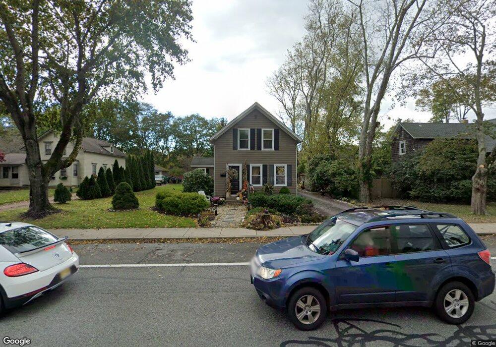
932 Kingstown Rd Wakefield, RI 02879
Estimated Value: $538,438 - $633,000
5
Beds
2
Baths
1,912
Sq Ft
$308/Sq Ft
Est. Value
About This Home
This home is located at 932 Kingstown Rd, Wakefield, RI 02879 and is currently estimated at $589,610, approximately $308 per square foot. 932 Kingstown Rd is a home located in Washington County with nearby schools including South Kingstown High School, Monsignor Matthew Clarke Catholic Regional School, and Bradley School-South.
Ownership History
Date
Name
Owned For
Owner Type
Purchase Details
Closed on
Jun 2, 2003
Sold by
Murray Patrick W
Bought by
Gretchner Lisa E
Current Estimated Value
Purchase Details
Closed on
Oct 17, 2002
Sold by
Todd Richard
Bought by
Murray Patrick W
Create a Home Valuation Report for This Property
The Home Valuation Report is an in-depth analysis detailing your home's value as well as a comparison with similar homes in the area
Home Values in the Area
Average Home Value in this Area
Purchase History
| Date | Buyer | Sale Price | Title Company |
|---|---|---|---|
| Gretchner Lisa E | $272,500 | -- | |
| Murray Patrick W | $17,500 | -- |
Source: Public Records
Mortgage History
| Date | Status | Borrower | Loan Amount |
|---|---|---|---|
| Open | Murray Patrick W | $192,000 | |
| Closed | Murray Patrick W | $222,400 |
Source: Public Records
Tax History Compared to Growth
Tax History
| Year | Tax Paid | Tax Assessment Tax Assessment Total Assessment is a certain percentage of the fair market value that is determined by local assessors to be the total taxable value of land and additions on the property. | Land | Improvement |
|---|---|---|---|---|
| 2025 | $3,985 | $445,700 | $152,100 | $293,600 |
| 2024 | $3,876 | $350,800 | $117,000 | $233,800 |
| 2023 | $3,876 | $350,800 | $117,000 | $233,800 |
| 2022 | $3,841 | $350,800 | $117,000 | $233,800 |
| 2021 | $3,474 | $240,400 | $74,900 | $165,500 |
| 2020 | $3,474 | $240,400 | $74,900 | $165,500 |
| 2019 | $3,474 | $240,400 | $74,900 | $165,500 |
| 2018 | $3,128 | $199,500 | $64,200 | $135,300 |
| 2017 | $3,054 | $199,500 | $64,200 | $135,300 |
| 2016 | $3,010 | $199,500 | $64,200 | $135,300 |
| 2015 | $3,098 | $199,600 | $68,100 | $131,500 |
| 2014 | $3,090 | $199,600 | $68,100 | $131,500 |
Source: Public Records
Map
Nearby Homes
- 40 Amos St
- 70 Broad Rock Rd
- 156 River St Unit B
- 3 Larkin St
- 10 Hendricks St
- 48 Stone Bridge Dr
- 37 Columbia St
- 128 North Rd
- 45 Cherry Ln Unit C
- 39 Hazard Ave
- 128 Camden Ct
- 73 Camden Ct
- 38 Eisenhower Place
- 228 Rodman St
- 98 Meadow Ave
- 128 Rodman St
- 17 Celestial Heights Dr
- 53 Rocky Brook Way
- 23 Rockland Dr
- 918 Saugatucket Rd
- 924 Kingstown Rd
- 940 Kingstown Rd
- 920 Kingstown Rd
- 16 Amos St
- 981 Kingstown Rd Unit A
- 981 Kingstown Rd Unit B
- 916 Kingstown Rd
- 916 Kingstown Rd Unit 1
- 914 Kingstown Rd Unit 2
- 950 Kingstown Rd
- 943 Kingstown Rd
- 0 Broad Rock Rd
- 17 Amos St
- 923 Kingstown Rd
- 28 Amos
- 931 Kingstown Rd
- 28 Amos St
- 902 Kingstown Rd
- 917 Kingstown Rd
- 30 Amos St