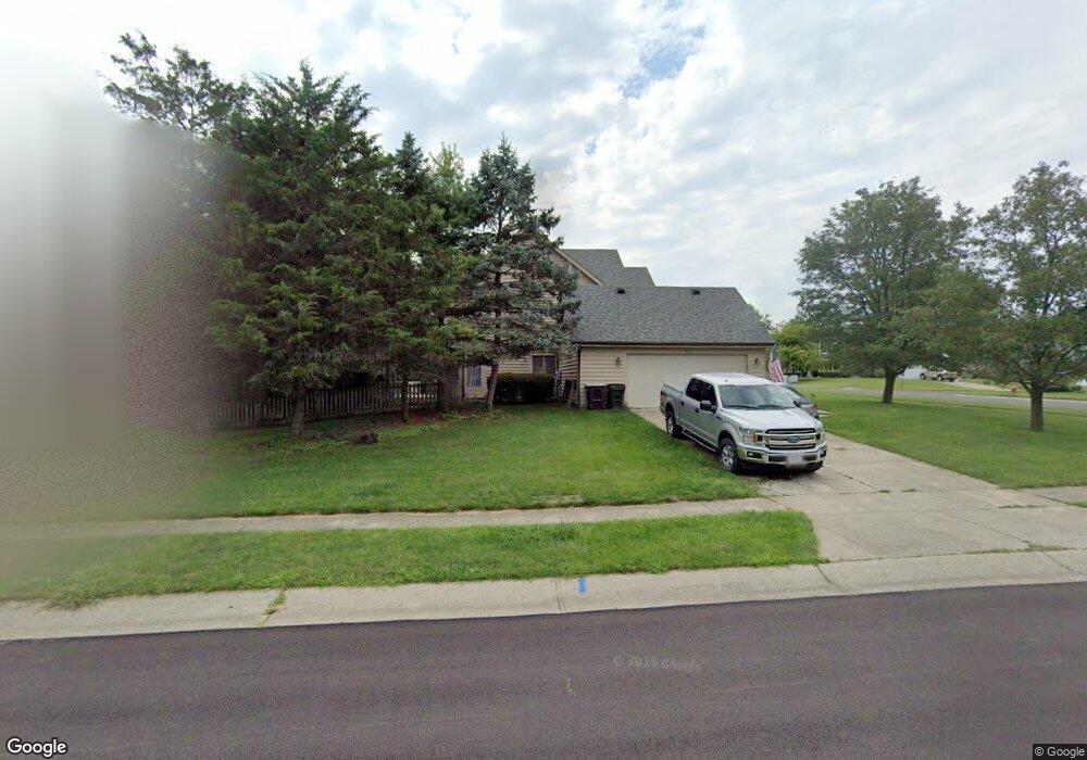
932 Oaknoll Dr Springboro, OH 45066
Clearcreek Township NeighborhoodEstimated Value: $442,337 - $494,000
3
Beds
3
Baths
2,637
Sq Ft
$178/Sq Ft
Est. Value
About This Home
This home is located at 932 Oaknoll Dr, Springboro, OH 45066 and is currently estimated at $468,834, approximately $177 per square foot. 932 Oaknoll Dr is a home located in Warren County with nearby schools including Clearcreek Elementary School, Springboro Intermediate School, and Springboro Junior High School.
Ownership History
Date
Name
Owned For
Owner Type
Purchase Details
Closed on
Nov 5, 2020
Sold by
Whitehead Kayla R and Whitehead Zachary B
Bought by
Allison Dustin and Allison Ciara
Current Estimated Value
Home Financials for this Owner
Home Financials are based on the most recent Mortgage that was taken out on this home.
Original Mortgage
$284,430
Outstanding Balance
$253,556
Interest Rate
2.9%
Mortgage Type
New Conventional
Estimated Equity
$215,278
Purchase Details
Closed on
May 13, 2015
Sold by
James Timothy
Bought by
Whitehead Kayla R and Whitehead Zachary B
Purchase Details
Closed on
Apr 4, 2014
Sold by
Richardson Clay C and Richardson Clay
Bought by
James Timothy
Purchase Details
Closed on
Mar 17, 2008
Sold by
Caisse Eugene J
Bought by
Richardson Clay C and Richardson Lauren C
Home Financials for this Owner
Home Financials are based on the most recent Mortgage that was taken out on this home.
Original Mortgage
$224,000
Interest Rate
5.74%
Mortgage Type
Purchase Money Mortgage
Purchase Details
Closed on
Jun 25, 2007
Sold by
Caisse Karen L
Bought by
Caisse Eugene J
Home Financials for this Owner
Home Financials are based on the most recent Mortgage that was taken out on this home.
Original Mortgage
$185,500
Interest Rate
6.37%
Mortgage Type
New Conventional
Purchase Details
Closed on
Mar 5, 1996
Sold by
Ranstead Merritt M
Bought by
Caisse Eugene J and Caisse Karen L
Home Financials for this Owner
Home Financials are based on the most recent Mortgage that was taken out on this home.
Original Mortgage
$185,250
Interest Rate
7.07%
Mortgage Type
New Conventional
Purchase Details
Closed on
Jun 21, 1990
Sold by
Peth Nick A and Peth Shelly
Bought by
Ranstead and Ranstead Merritt M
Purchase Details
Closed on
Feb 20, 1990
Sold by
Roger Roger and Roger Irving B
Bought by
Peth Peth and Peth Nick A
Purchase Details
Closed on
Feb 24, 1988
Sold by
Irving Roger and Irving B.
Bought by
Roger Roger and Roger Irving B
Create a Home Valuation Report for This Property
The Home Valuation Report is an in-depth analysis detailing your home's value as well as a comparison with similar homes in the area
Home Values in the Area
Average Home Value in this Area
Purchase History
| Date | Buyer | Sale Price | Title Company |
|---|---|---|---|
| Allison Dustin | $299,400 | Home Services Title Llc | |
| Whitehead Kayla R | -- | Attorney | |
| James Timothy | $170,000 | None Available | |
| Richardson Clay C | $224,000 | Gw Land Title | |
| Caisse Eugene J | -- | Triadtitle | |
| Caisse Eugene J | $195,000 | -- | |
| Ranstead | $187,000 | -- | |
| Peth Peth | $33,500 | -- | |
| Roger Roger | -- | -- |
Source: Public Records
Mortgage History
| Date | Status | Borrower | Loan Amount |
|---|---|---|---|
| Open | Allison Dustin | $284,430 | |
| Previous Owner | Richardson Clay C | $224,000 | |
| Previous Owner | Caisse Eugene J | $185,500 | |
| Previous Owner | Caisse Eugene J | $185,250 |
Source: Public Records
Tax History Compared to Growth
Tax History
| Year | Tax Paid | Tax Assessment Tax Assessment Total Assessment is a certain percentage of the fair market value that is determined by local assessors to be the total taxable value of land and additions on the property. | Land | Improvement |
|---|---|---|---|---|
| 2024 | $5,128 | $125,790 | $31,500 | $94,290 |
| 2023 | $4,480 | $100,870 | $17,220 | $83,650 |
| 2022 | $4,381 | $100,870 | $17,220 | $83,650 |
| 2021 | $4,123 | $100,870 | $17,220 | $83,650 |
| 2020 | $3,875 | $82,009 | $14,000 | $68,009 |
| 2019 | $3,591 | $82,009 | $14,000 | $68,009 |
| 2018 | $3,582 | $82,009 | $14,000 | $68,009 |
| 2017 | $3,565 | $73,276 | $12,429 | $60,848 |
| 2016 | $3,709 | $73,276 | $12,429 | $60,848 |
| 2015 | $3,813 | $73,276 | $12,429 | $60,848 |
| 2014 | $3,740 | $69,790 | $11,840 | $57,950 |
| 2013 | $3,738 | $82,540 | $14,000 | $68,540 |
Source: Public Records
Map
Nearby Homes
- 849 Wind Bluff Point
- 639 Birchcreek Way
- 1009 Highpoint Dr
- 0 White Cedar Way Unit 1818661
- 8479 London Ct
- 8455 London Ct
- 8234 Voltaire Ct
- 9159 Glenridge Blvd
- 249 Chapel Dr
- 7498 Majestic Trail
- 9195 Glenridge Blvd
- 1211 Normandy Rue
- 9192 Glenridge Blvd
- 1241 Normandy Rue
- 1214 Normandy Rue
- 1232 Normandy Rue
- 1198 Normandy Rue
- 1282 Normandy Rue
- 9333 Rochelle Ln
- 213 Bentridge Dr
- 799 Highpoint Dr
- 912 Oaknoll Dr
- 8764 Ridgewood Place
- 865 Highpoint Dr
- 781 Highpoint Dr
- 892 Oaknoll Dr
- 911 Oaknoll Dr
- 8763 Ridgewood Place
- 8763 Cottonwood Place
- 8780 Ridgewood Place
- 8670 Hawthorne Place
- 853 Wind Bluff Point
- 761 Highpoint Dr
- 874 Oaknoll Dr
- 8781 Ridgewood Place
- 855 Wind Bluff Point
- 0 Ridgewood Place
- 8781 Cottonwood Place
- 8676 Hawthorne Place
- 8658 Hawthorne Place