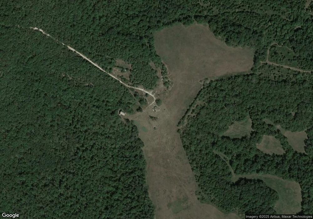
932 Reese Rd Chadwick, MO 65629
Estimated Value: $269,000 - $302,117
3
Beds
1
Bath
884
Sq Ft
$323/Sq Ft
Est. Value
About This Home
This home is located at 932 Reese Rd, Chadwick, MO 65629 and is currently estimated at $285,559, approximately $323 per square foot. 932 Reese Rd is a home located in Christian County with nearby schools including Chadwick Elementary School and Chadwick High School.
Ownership History
Date
Name
Owned For
Owner Type
Purchase Details
Closed on
Dec 19, 2024
Sold by
Harris Clint and Harris Amanda
Bought by
Dogwood Springs Ranch Llc
Current Estimated Value
Purchase Details
Closed on
Apr 9, 2020
Sold by
Rook Steven Scott and Rook Kayla Renee
Bought by
Harris Clint and Harris Amanda
Home Financials for this Owner
Home Financials are based on the most recent Mortgage that was taken out on this home.
Original Mortgage
$422,100
Interest Rate
3.4%
Mortgage Type
New Conventional
Purchase Details
Closed on
Apr 25, 2016
Sold by
Rook Richard and Rook Charlotte
Bought by
Scott Rook Steven
Purchase Details
Closed on
Sep 6, 2005
Sold by
Page Jordan and Page Stacey
Bought by
Rodebush James Wesley
Create a Home Valuation Report for This Property
The Home Valuation Report is an in-depth analysis detailing your home's value as well as a comparison with similar homes in the area
Home Values in the Area
Average Home Value in this Area
Purchase History
| Date | Buyer | Sale Price | Title Company |
|---|---|---|---|
| Dogwood Springs Ranch Llc | -- | None Listed On Document | |
| Dogwood Springs Ranch Llc | -- | None Listed On Document | |
| Harris Clint | -- | Titan Ttl & Closing Of Mo Ll | |
| Harris Clint | -- | Titan Ttl & Closing Of Mo Ll | |
| Scott Rook Steven | -- | Great American Title | |
| Rodebush James Wesley | -- | None Available |
Source: Public Records
Mortgage History
| Date | Status | Borrower | Loan Amount |
|---|---|---|---|
| Previous Owner | Harris Clint | $422,100 |
Source: Public Records
Tax History Compared to Growth
Tax History
| Year | Tax Paid | Tax Assessment Tax Assessment Total Assessment is a certain percentage of the fair market value that is determined by local assessors to be the total taxable value of land and additions on the property. | Land | Improvement |
|---|---|---|---|---|
| 2024 | $750 | $14,070 | -- | -- |
| 2023 | $750 | $14,070 | $0 | $0 |
| 2022 | $672 | $12,070 | $0 | $0 |
| 2021 | $673 | $12,070 | $0 | $0 |
| 2020 | $653 | $11,270 | $0 | $0 |
| 2019 | $653 | $11,270 | $0 | $0 |
| 2018 | $651 | $10,990 | $0 | $0 |
| 2017 | $651 | $10,990 | $0 | $0 |
| 2016 | $636 | $10,990 | $0 | $0 |
| 2015 | $652 | $10,990 | $10,990 | $0 |
| 2014 | $586 | $10,830 | $0 | $0 |
| 2013 | $6 | $10,830 | $0 | $0 |
| 2011 | $6 | $21,660 | $0 | $0 |
Source: Public Records
Map
Nearby Homes
- 000 Merritt Rd
- 242 Blue Jay Dr
- 69 Hcr Box 67
- 000 Rd
- 1899 State Hwy Dd
- 6955 Chadwick Rd
- 7789 W Co Rd Unit T-561
- 3191 State Highway Dd Private Rd B Unit Tract 3
- 7789 E Co Rd Unit T-561
- 299 Hwy T
- 000 State Hwy 125
- 19927 State Highway 125 S
- 3176 State Highway Dd
- 000 State Highway Dd
- 000 Missouri 125
- 000 Hwy T
- Hcr 69 Box 67
- 000 Missouri 125
- 507 Barber Rd
- 130 Church St
- 1694 Merritt Rd
- 721 Quail Rd
- 0 Whippoorwill Unit 60150113
- 0 S State Highway Uu Unit 11201908
- 0 S State Highway Uu Unit 10811182
- 0 S State Highway Uu Unit 10818042
- 0 S State Highway Uu Unit 10818044
- 0 S State Highway Uu Unit 10906807
- 0 S State Highway Uu Unit 11114738
- 0 S State Highway Uu Unit 11110895
- 0 S State Highway Uu Unit 60053533
- 0 S State Highway Uu Unit 60054986
- 965 Whipporwill Rd
- 0 Whipporwill Unit 11015275
- 0 Whipporwill Unit 60121451
- 1500 Merritt Rd
