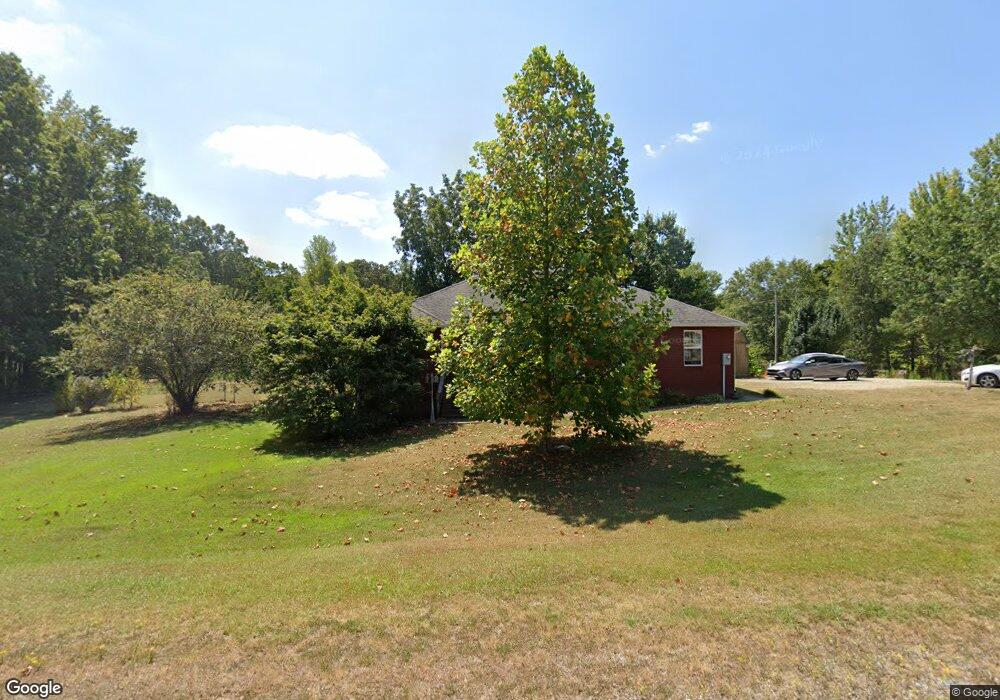
932 Sherrod Ln Tuscumbia, AL 35674
Estimated Value: $197,000 - $315,000
--
Bed
--
Bath
1,661
Sq Ft
$147/Sq Ft
Est. Value
About This Home
This home is located at 932 Sherrod Ln, Tuscumbia, AL 35674 and is currently estimated at $243,845, approximately $146 per square foot. 932 Sherrod Ln is a home located in Colbert County with nearby schools including New Bethel Elementary School and Colbert Heights High School.
Ownership History
Date
Name
Owned For
Owner Type
Purchase Details
Closed on
Dec 22, 2020
Sold by
Grimes Jonathan Matthew and Grimes Janice Elizabeth
Bought by
Grimes Bruce E and Grimes Patricia C
Current Estimated Value
Purchase Details
Closed on
Sep 16, 2012
Sold by
Green Tree Servicing Llc
Bought by
Grimes Bruce E and Grimes Patricia W
Home Financials for this Owner
Home Financials are based on the most recent Mortgage that was taken out on this home.
Original Mortgage
$181,500
Outstanding Balance
$125,650
Interest Rate
3.58%
Mortgage Type
New Conventional
Estimated Equity
$118,195
Create a Home Valuation Report for This Property
The Home Valuation Report is an in-depth analysis detailing your home's value as well as a comparison with similar homes in the area
Home Values in the Area
Average Home Value in this Area
Purchase History
| Date | Buyer | Sale Price | Title Company |
|---|---|---|---|
| Grimes Bruce E | -- | None Available | |
| Grimes Bruce E | -- | -- |
Source: Public Records
Mortgage History
| Date | Status | Borrower | Loan Amount |
|---|---|---|---|
| Open | Grimes Bruce E | $181,500 |
Source: Public Records
Tax History Compared to Growth
Tax History
| Year | Tax Paid | Tax Assessment Tax Assessment Total Assessment is a certain percentage of the fair market value that is determined by local assessors to be the total taxable value of land and additions on the property. | Land | Improvement |
|---|---|---|---|---|
| 2024 | $759 | $20,100 | $1,040 | $19,060 |
| 2023 | $505 | $19,200 | $0 | $0 |
| 2022 | $443 | $17,460 | $0 | $0 |
| 2021 | $413 | $16,160 | $0 | $0 |
| 2020 | $376 | $14,600 | $0 | $0 |
| 2019 | $383 | $14,900 | $0 | $0 |
| 2018 | $383 | $14,900 | $0 | $0 |
| 2017 | $367 | $14,200 | $0 | $0 |
| 2016 | $366 | $14,160 | $0 | $0 |
| 2013 | -- | $0 | $0 | $0 |
Source: Public Records
Map
Nearby Homes
- 589 Hester Porter Rd
- 92 Mountain Unit Road
- 20838 Highway 72
- 425 Cedar Hill Ln
- 00 Pilgrim Rd
- 163 McGee Way
- Tract E Old Memphis Pike
- Tract D Old Memphis Pike
- 0 Posey Loop
- 710 Carter Dr
- Tract C Old Memphis Pike
- Tract B Old Memphis Pike
- 00 New Cut Rd
- 00 Underwood Mountain Rd
- Tract F Old Memphis Pike
- 149 Wilson Way
- 121 Darrell Dr
- 1096 Rain Tree Dr
- 1100 Rain Tree Dr
- 1104 Anna Dr
- 1004 Sherrod Ln
- 905 Sherrod Ln
- 1010 Sherrod Ln
- 825 Sherrod Ln
- 944 Sherrod Ln
- 1050 Sherrod Ln
- 1067 Sherrod Ln
- 810 Sherrod Ln
- 1065 Sherrod Ln
- 795 Sherrod Ln
- 1099 Sherrod Ln
- 755 Sherrod Ln
- 1200 Sherrod Ln
- 720 Sherrod Ln
- 725 Sherrod Ln
- 635 Sherrod Ln
- 1330 Sherrod Ln
- 500 Sherrod Ln
- 565 Sherrod Ln
- 370 Sherrod Ln