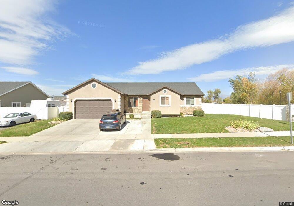
932 W 1250 S Payson, UT 84651
Estimated Value: $539,266 - $557,000
3
Beds
3
Baths
1,355
Sq Ft
$404/Sq Ft
Est. Value
About This Home
This home is located at 932 W 1250 S, Payson, UT 84651 and is currently estimated at $546,755, approximately $403 per square foot. 932 W 1250 S is a home with nearby schools including Wilson Elementary School, Payson Junior High School, and Mt. Nebo Middle.
Ownership History
Date
Name
Owned For
Owner Type
Purchase Details
Closed on
Apr 8, 2025
Sold by
Castillo Marco
Bought by
Marco Antonio Castillo And Maria Del Carmen M and Castillo
Current Estimated Value
Purchase Details
Closed on
Mar 1, 2021
Sold by
Castillo Marco and Martinez Maria C
Bought by
Castillo Marco
Home Financials for this Owner
Home Financials are based on the most recent Mortgage that was taken out on this home.
Original Mortgage
$170,000
Interest Rate
2.7%
Mortgage Type
New Conventional
Purchase Details
Closed on
Sep 10, 2010
Sold by
Rural Housing Development Corporation
Bought by
Castillo Marco and Martinez Maria C
Home Financials for this Owner
Home Financials are based on the most recent Mortgage that was taken out on this home.
Original Mortgage
$185,376
Interest Rate
4.45%
Mortgage Type
Purchase Money Mortgage
Purchase Details
Closed on
Feb 5, 2010
Sold by
Clark Real Estate Co
Bought by
Rural Housing Development Corporation
Create a Home Valuation Report for This Property
The Home Valuation Report is an in-depth analysis detailing your home's value as well as a comparison with similar homes in the area
Home Values in the Area
Average Home Value in this Area
Purchase History
| Date | Buyer | Sale Price | Title Company |
|---|---|---|---|
| Marco Antonio Castillo And Maria Del Carmen M | -- | Prospect Title | |
| Castillo Marco | -- | Provo Land Title Company | |
| Castillo Marco | -- | Backman | |
| Rural Housing Development Corporation | -- | Backman |
Source: Public Records
Mortgage History
| Date | Status | Borrower | Loan Amount |
|---|---|---|---|
| Previous Owner | Castillo Marco | $170,000 | |
| Previous Owner | Castillo Marco | $185,376 |
Source: Public Records
Tax History
| Year | Tax Paid | Tax Assessment Tax Assessment Total Assessment is a certain percentage of the fair market value that is determined by local assessors to be the total taxable value of land and additions on the property. | Land | Improvement |
|---|---|---|---|---|
| 2025 | $2,571 | $276,210 | -- | -- |
| 2024 | $2,571 | $261,690 | $0 | $0 |
| 2023 | $2,603 | $265,650 | $0 | $0 |
| 2022 | $2,708 | $271,755 | $0 | $0 |
| 2021 | $2,285 | $367,800 | $108,300 | $259,500 |
| 2020 | $2,141 | $337,200 | $94,200 | $243,000 |
| 2019 | $2,014 | $325,200 | $94,200 | $231,000 |
| 2018 | $1,675 | $260,700 | $73,100 | $187,600 |
| 2017 | $1,549 | $129,635 | $0 | $0 |
| 2016 | $1,499 | $124,685 | $0 | $0 |
| 2015 | $1,393 | $115,060 | $0 | $0 |
| 2014 | $1,253 | $104,225 | $0 | $0 |
Source: Public Records
Map
Nearby Homes
- 1172 S 880 W
- 1320 S 950 W
- 1116 W 1290 S
- 1333 S 1050 W
- 1128 W 1150 S Unit 9
- 1146 W 1260 S
- 1338 S 1050 W
- 991 S 930 W
- 1216 S 1150 W Unit 19
- 2003 S 1150 W Unit 1040
- 1068 S 1150 W
- 1192 W 1130 St S Unit 202
- 1183 W 1050 S Unit 212
- 1024 S 1170 W
- 1152 W 1000 S
- 846 S 880 W
- 802 Brookside Ct
- 1468 S 910 W
- 1589 S 840 W
- 1631 S Highway 198
- 952 W 1250 S
- 952 W 1250 S Unit 11
- 955 W 1150 S
- 955 W 1150 S Unit 9
- 1265 S 950 W
- 997 W 1150 S
- 984 W 1250 S
- 1266 S 950 W
- 1001 W 1150 S
- 1001 W 1150 S Unit 7
- 1275 S 950 W
- 1016 W 1250 S
- 956 W 1150 S
- 956 W 1150 S Unit 1
- 1276 S 950 W
- 986 W 1150 S
- 986 W 1150 S Unit 2
- 1263 S 1050 W
- 1025 W 1150 S
- 1025 W 1150 S Unit 6
Your Personal Tour Guide
Ask me questions while you tour the home.