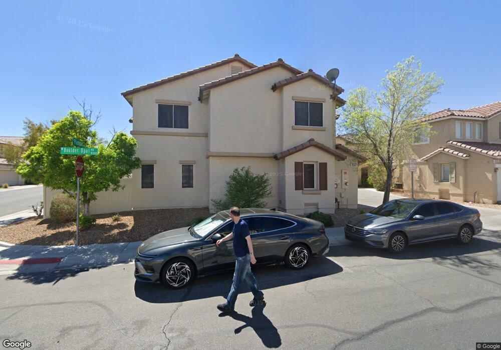
9321 Boulder Opal Ave Las Vegas, NV 89148
Estimated Value: $427,000 - $441,000
3
Beds
3
Baths
1,937
Sq Ft
$223/Sq Ft
Est. Value
About This Home
This home is located at 9321 Boulder Opal Ave, Las Vegas, NV 89148 and is currently estimated at $432,818, approximately $223 per square foot. 9321 Boulder Opal Ave is a home located in Clark County with nearby schools including Wayne N. Tanaka Elementary School, Wilbur & Theresa Faiss Middle School, and Sierra Vista High School.
Ownership History
Date
Name
Owned For
Owner Type
Purchase Details
Closed on
Oct 30, 2024
Sold by
Watkins Ayako S
Bought by
Watkins Trust and Watkins
Current Estimated Value
Purchase Details
Closed on
May 7, 2003
Sold by
Richmond American Homes Of Nevada Inc
Bought by
Watkins Ayako S
Home Financials for this Owner
Home Financials are based on the most recent Mortgage that was taken out on this home.
Original Mortgage
$168,350
Interest Rate
5.84%
Create a Home Valuation Report for This Property
The Home Valuation Report is an in-depth analysis detailing your home's value as well as a comparison with similar homes in the area
Home Values in the Area
Average Home Value in this Area
Purchase History
| Date | Buyer | Sale Price | Title Company |
|---|---|---|---|
| Watkins Trust | -- | None Listed On Document | |
| Watkins Ayako S | $177,262 | Stewart Title Of Nevada |
Source: Public Records
Mortgage History
| Date | Status | Borrower | Loan Amount |
|---|---|---|---|
| Previous Owner | Watkins Ayako S | $168,350 |
Source: Public Records
Tax History Compared to Growth
Tax History
| Year | Tax Paid | Tax Assessment Tax Assessment Total Assessment is a certain percentage of the fair market value that is determined by local assessors to be the total taxable value of land and additions on the property. | Land | Improvement |
|---|---|---|---|---|
| 2025 | $2,199 | $106,137 | $31,500 | $74,637 |
| 2024 | $2,036 | $106,137 | $31,500 | $74,637 |
| 2023 | $2,036 | $101,992 | $31,500 | $70,492 |
| 2022 | $1,886 | $88,877 | $24,500 | $64,377 |
| 2021 | $1,746 | $83,959 | $22,750 | $61,209 |
| 2020 | $1,619 | $83,421 | $22,750 | $60,671 |
| 2019 | $1,517 | $78,810 | $19,250 | $59,560 |
| 2018 | $1,448 | $72,016 | $15,050 | $56,966 |
| 2017 | $2,112 | $72,001 | $14,350 | $57,651 |
| 2016 | $1,356 | $65,962 | $10,850 | $55,112 |
| 2015 | $1,353 | $59,535 | $8,750 | $50,785 |
| 2014 | $1,313 | $43,432 | $5,950 | $37,482 |
Source: Public Records
Map
Nearby Homes
- 9299 Adamshurst Ave
- 9249 Shellmont Ct
- 0 Fort Apache Unit 2719841
- 9272 Keaton Ave
- 7264 Morrison St
- 7011 Azure Beach St
- 9544 Wild Valley Ave
- 9557 Belmont Bay Ave
- 7325 Ringquist St
- 9330 W Maule Ave Unit 226
- 9330 W Maule Ave Unit 212
- 9229 Millikan Ave
- 7431 Ademar St
- 9050 W Warm Springs Rd Unit 1164
- 9050 W Warm Springs Rd Unit 1092
- 9050 W Warm Springs Rd Unit 2099
- 9123 Hilverson Ave
- 9119 Glennon Ave
- 7457 Margollini St
- 7469 Margollini St
- 9325 Boulder Opal Ave
- 9333 Boulder Opal Ave
- 9329 Boulder Opal Ave
- 7164 Plushstone St
- 9334 Boulder Opal Ave
- 7156 Plushstone St
- 9341 Boulder Opal Ave
- 9341 Boulder Opal Ave
- 9341 Boulder Opal Ave
- 9341 Boulder Opal Ave
- 9341 Boulder Opal Ave
- 9345 Boulder Opal Ave
- 7176 Plushstone St
- 9326 Boulder Opal Ave
- 7144 Plushstone St
- 7168 Plushstone St
- 9342 Boulder Opal Ave
- 9330 Boulder Opal Ave
- 7152 Plushstone St
- 7184 Plushstone St