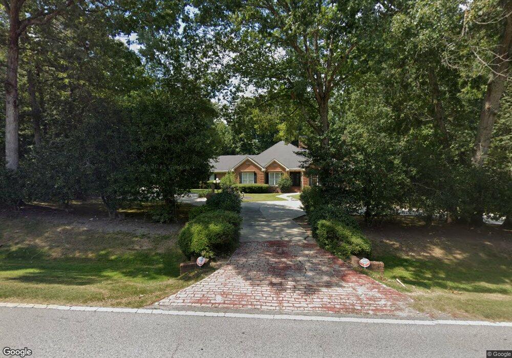
9327 Floyd Rd Jonesboro, GA 30236
Estimated Value: $631,000 - $812,000
3
Beds
4
Baths
4,832
Sq Ft
$152/Sq Ft
Est. Value
About This Home
This home is located at 9327 Floyd Rd, Jonesboro, GA 30236 and is currently estimated at $734,167, approximately $151 per square foot. 9327 Floyd Rd is a home located in Clayton County with nearby schools including Suder Elementary School, M. D. Roberts Middle School, and Jonesboro High School.
Ownership History
Date
Name
Owned For
Owner Type
Purchase Details
Closed on
Nov 20, 2020
Sold by
Banke Loretta
Bought by
Eli Gerald E
Current Estimated Value
Home Financials for this Owner
Home Financials are based on the most recent Mortgage that was taken out on this home.
Original Mortgage
$335,000
Outstanding Balance
$296,219
Interest Rate
2.8%
Mortgage Type
New Conventional
Estimated Equity
$437,948
Purchase Details
Closed on
Oct 25, 2002
Sold by
Banke Harold R
Bought by
Banke Loretta
Create a Home Valuation Report for This Property
The Home Valuation Report is an in-depth analysis detailing your home's value as well as a comparison with similar homes in the area
Home Values in the Area
Average Home Value in this Area
Purchase History
| Date | Buyer | Sale Price | Title Company |
|---|---|---|---|
| Eli Gerald E | $535,000 | -- | |
| Banke Loretta | -- | -- |
Source: Public Records
Mortgage History
| Date | Status | Borrower | Loan Amount |
|---|---|---|---|
| Open | Eli Gerald E | $335,000 |
Source: Public Records
Tax History Compared to Growth
Tax History
| Year | Tax Paid | Tax Assessment Tax Assessment Total Assessment is a certain percentage of the fair market value that is determined by local assessors to be the total taxable value of land and additions on the property. | Land | Improvement |
|---|---|---|---|---|
| 2024 | $6,331 | $336,160 | $15,400 | $320,760 |
| 2023 | $11,628 | $322,040 | $15,400 | $306,640 |
| 2022 | $5,001 | $269,840 | $15,400 | $254,440 |
| 2021 | $8,335 | $211,040 | $15,400 | $195,640 |
| 2020 | $3,340 | $177,063 | $17,030 | $160,033 |
| 2019 | $3,442 | $177,105 | $17,030 | $160,075 |
| 2018 | $3,363 | $173,267 | $17,030 | $156,237 |
| 2017 | $3,180 | $157,263 | $17,030 | $140,233 |
| 2016 | $3,319 | $163,701 | $17,030 | $146,670 |
| 2015 | $3,241 | $0 | $0 | $0 |
| 2014 | $2,888 | $155,338 | $17,030 | $138,308 |
Source: Public Records
Map
Nearby Homes
- 3223 Rhonda Dr
- 707 Lexington Ave
- 3194 Liverpool St
- 3117 Jodeco Dr
- 3027 Jodeco Dr
- 9361 Sweetbriar Cir
- 3080 Jodeco Dr
- 210 Longwood Dr Unit 1
- 1013 Columbus Dr
- 0 Noahs Ark Rd Unit 20171854
- 0 Noahs Ark Rd Unit 7340284
- 440 Longwood Ct Unit 440
- 205 Providence Ct
- 2641 Jodeco Dr
- 2669 Jodeco Dr
- 0 S Bay Dr Unit 7644005
- 0 S Bay Dr Unit 10591885
- 2811 Carnes Rd
- 3681 Chestnut Lake Ct
- 3258 S Bay Dr
- 9310 Terri Ln
- 9334 Woodsboro Ct Unit 1
- 9334 Woodsboro Ct
- 9294 Terri Ln
- 9297 Floyd Rd
- 9338 Woodsboro Ct
- 9342 Woodsboro Ct
- 3211 Rhonda Dr
- 9285 Floyd Rd
- 9307 Terri Ln
- 3193 Rhonda Dr
- 0 Terri Ln Unit 8737779
- 9295 Terri Ln
- 9371 Wendover Ct
- 9346 Woodsboro Ct
- 0 Rhonda Dr Unit 8248040
- 0 Rhonda Dr Unit 8105433
- 9365 Floyd Rd
- 9283 Terri Ln
- 9372 Wendover Ct