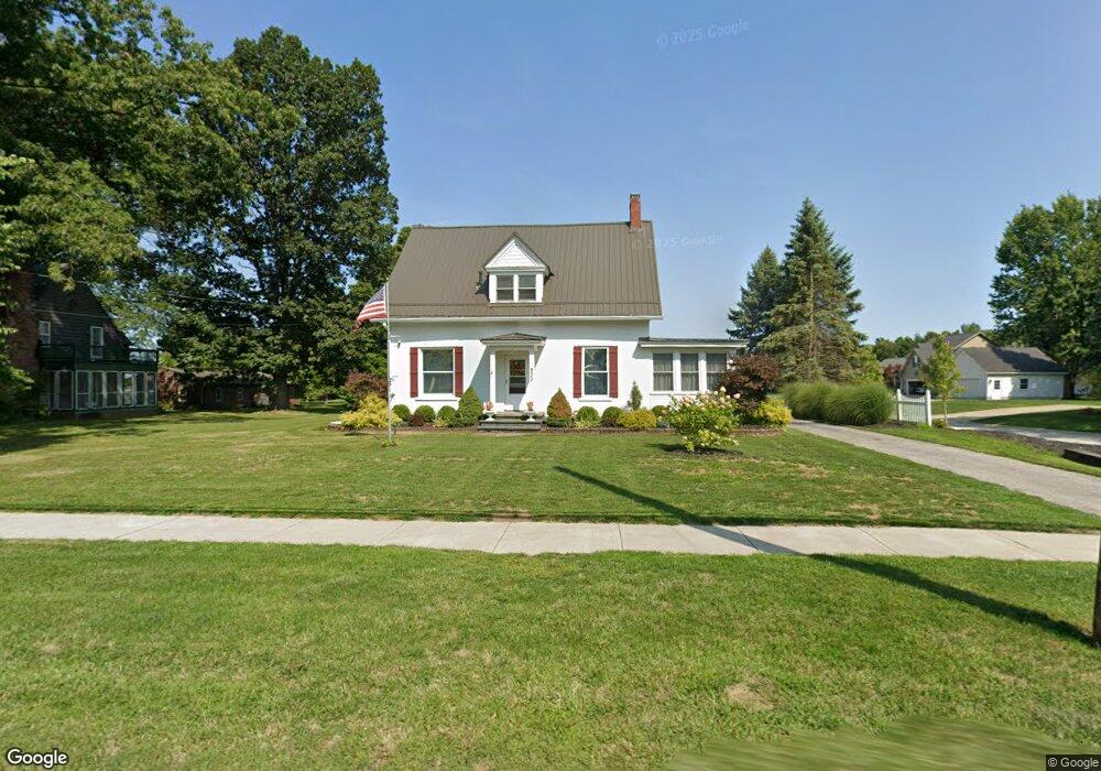
933 Madison Ave Painesville, OH 44077
Estimated Value: $283,000 - $414,000
4
Beds
3
Baths
1,558
Sq Ft
$206/Sq Ft
Est. Value
About This Home
This home is located at 933 Madison Ave, Painesville, OH 44077 and is currently estimated at $320,368, approximately $205 per square foot. 933 Madison Ave is a home located in Lake County with nearby schools including Henry F. Lamuth Middle School, Riverside Junior/Senior High School, and Summit Academy Community School - Painesville.
Ownership History
Date
Name
Owned For
Owner Type
Purchase Details
Closed on
May 4, 2001
Sold by
Colwell Richard J and Kluznik Kurt F
Bought by
Schilling William R and Schilling Cheryl H
Current Estimated Value
Home Financials for this Owner
Home Financials are based on the most recent Mortgage that was taken out on this home.
Original Mortgage
$73,600
Outstanding Balance
$26,406
Interest Rate
6.99%
Estimated Equity
$293,962
Create a Home Valuation Report for This Property
The Home Valuation Report is an in-depth analysis detailing your home's value as well as a comparison with similar homes in the area
Home Values in the Area
Average Home Value in this Area
Purchase History
| Date | Buyer | Sale Price | Title Company |
|---|---|---|---|
| Schilling William R | $92,000 | Commonwealth Land Title Agen |
Source: Public Records
Mortgage History
| Date | Status | Borrower | Loan Amount |
|---|---|---|---|
| Open | Schilling William R | $73,600 |
Source: Public Records
Tax History
| Year | Tax Paid | Tax Assessment Tax Assessment Total Assessment is a certain percentage of the fair market value that is determined by local assessors to be the total taxable value of land and additions on the property. | Land | Improvement |
|---|---|---|---|---|
| 2025 | -- | $80,440 | $21,410 | $59,030 |
| 2024 | -- | $80,440 | $21,410 | $59,030 |
| 2023 | $6,584 | $60,420 | $17,100 | $43,320 |
| 2022 | $3,540 | $60,420 | $17,100 | $43,320 |
| 2021 | $3,553 | $60,420 | $17,100 | $43,320 |
| 2020 | $3,500 | $52,550 | $14,880 | $37,670 |
| 2019 | $3,527 | $52,550 | $14,880 | $37,670 |
| 2018 | $3,538 | $41,600 | $8,260 | $33,340 |
| 2017 | $2,897 | $41,600 | $8,260 | $33,340 |
| 2016 | $2,552 | $41,600 | $8,260 | $33,340 |
| 2015 | $2,386 | $41,600 | $8,260 | $33,340 |
| 2014 | $2,425 | $41,600 | $8,260 | $33,340 |
| 2013 | $2,370 | $41,600 | $8,260 | $33,340 |
Source: Public Records
Map
Nearby Homes
- 959 Madison Ave
- 55 Grove Ave
- 145 Overlook Rd
- 1182 Dalton Dr
- 1250 Dorothea Dr
- 67 Red Pine Dr
- 990 Riverside Dr
- 80 Ridgecrest Dr
- 97 Park Rd
- 91 Paradise Rd
- 714 Rivers Edge Ln
- 248 Webster Ct
- 264 Park Rd
- 165 Paradise Rd
- 67 Tanners Farm Dr
- 823 Homewood Dr
- 850 Bank St
- 40 E Walnut Ave
- 30 Orton Rd
- 79 Hickory Hill Rd
- 925 Madison Ave
- 0 Madison Ave Unit 3604029
- 951 Madison Ave
- 45 Bellmore St
- 930 Madison Ave
- 940 Madison Ave
- SL 4 Madison Ave
- 51 Bellmore St
- 3 Country Scene Ln Unit 3
- 920 Madison Ave
- 48 Bellmore St
- 0 Madison Ave Unit 2432904
- 0 Madison Ave Unit 2432902
- 0 Madison Ave Unit 3676975
- 0 Madison Ave Unit 3767995
- 0 Madison Ave Unit 3794667
- 0 Madison Ave Unit 3425560
- 7 S/L Country Scene Ln Unit 7
- 969 Madison Ave
- 11 S/L Country Scene Ln Unit 11
Your Personal Tour Guide
Ask me questions while you tour the home.