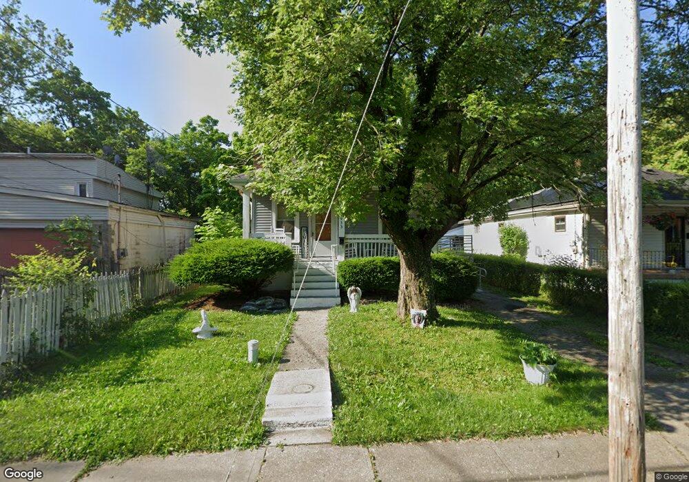
933 Matthews Dr Cincinnati, OH 45215
Estimated Value: $72,000 - $137,000
2
Beds
1
Bath
792
Sq Ft
$125/Sq Ft
Est. Value
About This Home
This home is located at 933 Matthews Dr, Cincinnati, OH 45215 and is currently estimated at $99,218, approximately $125 per square foot. 933 Matthews Dr is a home located in Hamilton County with nearby schools including Glendale Elementary School, Princeton Community Middle School, and Princeton High School.
Ownership History
Date
Name
Owned For
Owner Type
Purchase Details
Closed on
Sep 24, 2020
Sold by
Mills Cynthia Ann
Bought by
Mills Darren L
Current Estimated Value
Purchase Details
Closed on
Jan 13, 2014
Sold by
Mills Darren L and Mills Cynthia Ann
Bought by
Mills Darren L and Mills Cynthia Ann
Home Financials for this Owner
Home Financials are based on the most recent Mortgage that was taken out on this home.
Original Mortgage
$46,900
Outstanding Balance
$12,005
Interest Rate
4.41%
Mortgage Type
New Conventional
Estimated Equity
$87,213
Purchase Details
Closed on
Jul 30, 1997
Sold by
Land Holding Corp Of Ohio
Bought by
Mills Darren L
Purchase Details
Closed on
Feb 6, 1997
Sold by
Leis Simon L and Grissom Lillie Y
Bought by
Land Holding Corp Of Ohio
Create a Home Valuation Report for This Property
The Home Valuation Report is an in-depth analysis detailing your home's value as well as a comparison with similar homes in the area
Home Values in the Area
Average Home Value in this Area
Purchase History
| Date | Buyer | Sale Price | Title Company |
|---|---|---|---|
| Mills Darren L | -- | None Available | |
| Mills Darren L | -- | First American Title Ins Co | |
| Mills Darren L | $14,000 | -- | |
| Land Holding Corp Of Ohio | $22,000 | -- |
Source: Public Records
Mortgage History
| Date | Status | Borrower | Loan Amount |
|---|---|---|---|
| Open | Mills Darren L | $46,900 |
Source: Public Records
Tax History
| Year | Tax Paid | Tax Assessment Tax Assessment Total Assessment is a certain percentage of the fair market value that is determined by local assessors to be the total taxable value of land and additions on the property. | Land | Improvement |
|---|---|---|---|---|
| 2025 | $1,109 | $13,689 | $1,330 | $12,359 |
| 2023 | $936 | $13,689 | $1,330 | $12,359 |
| 2022 | $561 | $5,331 | $1,330 | $4,001 |
| 2021 | $559 | $5,331 | $1,330 | $4,001 |
| 2020 | $554 | $5,331 | $1,330 | $4,001 |
| 2019 | $585 | $5,331 | $1,330 | $4,001 |
| 2018 | $566 | $5,331 | $1,330 | $4,001 |
| 2017 | $552 | $5,331 | $1,330 | $4,001 |
| 2016 | $541 | $5,996 | $1,680 | $4,316 |
| 2015 | $571 | $5,996 | $1,680 | $4,316 |
| 2014 | $576 | $5,996 | $1,680 | $4,316 |
| 2013 | $699 | $7,494 | $2,100 | $5,394 |
Source: Public Records
Map
Nearby Homes
- 1201 Dixie Ct
- 949 Adams St
- 10152 Chester Rd
- 1174 Prairie Ave
- 1100 Timberland Dr
- 502 Marion Rd
- 10167 Wayne Ave
- 1401 Chamberlain Ave
- 1282 Steffen Ave
- 1076 Schumard Ave
- 964 Shepherd Ln
- 1415 Maple Ave
- 1704 Harmon Dr
- 405 Home Ave
- 315 Home Ave
- 112 W Leslie Ave
- 504 N Cooper Ave
- 11 Rolling Hills Ct
- 1239 Springfield Pike
- 182 Mayview Forest Dr
- 923 Matthews Dr
- 911 Matthews Dr
- 955 Matthews Dr
- 967 Matthews Dr
- 901 Matthews Dr
- 922 Van Buren Ave
- 932 Van Buren Ave
- 954 Van Buren Ave
- 910 Van Buren Ave
- 977 Matthews Dr
- 889 Matthews Dr
- 966 Van Buren Ave
- 932 Matthews Dr
- 954 Matthews Dr
- 910 Matthews Dr
- 989 Matthews Dr
- 877 Matthews Dr
- 966 Matthews Dr
- 908 Matthews Dr
- 988 Van Buren Ave