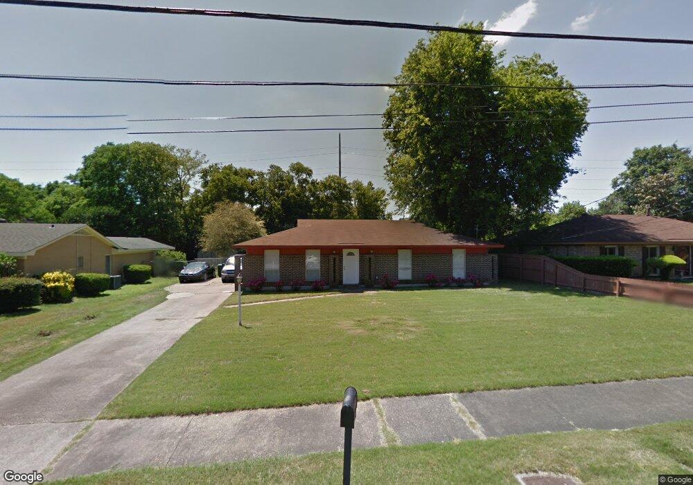
933 Queensbury Dr Montgomery, AL 36116
Estimated Value: $115,997 - $128,000
3
Beds
2
Baths
1,720
Sq Ft
$72/Sq Ft
Est. Value
About This Home
This home is located at 933 Queensbury Dr, Montgomery, AL 36116 and is currently estimated at $124,499, approximately $72 per square foot. 933 Queensbury Dr is a home located in Montgomery County with nearby schools including Johnson Elementary School, McKee Middle School, and Lanier Senior High School.
Ownership History
Date
Name
Owned For
Owner Type
Purchase Details
Closed on
Oct 3, 2003
Sold by
Hud
Bought by
Jarrett Deondre J
Current Estimated Value
Home Financials for this Owner
Home Financials are based on the most recent Mortgage that was taken out on this home.
Original Mortgage
$59,421
Outstanding Balance
$27,641
Interest Rate
6.28%
Mortgage Type
FHA
Estimated Equity
$96,858
Purchase Details
Closed on
Dec 19, 2002
Sold by
Collins Bennie L and Collins Dorothy T
Bought by
Countrywide Home Loans Servicing Lp
Purchase Details
Closed on
May 28, 1999
Sold by
Norris Debra W and Norris Julius N
Bought by
Collins Bennie L and Collins Dorothy T
Home Financials for this Owner
Home Financials are based on the most recent Mortgage that was taken out on this home.
Original Mortgage
$78,850
Interest Rate
6.9%
Mortgage Type
FHA
Create a Home Valuation Report for This Property
The Home Valuation Report is an in-depth analysis detailing your home's value as well as a comparison with similar homes in the area
Home Values in the Area
Average Home Value in this Area
Purchase History
| Date | Buyer | Sale Price | Title Company |
|---|---|---|---|
| Jarrett Deondre J | $58,000 | -- | |
| Countrywide Home Loans Servicing Lp | $80,425 | -- | |
| Collins Bennie L | $79,350 | -- |
Source: Public Records
Mortgage History
| Date | Status | Borrower | Loan Amount |
|---|---|---|---|
| Open | Jarrett Deondre J | $59,421 | |
| Previous Owner | Collins Bennie L | $78,850 |
Source: Public Records
Tax History Compared to Growth
Tax History
| Year | Tax Paid | Tax Assessment Tax Assessment Total Assessment is a certain percentage of the fair market value that is determined by local assessors to be the total taxable value of land and additions on the property. | Land | Improvement |
|---|---|---|---|---|
| 2025 | $523 | $11,420 | $1,000 | $10,420 |
| 2024 | $500 | $10,940 | $1,000 | $9,940 |
| 2023 | $500 | $9,280 | $1,000 | $8,280 |
| 2022 | $247 | $7,900 | $1,000 | $6,900 |
| 2021 | $182 | $6,100 | $0 | $0 |
| 2020 | $182 | $6,100 | $1,000 | $5,100 |
| 2019 | $182 | $6,100 | $1,000 | $5,100 |
| 2018 | $223 | $6,100 | $1,000 | $5,100 |
| 2017 | $171 | $11,600 | $2,000 | $9,600 |
| 2014 | $174 | $5,880 | $1,000 | $4,880 |
| 2013 | -- | $5,830 | $1,000 | $4,830 |
Source: Public Records
Map
Nearby Homes
- 869 Queensbury Dr
- 4607 Delray Rd
- 1152 Woodbridge Dr
- 829 Leicester Dr
- 743 Leicester Dr
- 1206 Woodbridge Dr
- 1712 Marlowe Dr
- 742 Queensbury Dr
- 731 Leicester Dr
- 4804 Regal Dr
- 4816 Regal Dr
- 0 Seibels Rd
- 1206 Seth Johnson Dr
- 1249 Seth Johnson Dr
- 1244 Seth Johnson Dr
- 1255 Seth Johnson Dr
- 1348 Marco Rd
- 712 Buckingham Dr
- 4287 Sussex Dr
- 4314 Nordale Dr
- 939 Queensbury Dr
- 927 Queensbury Dr
- 945 Queensbury Dr
- 921 Queensbury Dr
- 920 Queensbury Dr
- 940 Queensbury Dr
- 951 Queensbury Dr
- 4843 Delray Rd
- 4837 Delray Rd
- 915 Queensbury Dr
- 4831 Delray Rd
- 4849 Delray Rd
- 946 Queensbury Dr
- 4825 Delray Rd
- 4855 Delray Rd
- 957 Queensbury Dr
- 909 Queensbury Dr
- 4819 Delray Rd
- 902 Queensbury Dr
- 4700 Valerie Cir