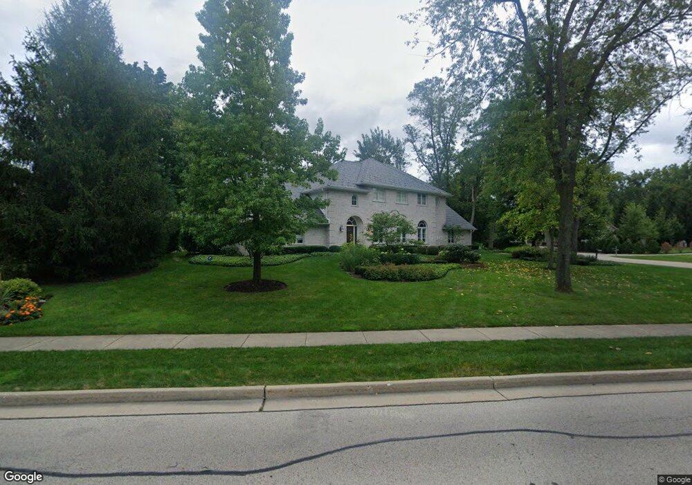
933 Sandstone Dr Libertyville, IL 60048
Estimated Value: $1,164,030 - $1,625,000
5
Beds
5
Baths
3,876
Sq Ft
$362/Sq Ft
Est. Value
About This Home
This home is located at 933 Sandstone Dr, Libertyville, IL 60048 and is currently estimated at $1,402,258, approximately $361 per square foot. 933 Sandstone Dr is a home located in Lake County with nearby schools including Adler Park School, Highland Middle School, and Libertyville High School.
Ownership History
Date
Name
Owned For
Owner Type
Purchase Details
Closed on
Aug 20, 2008
Sold by
Coury Christopher and Coury Ellen Ventura
Bought by
Coury Ellen V and Ellen V Coury Revocable Trust
Current Estimated Value
Purchase Details
Closed on
Sep 23, 2004
Sold by
Carroll A Dennison
Bought by
Coury Christopher and Coury Ellen Ventura
Home Financials for this Owner
Home Financials are based on the most recent Mortgage that was taken out on this home.
Original Mortgage
$650,000
Interest Rate
3.87%
Mortgage Type
New Conventional
Purchase Details
Closed on
Apr 10, 1998
Sold by
Jensen Dennis A and Jensen Melissa A
Bought by
Carroll A Dennison
Home Financials for this Owner
Home Financials are based on the most recent Mortgage that was taken out on this home.
Original Mortgage
$325,000
Interest Rate
6.87%
Create a Home Valuation Report for This Property
The Home Valuation Report is an in-depth analysis detailing your home's value as well as a comparison with similar homes in the area
Home Values in the Area
Average Home Value in this Area
Purchase History
| Date | Buyer | Sale Price | Title Company |
|---|---|---|---|
| Coury Ellen V | -- | None Available | |
| Coury Christopher | $960,000 | -- | |
| Carroll A Dennison | $472,500 | -- |
Source: Public Records
Mortgage History
| Date | Status | Borrower | Loan Amount |
|---|---|---|---|
| Previous Owner | Coury Christopher | $650,000 | |
| Previous Owner | Carroll A Dennison | $325,000 | |
| Closed | Coury Christopher | $150,000 |
Source: Public Records
Tax History Compared to Growth
Tax History
| Year | Tax Paid | Tax Assessment Tax Assessment Total Assessment is a certain percentage of the fair market value that is determined by local assessors to be the total taxable value of land and additions on the property. | Land | Improvement |
|---|---|---|---|---|
| 2024 | $24,541 | $339,051 | $93,133 | $245,918 |
| 2023 | $21,538 | $312,720 | $85,900 | $226,820 |
| 2022 | $21,538 | $275,305 | $82,563 | $192,742 |
| 2021 | $20,743 | $269,379 | $80,786 | $188,593 |
| 2020 | $22,238 | $294,278 | $88,253 | $206,025 |
| 2019 | $21,684 | $291,480 | $87,414 | $204,066 |
| 2018 | $12,302 | $316,916 | $102,697 | $214,219 |
| 2017 | $22,534 | $306,911 | $99,455 | $207,456 |
| 2016 | $21,810 | $290,994 | $94,297 | $196,697 |
| 2015 | $21,644 | $306,348 | $88,136 | $218,212 |
| 2014 | $20,513 | $252,958 | $82,814 | $170,144 |
| 2012 | $18,772 | $255,152 | $83,532 | $171,620 |
Source: Public Records
Map
Nearby Homes
- 224 Newberry Ave
- 1211 Parliament Ct
- 922 N Milwaukee Ave Unit A
- 204 W Ellis Ave
- 208 W Ellis Ave
- 212 W Ellis Ave
- 217 E Church St
- 31132-31140 N Milwaukee Ave
- 619 Parkside Ct
- 616 Parkside Ct
- 212 Elm Ct
- 601 Broadway St
- 505 Lange Ct
- 662 Parkside Ct
- 420 W Cook Ave
- 694 Parkside Ct
- 121 4th St
- 112 3rd St
- 16108 W Des Plaines Dr
- 16051 W Des Plaines Dr
- 937 Sandstone Dr
- 937 Manor Cir
- 941 Sandstone Dr
- 817 Orchard Cir
- 922 Sandstone Dr
- 939 Sandstone Dr
- 785 Orchard Cir
- 675 Orchard Cir
- 939 Bartlett Terrace
- 937 Bartlett Terrace
- 932 Sandstone Dr
- 941 Bartlett Terrace
- 828 Sandstone Dr
- 945 Sandstone Dr Unit 3
- 811 Sandstone Dr
- 943 Bartlett Terrace
- 942 Sandstone Dr
- 813 Orchard Cir Unit 3
- 935 Bartlett Terrace
- 249 E Ellis Ave