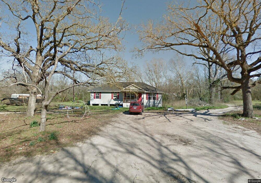
933 Stephenson Brown Rd Lufkin, TX 75904
Estimated Value: $195,422 - $343,000
--
Bed
--
Bath
1,364
Sq Ft
$182/Sq Ft
Est. Value
About This Home
This home is located at 933 Stephenson Brown Rd, Lufkin, TX 75904 and is currently estimated at $248,106, approximately $181 per square foot. 933 Stephenson Brown Rd is a home located in Angelina County with nearby schools including W.F. Peavy Primary School, W.H. Bonner Elementary School, and Hudson Middle School.
Ownership History
Date
Name
Owned For
Owner Type
Purchase Details
Closed on
Nov 20, 2007
Sold by
Cole Donald and Cole Martha
Bought by
Mcmullen Christopher
Current Estimated Value
Purchase Details
Closed on
Sep 8, 2006
Sold by
Cole Donald Eugene and Cole Martha Dale
Bought by
Mcmullen Thomas Lynn and Mcmullen Wanda Jean
Create a Home Valuation Report for This Property
The Home Valuation Report is an in-depth analysis detailing your home's value as well as a comparison with similar homes in the area
Home Values in the Area
Average Home Value in this Area
Purchase History
| Date | Buyer | Sale Price | Title Company |
|---|---|---|---|
| Mcmullen Christopher | -- | None Available | |
| Mcmullen Thomas Lynn | -- | None Available |
Source: Public Records
Tax History Compared to Growth
Tax History
| Year | Tax Paid | Tax Assessment Tax Assessment Total Assessment is a certain percentage of the fair market value that is determined by local assessors to be the total taxable value of land and additions on the property. | Land | Improvement |
|---|---|---|---|---|
| 2025 | $2,290 | $170,060 | $42,700 | $127,360 |
| 2024 | $2,084 | $168,110 | $42,700 | $125,410 |
| 2023 | $1,886 | $167,300 | $42,700 | $124,600 |
| 2022 | $1,953 | $152,820 | $30,500 | $122,320 |
| 2021 | $1,927 | $143,610 | $30,500 | $113,110 |
| 2020 | $1,747 | $95,160 | $14,280 | $80,880 |
| 2019 | $1,772 | $93,330 | $13,860 | $79,470 |
| 2018 | $1,731 | $91,290 | $13,860 | $77,430 |
| 2017 | $1,731 | $90,180 | $11,100 | $79,080 |
| 2016 | $1,720 | $89,540 | $11,100 | $78,440 |
| 2015 | -- | $89,540 | $11,100 | $78,440 |
| 2014 | -- | $84,530 | $11,100 | $73,430 |
Source: Public Records
Map
Nearby Homes
- 1072 Stephenson Brown Rd
- 3405 Bethlehem Rd
- 3335 Bethlehem Rd
- 105,115,116,195 Wilcox Dr
- 4136 Bethlehem Rd
- 3202 Bethlehem Rd
- Lot 2 Bethlehem Rd
- 325 Evans Gann Rd
- R143729 (Lot 6) Dena Kay Dr
- R143727 (Lot 4) Dena Kay Dr
- 130 Dena Kay Dr
- 0000 Roy Christie Rd
- 465 Roper Rd
- R143745 (Lot22) Dena Kay Dr
- R143749(Lot26) Dena Kay Dr
- R143749 Dena Kay Dr
- R143745 Dena Kay Dr
- multiple Dena Kay Dr
- R143742 (Lot19) Dena Kay Dr
- R143729 Dena Kay Dr
- 959 Stephenson Brown Rd
- 907 Stephenson Brown Rd
- tbd Stephenson Brown Rd
- 0 Stephenson Brown Rd
- 1033 Stephenson Brown Rd
- 779 Stephenson Brown Rd
- 689 Stephenson Brown Rd
- 1061 Stephenson Brown Rd
- 1048 Stephenson Brown Rd
- 830 Stephenson Brown Rd
- 655 Stephenson Brown Rd
- 1065 Stephenson Brown Rd
- 1073 Stephenson Brown Rd
- 816 Stephenson Brown Rd
- 784 Stephenson Brown Rd
- 1074 Stephenson Brown Rd
- 770 Stephenson Brown Rd
- 1076 Stephenson Brown Rd
- 1194 Stephenson Brown Rd
- 174 Robinson Rd