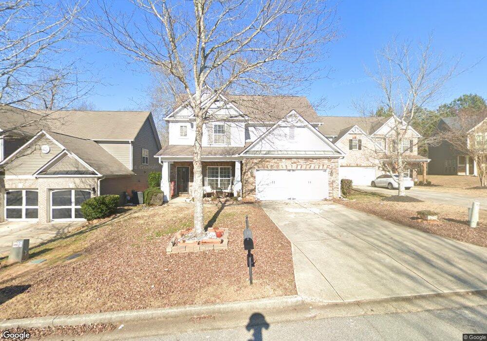
9333 Opal Dr Unit 75 Douglasville, GA 30135
Estimated Value: $341,374 - $394,000
4
Beds
3
Baths
2,230
Sq Ft
$162/Sq Ft
Est. Value
About This Home
This home is located at 9333 Opal Dr Unit 75, Douglasville, GA 30135 and is currently estimated at $361,094, approximately $161 per square foot. 9333 Opal Dr Unit 75 is a home located in Douglas County with nearby schools including Mt. Carmel Elementary School, Chestnut Log Middle School, and New Manchester High School.
Ownership History
Date
Name
Owned For
Owner Type
Purchase Details
Closed on
Oct 23, 2020
Sold by
App Derrek H
Bought by
Rascoe Krystal Nicole
Current Estimated Value
Home Financials for this Owner
Home Financials are based on the most recent Mortgage that was taken out on this home.
Original Mortgage
$254,308
Outstanding Balance
$224,865
Interest Rate
2.9%
Mortgage Type
FHA
Estimated Equity
$136,229
Purchase Details
Closed on
Oct 20, 2006
Sold by
Tozzi Roberta D
Bought by
App Derrek H and App Roberta D
Purchase Details
Closed on
Dec 19, 2005
Sold by
Ryland Grp
Bought by
Tozzi Roberta D and App Derrek
Home Financials for this Owner
Home Financials are based on the most recent Mortgage that was taken out on this home.
Original Mortgage
$162,276
Interest Rate
6.29%
Mortgage Type
New Conventional
Create a Home Valuation Report for This Property
The Home Valuation Report is an in-depth analysis detailing your home's value as well as a comparison with similar homes in the area
Home Values in the Area
Average Home Value in this Area
Purchase History
| Date | Buyer | Sale Price | Title Company |
|---|---|---|---|
| Rascoe Krystal Nicole | $259,000 | -- | |
| App Derrek H | -- | -- | |
| Tozzi Roberta D | $202,900 | -- |
Source: Public Records
Mortgage History
| Date | Status | Borrower | Loan Amount |
|---|---|---|---|
| Open | Rascoe Krystal Nicole | $254,308 | |
| Previous Owner | Tozzi Roberta D | $162,276 |
Source: Public Records
Tax History Compared to Growth
Tax History
| Year | Tax Paid | Tax Assessment Tax Assessment Total Assessment is a certain percentage of the fair market value that is determined by local assessors to be the total taxable value of land and additions on the property. | Land | Improvement |
|---|---|---|---|---|
| 2024 | $5,627 | $135,400 | $27,000 | $108,400 |
| 2023 | $5,627 | $135,400 | $27,000 | $108,400 |
| 2022 | $4,402 | $108,520 | $18,000 | $90,520 |
| 2021 | $4,095 | $100,560 | $19,600 | $80,960 |
| 2020 | $3,175 | $76,520 | $14,560 | $61,960 |
| 2019 | $2,939 | $74,800 | $14,560 | $60,240 |
| 2018 | $3,008 | $76,040 | $14,240 | $61,800 |
| 2017 | $2,837 | $70,960 | $14,720 | $56,240 |
| 2016 | $2,743 | $67,400 | $14,720 | $52,680 |
| 2015 | $2,413 | $70,160 | $13,120 | $57,040 |
| 2014 | $2,413 | $58,760 | $11,840 | $46,920 |
| 2013 | -- | $59,080 | $12,000 | $47,080 |
Source: Public Records
Map
Nearby Homes
- 5037 Saphire Ct
- 9353 Opal Dr
- 2709 Gentry Dr
- 5056 Manning Dr
- 2925 Frederica Ct
- 2935 Frederica Ct
- 2841 Fareed St
- 2811 Fareed St
- 2821 Fareed St
- 3070 Fareed St
- 2979 Dungeness Dr
- 3890 Brookhollow Dr
- 5260 Prestley Crossing Ln
- 5357 Steeple Chase
- 5264 Prestley Crossing Ln
- 4912 Saint Johns Dr
- 3675 Brookhollow Dr
- 9333 Opal Dr
- 9335 Opal Dr
- 9331 Opal Dr
- 9337 Opal Dr
- 9329 Opal Dr Unit 77E
- 9329 Opal Dr
- 9339 Opal Dr
- 9334 Opal Dr
- 9332 Opal Dr
- 9332 Opal Dr
- 9336 Opal Dr
- 9330 Opal Dr
- 9338 Opal Dr Unit 85E
- 9338 Opal Dr
- 9326 Opal Dr Unit 1
- 9341 Opal Dr Unit 1
- 9328 Opal Dr
- 9328 Opal Dr Unit 80
- 9340 Opal Dr Unit 86E
- 9340 Opal Dr